Peyremale
| Peyremale | ||
|---|---|---|
| Commune | ||
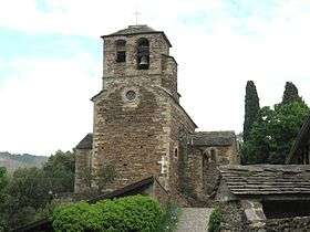 The church of Peyremale | ||
| ||
 Peyremale Location within Occitanie region  Peyremale | ||
| Coordinates: 44°18′05″N 4°03′46″E / 44.3014°N 4.0628°ECoordinates: 44°18′05″N 4°03′46″E / 44.3014°N 4.0628°E | ||
| Country | France | |
| Region | Occitanie | |
| Department | Gard | |
| Arrondissement | Alès | |
| Canton | Rousson | |
| Intercommunality | Cévennes Actives | |
| Government | ||
| • Mayor (2008–2014) | Jean-Pierre Pouly | |
| Area1 | 8.62 km2 (3.33 sq mi) | |
| Population (2008)2 | 272 | |
| • Density | 32/km2 (82/sq mi) | |
| Time zone | UTC+1 (CET) | |
| • Summer (DST) | UTC+2 (CEST) | |
| INSEE/Postal code | 30194 /30160 | |
| Elevation | 162–619 m (531–2,031 ft) | |
|
1 French Land Register data, which excludes lakes, ponds, glaciers > 1 km2 (0.386 sq mi or 247 acres) and river estuaries. 2 Population without double counting: residents of multiple communes (e.g., students and military personnel) only counted once. | ||
.svg.png)
Peyremale is a commune in the Gard department in southern France.
Population
| Historical population | ||
|---|---|---|
| Year | Pop. | ±% |
| 1831 | 687 | — |
| 1836 | 1,026 | +49.3% |
| 1841 | 1,139 | +11.0% |
| 1846 | 777 | −31.8% |
| 1851 | 777 | +0.0% |
| 1856 | 732 | −5.8% |
| 1861 | 702 | −4.1% |
| 1866 | 680 | −3.1% |
| 1876 | 650 | −4.4% |
| 1881 | 626 | −3.7% |
| 1886 | 671 | +7.2% |
| 1891 | 670 | −0.1% |
| 1896 | 646 | −3.6% |
| 1901 | 588 | −9.0% |
| 1906 | 628 | +6.8% |
| 1911 | 572 | −8.9% |
| 1921 | 508 | −11.2% |
| 1926 | 468 | −7.9% |
| 1931 | 441 | −5.8% |
| 1936 | 419 | −5.0% |
| 1946 | 432 | +3.1% |
| 1954 | 406 | −6.0% |
| 1962 | 404 | −0.5% |
| 1968 | 371 | −8.2% |
| 1975 | 305 | −17.8% |
| 1982 | 275 | −9.8% |
| 1990 | 273 | −0.7% |
| 1999 | 281 | +2.9% |
| 2008 | 272 | −3.2% |
See also
References
| Wikimedia Commons has media related to Peyremale. |
This article is issued from
Wikipedia.
The text is licensed under Creative Commons - Attribution - Sharealike.
Additional terms may apply for the media files.