Valleraugue
| Valleraugue | ||
|---|---|---|
| Commune | ||
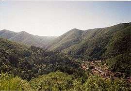 A general view of Valleraugue | ||
| ||
 Valleraugue Location within Occitanie region  Valleraugue | ||
| Coordinates: 44°04′54″N 3°38′33″E / 44.0817°N 3.6425°ECoordinates: 44°04′54″N 3°38′33″E / 44.0817°N 3.6425°E | ||
| Country | France | |
| Region | Occitanie | |
| Department | Gard | |
| Arrondissement | Le Vigan | |
| Canton | Le Vigan | |
| Intercommunality | Aigoual | |
| Government | ||
| • Mayor (2008–2015) | Thomas Vidal | |
| Area1 | 78.35 km2 (30.25 sq mi) | |
| Population (2008)2 | 1,073 | |
| • Density | 14/km2 (35/sq mi) | |
| Time zone | UTC+1 (CET) | |
| • Summer (DST) | UTC+2 (CEST) | |
| INSEE/Postal code | 30339 /30570 | |
| Elevation |
294–1,567 m (965–5,141 ft) (avg. 367 m or 1,204 ft) | |
|
1 French Land Register data, which excludes lakes, ponds, glaciers > 1 km2 (0.386 sq mi or 247 acres) and river estuaries. 2 Population without double counting: residents of multiple communes (e.g., students and military personnel) only counted once. | ||
.svg.png)
Valleraugue is a commune in the Gard department in southern France.
Geography
Valleraugue is located in a deep valley of the Cévennes mountains, on the Hérault River.
Population
| Historical population | ||
|---|---|---|
| Year | Pop. | ±% |
| 1793 | 3,264 | — |
| 1851 | 4,190 | +28.4% |
| 1891 | 2,799 | −33.2% |
| 1946 | 1,401 | −49.9% |
| 1962 | 987 | −29.6% |
| 1968 | 1,017 | +3.0% |
| 1975 | 1,028 | +1.1% |
| 1982 | 1,041 | +1.3% |
| 1990 | 1,091 | +4.8% |
| 1999 | 1,009 | −7.5% |
| 2008 | 1,073 | +6.3% |
Sights
Picturesque medieval town, 26 bridges, most of them several centuries old.
Weather station
The Mont Aigoual weather station is located on the territory of the commune.
Personalities
Valleraugue was the birthplace of:
- Jean Louis Armand de Quatrefages de Bréau (1810–1892), naturalist was born at Berthézène, which is part of Valleraugue
- Francois Perrier (1835–1888), Brigadier-general and commander of the Légion d'honneur
See also
References
| Wikimedia Commons has media related to Valleraugue. |
This article is issued from
Wikipedia.
The text is licensed under Creative Commons - Attribution - Sharealike.
Additional terms may apply for the media files.