Saint-Laurent-de-Carnols
| Saint-Laurent-de-Carnols | ||
|---|---|---|
| Commune | ||
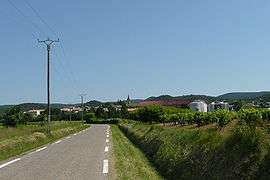 A general view of Saint-Laurent-de-Carnols | ||
| ||
 Saint-Laurent-de-Carnols Location within Occitanie region  Saint-Laurent-de-Carnols | ||
| Coordinates: 44°12′47″N 4°31′52″E / 44.2131°N 4.5311°ECoordinates: 44°12′47″N 4°31′52″E / 44.2131°N 4.5311°E | ||
| Country | France | |
| Region | Occitanie | |
| Department | Gard | |
| Arrondissement | Nîmes | |
| Canton | Pont-Saint-Esprit | |
| Intercommunality | ValCezArd | |
| Government | ||
| • Mayor (2001–2008) | Guy Aubanel | |
| Area1 | 10.15 km2 (3.92 sq mi) | |
| Population (2008)2 | 463 | |
| • Density | 46/km2 (120/sq mi) | |
| Time zone | UTC+1 (CET) | |
| • Summer (DST) | UTC+2 (CEST) | |
| INSEE/Postal code | 30277 /30200 | |
| Elevation |
59–359 m (194–1,178 ft) (avg. 150 m or 490 ft) | |
|
1 French Land Register data, which excludes lakes, ponds, glaciers > 1 km2 (0.386 sq mi or 247 acres) and river estuaries. 2 Population without double counting: residents of multiple communes (e.g., students and military personnel) only counted once. | ||
.svg.png)
Saint-Laurent-de-Carnols is a commune in the Gard department in southern France.
Population
| Historical population | ||
|---|---|---|
| Year | Pop. | ±% |
| 1962 | 174 | — |
| 1968 | 189 | +8.6% |
| 1975 | 189 | +0.0% |
| 1982 | 203 | +7.4% |
| 1990 | 279 | +37.4% |
| 1999 | 403 | +44.4% |
| 2008 | 463 | +14.9% |
See also
References
| Wikimedia Commons has media related to Saint-Laurent-de-Carnols. |
This article is issued from
Wikipedia.
The text is licensed under Creative Commons - Attribution - Sharealike.
Additional terms may apply for the media files.