Branoux-les-Taillades
| Branoux-les-Taillades | ||
|---|---|---|
| Commune | ||
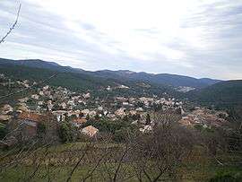 A general view of Branoux-les-Taillades | ||
| ||
 Branoux-les-Taillades Location within Occitanie region  Branoux-les-Taillades | ||
| Coordinates: 44°13′16″N 3°59′27″E / 44.2211°N 3.9908°ECoordinates: 44°13′16″N 3°59′27″E / 44.2211°N 3.9908°E | ||
| Country | France | |
| Region | Occitanie | |
| Department | Gard | |
| Arrondissement | Alès | |
| Canton | La Grand-Combe | |
| Intercommunality | Pays Grand'Combien | |
| Government | ||
| • Mayor (2008–2014) | Alain Rey | |
| Area1 | 15.02 km2 (5.80 sq mi) | |
| Population (2008)2 | 1,331 | |
| • Density | 89/km2 (230/sq mi) | |
| Time zone | UTC+1 (CET) | |
| • Summer (DST) | UTC+2 (CEST) | |
| INSEE/Postal code | 30051 /30110 | |
| Elevation |
189–900 m (620–2,953 ft) (avg. 360 m or 1,180 ft) | |
|
1 French Land Register data, which excludes lakes, ponds, glaciers > 1 km2 (0.386 sq mi or 247 acres) and river estuaries. 2 Population without double counting: residents of multiple communes (e.g., students and military personnel) only counted once. | ||
.svg.png)
Branoux-les-Taillades is a commune in the Gard department in southern France.
Population
| Historical population | ||
|---|---|---|
| Year | Pop. | ±% |
| 1793 | 650 | — |
| 1821 | 711 | +9.4% |
| 1846 | 792 | +11.4% |
| 1876 | 790 | −0.3% |
| 1901 | 1,452 | +83.8% |
| 1926 | 1,573 | +8.3% |
| 1946 | 1,655 | +5.2% |
| 1962 | 2,061 | +24.5% |
| 1968 | 1,697 | −17.7% |
| 1975 | 1,424 | −16.1% |
| 1982 | 1,404 | −1.4% |
| 1990 | 1,338 | −4.7% |
| 1999 | 1,274 | −4.8% |
| 2008 | 1,331 | +4.5% |
See also
References
| Wikimedia Commons has media related to Branoux-les-Taillades. |
This article is issued from
Wikipedia.
The text is licensed under Creative Commons - Attribution - Sharealike.
Additional terms may apply for the media files.