Blandas
| Blandas | ||
|---|---|---|
| Commune | ||
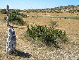 Part of the Rigalderie stone circle in Blandas | ||
| ||
 Blandas Location within Occitanie region  Blandas | ||
| Coordinates: 43°54′49″N 3°30′49″E / 43.9136°N 3.5136°ECoordinates: 43°54′49″N 3°30′49″E / 43.9136°N 3.5136°E | ||
| Country | France | |
| Region | Occitanie | |
| Department | Gard | |
| Arrondissement | Le Vigan | |
| Canton | Le Vigan | |
| Intercommunality | Pays Viganais | |
| Government | ||
| • Mayor (2008–2014) | Edith Vézinet | |
| Area1 | 37.46 km2 (14.46 sq mi) | |
| Population (2008)2 | 128 | |
| • Density | 3.4/km2 (8.8/sq mi) | |
| Time zone | UTC+1 (CET) | |
| • Summer (DST) | UTC+2 (CEST) | |
| INSEE/Postal code | 30040 /30770 | |
| Elevation |
280–953 m (919–3,127 ft) (avg. 650 m or 2,130 ft) | |
|
1 French Land Register data, which excludes lakes, ponds, glaciers > 1 km2 (0.386 sq mi or 247 acres) and river estuaries. 2 Population without double counting: residents of multiple communes (e.g., students and military personnel) only counted once. | ||
.svg.png)
Blandas is a commune in the Gard department in southern France.
Population
| Historical population | ||
|---|---|---|
| Year | Pop. | ±% |
| 1881 | 528 | — |
| 1891 | 506 | −4.2% |
| 1901 | 420 | −17.0% |
| 1911 | 355 | −15.5% |
| 1921 | 268 | −24.5% |
| 1931 | 268 | +0.0% |
| 1936 | 227 | −15.3% |
| 1954 | 196 | −13.7% |
| 1962 | 172 | −12.2% |
| 1968 | 141 | −18.0% |
| 1975 | 115 | −18.4% |
| 1982 | 116 | +0.9% |
| 1990 | 112 | −3.4% |
| 1999 | 106 | −5.4% |
| 2008 | 128 | +20.8% |
See also
References
| Wikimedia Commons has media related to Blandas. |
This article is issued from
Wikipedia.
The text is licensed under Creative Commons - Attribution - Sharealike.
Additional terms may apply for the media files.