Arpaillargues-et-Aureillac
| Arpaillargues-et-Aureillac | ||
|---|---|---|
| Commune | ||
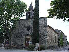 The church in Arpaillargues-et-Aureillac | ||
| ||
 Arpaillargues-et-Aureillac Location within Occitanie region  Arpaillargues-et-Aureillac | ||
| Coordinates: 44°00′05″N 4°22′24″E / 44.0014°N 4.3733°ECoordinates: 44°00′05″N 4°22′24″E / 44.0014°N 4.3733°E | ||
| Country | France | |
| Region | Occitanie | |
| Department | Gard | |
| Arrondissement | Nîmes | |
| Canton | Uzès | |
| Intercommunality | CC Pays Uzès | |
| Government | ||
| • Mayor (2014-2020) | Alain Valantin | |
| Area1 | 13.67 km2 (5.28 sq mi) | |
| Population (2015)2 | 1,021 | |
| • Density | 75/km2 (190/sq mi) | |
| Time zone | UTC+1 (CET) | |
| • Summer (DST) | UTC+2 (CEST) | |
| INSEE/Postal code | 30014 /30700 | |
| Elevation |
69–200 m (226–656 ft) (avg. 116 m or 381 ft) | |
|
1 French Land Register data, which excludes lakes, ponds, glaciers > 1 km2 (0.386 sq mi or 247 acres) and river estuaries. 2 Population without double counting: residents of multiple communes (e.g., students and military personnel) only counted once. | ||
.svg.png)
Arpaillargues-et-Aureillac (Occitan: Arpalhargues e Aurelhac) is a commune in the Gard department in southern France.
Population
| Historical population | ||
|---|---|---|
| Year | Pop. | ±% |
| 1962 | 255 | — |
| 1968 | 265 | +3.9% |
| 1975 | 309 | +16.6% |
| 1982 | 459 | +48.5% |
| 1990 | 667 | +45.3% |
| 1999 | 785 | +17.7% |
| 2008 | 998 | +27.1% |
| 2015 | 1,021 | +2.3% |
See also
References
| Wikimedia Commons has media related to Arpaillargues-et-Aureillac. |
This article is issued from
Wikipedia.
The text is licensed under Creative Commons - Attribution - Sharealike.
Additional terms may apply for the media files.