Hamilton, Colorado
| Hamilton, Colorado | |
|---|---|
| Unincorporated community | |
| Coordinates: 40°21′51″N 107°37′00″W / 40.36417°N 107.61667°WCoordinates: 40°21′51″N 107°37′00″W / 40.36417°N 107.61667°W | |
| Country |
|
| State |
|
| Counties | Moffat[1] |
| Elevation[1] | 6,243 ft (1,903 m) |
| Time zone | UTC-7 (MST) |
| • Summer (DST) | UTC-6 (MDT) |
| ZIP code[2] | 81638 |
| Area code(s) | 970 |
Hamilton is an unincorporated community and a U.S. Post Office in Moffat County, Colorado, United States. The Hamilton Post Office has the ZIP Code 81638.[2]
Geography
Hamilton is located at 40°21′51″N 107°37′00″W / 40.36417°N 107.61667°W (40.364073,-107.616577).
References
- 1 2 "US Board on Geographic Names". United States Geological Survey. 2007-10-25. Retrieved 2008-01-31.
- 1 2 "ZIP Code Lookup". United States Postal Service. December 15, 2006. Archived from the original (JavaScript/HTML) on September 3, 2007. Retrieved December 15, 2006.
Municipalities and communities of Moffat County, Colorado, United States | ||
|---|---|---|
| City | 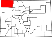 | |
| Town | ||
| CDP | ||
| Unincorporated communities | ||
| Ghost town | ||
This article is issued from
Wikipedia.
The text is licensed under Creative Commons - Attribution - Sharealike.
Additional terms may apply for the media files.