Dunstable Downs
| Dunstable Downs | |
|---|---|
 | |
| Highest point | |
| Elevation | 797 ft (243 m) |
| Prominence | c. 344 ft |
| Parent peak | Haddington Hill |
| Listing | County Top |
| Coordinates | 51°51′51″N 0°32′11″W / 51.864243°N 0.536344°WCoordinates: 51°51′51″N 0°32′11″W / 51.864243°N 0.536344°W |
| Geography | |
 Dunstable Downs Dunstable Downs in Bedfordshire | |
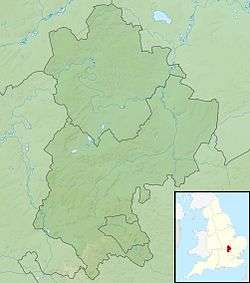
| Location | Chiltern Hills, England |
| OS grid | TL008194 |
| Topo map | OS Landranger 166 |
Dunstable Downs are part of the Chiltern Hills, in southern Bedfordshire in England. They are a chalk escarpment forming the north-eastern reaches of the Chilterns. At 797 ft (243 m), Dunstable Downs are the highest point of the county of Bedfordshire.[1]
Because of its elevation, Dunstable Downs hosted a station in the shutter telegraph chain which connected the Admiralty in London to its naval ships in the port of Great Yarmouth during the years 1808 to 1814.[2]
Whipsnade Zoo has cut an enormous lion shape into the chalk into the side of one of the hills. The lion can be seen from the B489 (Aylesbury to Dunstable road).
The downs are used by gliders, kite fliers, hang gliders and paragliders in the area because of their height. The London Gliding Club is based at the foot of the downs.
Much of the downs is managed by the National Trust as part of the Dunstable Downs & Whipsnade Estate property.
Ascents
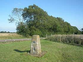
Central Bedfordshire Council and the National Trust commissioned Architype architects to build a visitor centre known as the Chilterns Gateway Centre, on the very top of Dunstable Downs. The summit is right next to the B4541 road that crosses the hill, and so an ascent of the hill requires nothing more than getting out of a car at the highest point and walking across to the trig point.
For those who wish to climb the hill from the base, it is possible to do a circular walk from the village of Whipsnade by following the Icknield Way Path and Chiltern Way, both of which are marked on Ordnance Survey maps. This circuit can be extended to take in the northern top of Five Knolls. The hill can also be ascended from Dunstable to the north. The Icknield Way Trail,[3] a horse rider and off-road cycle route, has been established following a similar route to the Icknield Way Path which passes over the Dunstable Downs.

Natural history
The downs are home to a wide variety of wildlife including many rare wild flowers, such as the bee orchid, and butterfly species, like the marbled white and the chalkhill blue.
Areas of the west-facing slope were notified in 1987 under the Wildlife and Countryside Act 1981 as a Site of Special Scientific Interest (SSSI) called Dunstable and Whipsnade Downs. Blow's Down is a continuation of the Dunstable Downs escarpment on the eastern side of Dunstable. It is also an SSSI and most of it is managed by the Wildlife Trust for Bedfordshire, Cambridgeshire and Northamptonshire (as Blow's Downs).
See also
Notes and references
- ↑ "Geographical Facts, Figures and Statistics about Bedfordshire". Bedfordshire Libraries. Archived from the original on 11 July 2007. Retrieved 23 February 2008.
- ↑ "Shutter telegraph signalled new era". Great Yarmouth Mercury. Retrieved 23 February 2008.
- ↑ Icknield Way Trail.
External links
| Wikimedia Commons has media related to Dunstable Downs. |