Bromley-by-Bow
| Bromley | |
|---|---|
 Kingsley Hall, Bromley | |
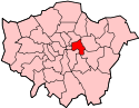
 Bromley Bromley shown within Greater London | |
| Population | 14,480 (2011 Census. Bromley Ward)[1] |
| OS grid reference | TQ375825 |
| London borough | |
| Ceremonial county | Greater London |
| Region | |
| Country | England |
| Sovereign state | United Kingdom |
| Post town | LONDON |
| Postcode district | E3 |
| Dialling code | 020 |
| Police | Metropolitan |
| Fire | London |
| Ambulance | London |
| EU Parliament | London |
| UK Parliament | |
| London Assembly | |
Bromley-by-Bow, historically and officially Bromley, is an inner-city district in the London Borough of Tower Hamlets, East London, England. The area is distinct from Bow, which lies immediately north of the boundary between the two, which runs along Bow Road, or near the Lea, slightly to the south of the Road. The formal boundaries of the area were set when the area became a parish in 1537, when it split from Stepney. The boundaries of the new parish were based on those of much older pre-existing estates.[2][3]
Bromley has a rich history, but many of its most historic buildings have been lost.
Toponymy
In early records the name first appears as Brambele, Brambelegh, or Brembeley and is likely to be derived from the Saxon words Brembel – a bramble, and lege – a field.[4]
Since 1967, the area has become known as Bromley-by-Bow due to Bromley tube station some 8 miles (12.9 km) to the south being renamed to Bromley-by-Bow, to prevent confusion with Bromley railway station in the London Borough of Bromley. Over time the station's name has become applied to the area itself.
Bow itself (also part of Stepney until the 18th century) was originally known as Stratforde, becoming Stratford-at-Bow when a medieval bridge was built, in the arched shape of a bow, to distinguish it from Stratford Langthorne on the other side of the River Lea.
History
Pre-conquest to the creation of the Parish
The oldest surviving written reference to the area, as Braembeleg, was from about the year 1000[5] when it was referred to as one of the Manors belonging to St Pauls Cathedral.
Bromley was home to St Leonard's Priory a Benedictine nunnery founded in the time of William the conqueror and mentioned in the General Prologue to Geoffrey Chaucer's Canterbury Tales. It was destroyed at the time of the Dissolution in 1536, and the manor and lands passed to Sir Ralph Sadleir, who lived at Sutton House in Homerton and was privy councillor to Henry VIII. The exception was the priory chapel which was retained.
From the creation of the parish (1537) to 1850
The priory chapel was turned into the parish church for a new parish, Bromley St Leonard, which split from the parish of Stepney and covered the area of two much older units, the Manor of Bromley and the estate of the Nunnery of St Leonard.[2][3]
In 1606 a palace was built for James I facing the line of St Leonard's Street by John Thorpe. This was principally used as a hunting lodge but was a grand residence of 24 rooms, including a State room, built along the lines of Hardwick Hall and Montacute House. Some of the stonework was quarried from the remains of the (now disused) priory. It remained in Royal use and was refurbished in the reigns of Charles II and James II and stables were added. During the 18th century the frontage of the building was renewed and the palace was converted into two merchant houses. It went through a variety of uses, including a boarding school and a colour works. The house was demolished at the end of the 19th century by the London School Board for construction of a new board school. Many of the original fittings remained in place and were said to be in fine condition. The house was sold piecemeal for £250 with the State room, panelling and an oak doorway going to the Victoria and Albert Museum.[6]
To 1850
Bromley was also known as Bromley-St Leonards, after St Leonard's Priory a Benedictine nunnery founded in the time of William the conqueror and mentioned in the General Prologue to Geoffrey Chaucer's Canterbury Tales. It was destroyed at the time of the Dissolution in 1536, and the manor and lands passed to Sir Ralph Sadleir, who lived at Sutton House in Homerton and was privy councillor to Henry VIII. The priory chapel was retained and turned into the parish church for a new parish, Bromley St Leonard, split from the parish of Stepney.

In 1606 a palace was built for James I facing the line of St Leonard's Street by John Thorpe. This was principally used as a hunting lodge but was a grand residence of 24 rooms, including a State room, built along the lines of Hardwick Hall and Montacute House. Some of the stonework was quarried from the remains of the (now disused) priory. It remained in Royal use and was refurbished in the reigns of Charles II and James II and stables were added. During the 18th century the frontage of the building was renewed and the palace was converted into two merchant houses. It went through a variety of uses, including a boarding school and a colour works. The house was demolished at the end of the 19th century by the London School Board for construction of a new board school. Many of the original fittings remained in place and were said to be in fine condition. The house was sold piecemeal for £250 with the State room, panelling and an oak doorway going to the Victoria and Albert Museum.[6]
1850-present
In 1868, the Poplar and Stepney Sick Asylum was opened on a site next to the present day Bromley-by-Bow tube station. It was renamed St Andrew's Hospital in 1921. It closed in 2006. [7] A new housing development, William Guy Gardens, now occupies the site. Henry Grattan Guinness founded the East London Missionary Training Institute (also called Harley College) at Harley House in Bromley-by-Bow in 1873, with Dr. Thomas Barnardo as co-director. The school outgrew the premises and relocated in 1883, eventually becoming Cliff College.
The Revd Richard Enraght, religious controversialist,[8] was the Curate of St Michael and All Angels Church in St Leonards Road from 1884–1888 and Rector of St Gabriel Church (now demolished), Chrisp Street (Poplar), from 1888-1895. Between 1899 and 1965 the parish of Bromley St Leonard formed part of the Metropolitan Borough of Poplar, within the County of London.[9]
The cluster of Victorian gas holders at Bromley by Bow is Grade II listed and has been named by the Victorian Society as a heritage building at risk of disrepair. [10]
The area suffered heavily in the Blitz and St Leonards Church was destroyed by enemy action in 1941. The ruins and much of the churchyard were swept away when the Blackwall Tunnel Approach Road was built through the area in the 1960s.
Governance
The area is covered by two wards in the London Borough of Tower Hamlets. The councillors elected in May 2018 were:
- Bromley North - Zenith Rahman (Labour) and Dan Tomlinson (Labour)
- Bromley South - Danny Hassell (Labour) and Helal Uddin (Labour).
Geography
Bromley-by-Bow is a part of the London Borough of Tower Hamlets in East London. To the north and west is Bow, and to the south are Poplar and Blackwall. The area is bisected north to south by the Blackwall Tunnel Approach Road (A12) and the boundary of the area to the east is the River Lea which forms the boundary with West Ham in the London Borough of Newham. Between the expanded tunnel approach and the river is the land is being regenerated along the banks of the River Lea. Nearby is Three Mills. On the eastern side of the A12 is East London's oldest surviving building, Bromley Hall. To the west are Poplar and the former district of Mile End.
The former Bow Common now forms Tower Hamlets Cemetery and Mile End Park. Bromley-by-Bow lies within the E3 postcode district. Small areas of employment land on the eastern, West Ham, side of the Lea share the same E3 postcode as Bromley and Bow and this leads to them sometimes being informally referred to as part of Bromley-by-Bow.
The London Thames Gateway Development Corporation's aims for the Lower Lea Valley include providing 8,000 new homes and 2,500 new jobs in the Bromley-by-Bow area[11]. The section of land between the River Lea and the A11 is currently being redeveloped. Immediately adjacent to it, in Newham, is the 26 acres (11 ha) Sugar House Island development, led by Vastint[12].
The remaining part of the Coventry Cross Estate forms the southern part of Bromley-by-Bow.
Demographics
In 2001, according to the UK national census data,[13] there were 11,581 people living in the ward in 2188 households, giving an average of 2.8 people per household. Of these 51% were female, 30% were under the age of 16 and 40% were of Bangladeshi origin.
Tenure in Bromley-by-Bow ward was predominantly rented with only 15% of households being owner-occupiers.[14] Census data indicates that the proportion of households in rented tenure was higher than the average for the borough. 60% of males were economically active with total unemployment being around 16% compared to 11% for the borough as a whole.
Community
- Community centres
Kingsley Hall is famous both for the visits of Mahatma Gandhi to the East End in 1931 and the therapeutic clinic run by the alternative psychologist R. D. Laing from 1965. Despite a severe fire in 1995, Kingsley Hall remains an active community centre.[15]
The Bromley-by-Bow Centre is known for it approach to integrated health care, with nursery care, training opportunities and a community centre. It has been cited as a model for the future development of community services and health care.[16]
Sports
Bromley By Bow Community Organisation (BBBCO) also provides Youth Provisions and Community Engagement programmes for Bromley By Bow. Its projects and services as a voluntary organisation provide the area with five football teams, Girls Group, Youth Group and Elderly and Community Services. It empowers the local residents, one of the most deprived wards in Tower Hamlets, and its surrounding areas to improve their socio-economic and cultural well-being and be able to sustain a good quality of life.
Transport
- Public transportation
Bromley-by-Bow station is located in the centre of Bromley and has the London Underground District and Hammersmith & City lines serving it. The Metropolitan line ceased serving Bromley in 1990 and National Rail (then British Rail) services used to stop at Bromley-by-Bow (then called Bromley) station on the London, Tilbury and Southend Line before 1962. Today these services pass the station without stopping.
London Buses routes 108 (Stratford International - Lewisham), 323 (Mile End - Canning Town), 488 (to Dalston Junction), D8 (Crosshabour - Stratford) all operate within the area.
- Private transportation
The area is connected to the National Road Network by the north-south A12 (East Cross Route), also east-west B140 Devons Road and Davas Road and local road Bromley High Street provides further access.
The Lea Valley Walk on the River Lea Navigation and Lea River passes on the area eastern side for pedestrians and cyclists. To the south, the Limehouse Cut starts at the Bow Locks.
Notable residents
- Prof William Harold Joseph Childs FRSE, physicist, born here
- Andrew Mawson OBE, founder of the Bromley by Bow Centre; entered the House of Lords as Baron Mawson, of Bromley-by-Bow in 2007[17]
- Mary Price, teacher at Bromley St Leonard's church school; mother of Professor Ralph Kekwick FRS (1908–2000), biochemist who did pioneering work on human blood plasma
- Jack Warner (the 'Dixon of Dock Green' actor) was, as a child, choir soloist at St. Leonard's Church
See also
References
- ↑ "Tower Hamlets Ward population 2011". Neighbourhood Statistics. Office for National Statistics. Retrieved 16 October 2016.
- 1 2 "Bromley St. Leonard (1934)". Mernick.org.uk. Retrieved 13 September 2018.
- 1 2 "Stepney: Early Stepney - British History Online". British-history.ac.uk. Retrieved 13 September 2018.
- ↑ Bromley St Leonard's, The Environs of London: volume 2: County of Middlesex (1795), pp. 59-69 accessed: 19 May 2008.
- ↑ Concise Oxford Dictionary of Place Names 4th Edition, Ekwall, 1990
- 1 2 The Old Palace of Bromley, Survey of London: volume 1: Bromley-by-Bow (1900), pp. 33-40. Date accessed: 14 February 2009
- ↑ "Hospitals". Derelict London.
- ↑ Rev R.W. Enraght BA My Prosecution (1883), Anglicanho=istory.org, accessed 17 May 2007
- ↑ F. A. Youngs, Guide to the Local Administrative Units of England, Vol.I, 1979
- ↑ "Victorian Society reveals top 10 buildings 'crying out' to be saved". BBC News. BBC.
- ↑ "New 'cut price' office space seeks to lure start-ups from Shoreditch". Evening Standard. Retrieved 2018-06-03.
- ↑ "Where young Londoners should look for new waterside homes without paying a Thames-side premium". Homes and Property. 2018-05-01. Retrieved 2018-06-03.
- ↑ census data Archived 26 September 2007 at the Wayback Machine. accessed 17 May 2007
- ↑ Summary 2001 census data for LAP6 Archived 26 September 2007 at the Wayback Machine. accessed 17 May 2007
- ↑ David Baker. "Kingsley Hall Community Centre in East London". Kingsley-hall.co.uk. Retrieved 13 September 2018.
- ↑ A man with a microscope Archived 2011-07-08 at the Wayback Machine., Civil Service Live, 29 Jan 2009. Retrieved 1 Apr 2010.
- ↑ "Six new non-party political peers". The Guardian. 15 February 2007. Retrieved 19 May 2008.
External links
- History of Bromley St. Leonard
- A Vision of Britain - Parish boundaries of Bromley St. Leonard
- Kingsley Hall Community Centre
- Bromley-by-Bow Centre
- Bromley-by-Bow Ward Profile - based on 2001 census data
- Local Area Partnership 6 for the Mile End East ward and the Bromley by Bow ward.
- 2001 Key Statistics for LAP6 - compared to London Borough of Tower Hamlets
- Bromley-by-Bow Ward Councillors
- Bromley By Bow Community Organisation including Bromley By Bow Football Club