Round Green
| Round Green | |
|---|---|
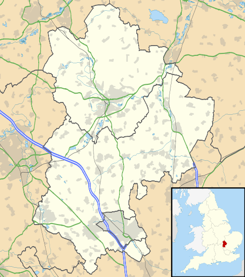 Round Green Round Green shown within Bedfordshire | |
| Population | 11,950 [1] |
| OS grid reference | TL095225 |
| Unitary authority | |
| Ceremonial county | |
| Region | |
| Country | England |
| Sovereign state | United Kingdom |
| Post town | LUTON |
| Postcode district | LU2 |
| Dialling code | 01582 |
| Police | Bedfordshire |
| Fire | Bedfordshire and Luton |
| Ambulance | East of England |
| EU Parliament | East of England |
| UK Parliament | |
Round Green is a suburb in the north-east of Luton. The area is roughly bounded by Badgers Hill to the north, People's Park, Richmond Hill and Turners Road South to the south, Wardown Crescent and Elmwood Crescent to the west, and Vauxhall Way to the east.
History
Formerly a small hamlet between Biscot, Leagrave and Stopsley, Round Green is one of the oldest parts of Luton, with references to the area dating back to 1170.
The area originally called Cowridge End stretches from what is now Old Bedford Road up to Birchen Grove in the North and down to Crawley Green in the south. The area was officially assumed into the boundary of Luton in 1933.
In 1908, the Luton Tram Service started up, with route one terminating at Round Green (starting out in Park Street). The tram service in the town was short-lived, and in 1931 the council decided to replace the trams with buses.[2]
Local Area
The local area is focused on the Stockingstone Road to the Hitchin Road roundabout, where two local pubs, the Jolly Topers[3] and The Round Green Tavern are situated within 20 metres of each other. Another pub, the Royal Oak, also traded in this area, however, it has recently closed due to increased competition. A small shopping area down Hitchin Road heading towards Luton has the local amenities such as the grocer's, newsagent, etc., and the local garage and childcare centre. In 1985 a travel agency called Double S Travel moved into what is the oldest building in Round Green. Built in 1902 it had views all the way down Stockingstone Road and up Montrose Avenue to the Biscot Mill windmill some two miles away.
Historically, a large horse-chestnut tree stood next to the roundabout outside the Jolly Topers pub; it had presided over the area for 150 years. However, in 2001, after heavy winds blew down its branches, it was deemed hazardous to leave standing. The tree was taken down and has recently been replaced.
Politics
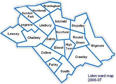
Round Green is part of the larger Round Green ward, which also contains parts of Ramridge End and Tin Town. The Councillors for Round Green ward are Cllr Yaqub Hanif (Labour), Cllr Mark Rivers (Labour), and Cllr Mohammed Zia (Labour).
The ward forms part of the parliamentary constituency of Luton South, and the MP is Gavin Shuker (Labour). Round Green is situated within the East of England (European Parliament constituency).
Local attractions
| Key | |
| Abbey/Priory/Cathedral | |
| Accessible open space | |
| Amusement/Theme Park | |
| Castle | |
| Country Park | |
| English Heritage | |
| Forestry Commission | |
| Heritage railway | |
| Historic House | |
| Museum (free/not free) | |
| National Trust | |
| Theatre | |
| Zoo | |
Local newspapers
Two weekly newspapers are delivered free to all houses in Round Green, with news about Luton and the surrounding area.
- Herald and Post (Luton based) - Delivered every Thursday
- Luton on Sunday - Delivered every Sunday
References
- ↑ Luton Borough Council, Population Estimates and Forecasts, estimate for Round Green ward in 2007. The count in the 2001 Census was 10,868.
- ↑ History of the trams in Luton
- ↑ Jolly Topers - Round Green Luton Bedfordshire
- Local History Book - The Story of Round Green by Barbara M. Benson