Saint-Martin-en-Vercors
| Saint-Martin-en-Vercors | |
|---|---|
| Commune | |
 Town hall | |
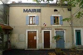
 Saint-Martin-en-Vercors Location within Auvergne-Rhône-Alpes region  Saint-Martin-en-Vercors | |
| Coordinates: 45°01′23″N 5°26′35″E / 45.023°N 5.443°ECoordinates: 45°01′23″N 5°26′35″E / 45.023°N 5.443°E | |
| Country | France |
| Region | Auvergne-Rhône-Alpes |
| Department | Drôme |
| Arrondissement | Die |
| Canton | Vercors-Monts du Matin |
| Intercommunality | Vercors |
| Government | |
| • Mayor (2008–2014) | Pierre Vignier |
| Area1 | 27.13 km2 (10.47 sq mi) |
| Population (2008)2 | 360 |
| • Density | 13/km2 (34/sq mi) |
| Time zone | UTC+1 (CET) |
| • Summer (DST) | UTC+2 (CEST) |
| INSEE/Postal code | 26315 /26420 |
| Elevation |
600–1,575 m (1,969–5,167 ft) (avg. 780 m or 2,560 ft) |
|
1 French Land Register data, which excludes lakes, ponds, glaciers > 1 km2 (0.386 sq mi or 247 acres) and river estuaries. 2 Population without double counting: residents of multiple communes (e.g., students and military personnel) only counted once. | |
Saint-Martin-en-Vercors is a commune in the Drôme department in southeastern France.
Population
| Historical population | ||
|---|---|---|
| Year | Pop. | ±% |
| 1911 | 760 | — |
| 1962 | 260 | −65.8% |
| 1968 | 318 | +22.3% |
| 1975 | 285 | −10.4% |
| 1982 | 292 | +2.5% |
| 1990 | 275 | −5.8% |
| 1999 | 295 | +7.3% |
| 2008 | 360 | +22.0% |
See also
References
| Wikimedia Commons has media related to Saint-Martin-en-Vercors. |
This article is issued from
Wikipedia.
The text is licensed under Creative Commons - Attribution - Sharealike.
Additional terms may apply for the media files.