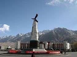
Taxkorgan Tajik Autonomous County
Taxkorgan Tajik Autonomous County[6][7][8] (also known as Taxkorgan County, sometimes spelled Tashkurgan or Tashkorgan) is a county of Kashgar Prefecture in Western Xinjiang, China. The county seat is the town of Tashkurgan.
Taxkorgan County 塔什库尔干县 تاشقۇرغان ناھىيىسى Tashkurgan, Tashiku'ergan | |
|---|---|
 | |
.png) Taxkorgan County (red) in Kashgar Prefecture (yellow) and Xinjiang | |
 Taxkorgan Location of the seat in Xinjiang | |
| Coordinates (Taxkorgan government): 37°46′20″N 75°13′48″E | |
| Country | People's Republic of China |
| Autonomous region | Xinjiang |
| Prefecture | Kashgar |
| County seat | Taxkorgan |
| Township-level divisions | 12[3] |
| Area | |
| • Total | 25,000 km2 (10,000 sq mi) |
| Elevation | 3,094 m (10,151 ft) |
| Population | |
| • Total | 37,843 |
| • Density | 1.5/km2 (3.9/sq mi) |
| Ethnic groups | |
| • Major ethnic groups | Mountain Tajiks (China)[3][5] |
| Time zone | UTC+8 (China Standard) |
| Postal code | 845250 |
| Area code(s) | 998 |
| Website | tskeg |
| Taxkorgan Tajik Autonomous County | |||||||||||||||
|---|---|---|---|---|---|---|---|---|---|---|---|---|---|---|---|
 "Welcome to Tashkurgan Tajik Autonomous County" | |||||||||||||||
| Chinese name | |||||||||||||||
| Simplified Chinese | 塔什库尔干塔吉克自治县 | ||||||||||||||
| Traditional Chinese | 塔什庫爾干塔吉克自治縣 | ||||||||||||||
| Hanyu Pinyin | Tǎshíkù'ěrgān Tǎjíkè Zìzhìxiàn | ||||||||||||||
| |||||||||||||||
| Puli County | |||||||||||||||
| Simplified Chinese | 蒲犁县 | ||||||||||||||
| Traditional Chinese | 蒲犁縣 | ||||||||||||||
| Hanyu Pinyin | Púlí Xiàn | ||||||||||||||
| |||||||||||||||
| Uyghur name | |||||||||||||||
| Uyghur | تاشقۇرغان تاجىك ئاپتونوم ناھىيىسى | ||||||||||||||
| |||||||||||||||
| Sarikoli name | |||||||||||||||
| Sarikoli | Toxkhürghon Tujik Oftunum Noya | ||||||||||||||
History
During the Han dynasty, Taxkorgan was known as Puli (Chinese: 蒲犁; pinyin: Púlí);[9] during the Tang dynasty, it was a protectorate of the Parthians, during the Yuan dynasty it was part of the Chaghatai empire. Taxkorgan Tajik Autonomous County was created in 1954 and is part of the district of Kashgar.
On September 17, 1954, Taxkorgan was made an autonomous region (自治区). On February 1955, it was made an autonomous county.[10]
In August 2013, the Chinese Academy of Social Sciences announced that they excavated a cluster of Zoroastrian tombs in Taxkorgan.[11]
In May 2017, the county was hit with a magnitude 5.5 earthquake that killed eight and injured 23.[12]
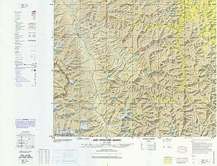
Geography
Taxkorgan County is located in the eastern part of the Pamir Plateau, where the Kunlun, Karakoram, Hindukush and Tian Shan mountains come together, at the borders with Afghanistan (Wakhan Corridor), Tajikistan (Gorno-Badakhshan Province) and Pakistan (Gilgit-Baltistan). The county seat is Taxkorgan Town.
The territorial expansion of the county is 178 kilometres (111 mi) from north to south and 140 kilometres (87 mi) from east to west, the total area is about 52,400 square kilometres (20,200 sq mi), at an average altitude above 4,000 metres (13,000 ft). The county includes a significant part of the Trans-Karakoram Tract, disputed by India and Pakistan in the ongoing Kashmir conflict; while Pakistan and China settled the border issue in 1963, India continues to claim it as part of the state of Jammu and Kashmir.
The Muztagh Ata, at 7,546 metres (24,757 ft), and the Kongur Tagh, at 7,719 metres (25,325 ft), are the main peaks in the county, while the two main rivers are the Taxkorgan River and the Tiznap (or Tiznef) River (Chinese: 提孜那甫河; pinyin: Tízīnàfǔ Hé). By including the Trans-Karakoram Tract, the county also borders several eight-thousanders, including K2, at 8,611 metres (28,251 ft) the second-highest mountain in the world. There are several hot springs and resources of gold, iron, and copper.
Climate
Taxkorgan has a cold desert climate (Köppen BWk), influenced by the high elevation, with long, very cold winters, and warm summers. Monthly daily average temperatures range from −11.9 °C (10.6 °F) in January to 16.4 °C (61.5 °F) in July, while the annual mean is 3.58 °C (38.4 °F). An average of only 68 millimetres (2.68 in) of precipitation falls per year
| Climate data for Taxkorgan (1971−2000) | |||||||||||||
|---|---|---|---|---|---|---|---|---|---|---|---|---|---|
| Month | Jan | Feb | Mar | Apr | May | Jun | Jul | Aug | Sep | Oct | Nov | Dec | Year |
| Record high °C (°F) | 6.5 (43.7) |
12.2 (54.0) |
18.9 (66.0) |
22.0 (71.6) |
25.1 (77.2) |
31.0 (87.8) |
32.5 (90.5) |
31.4 (88.5) |
27.8 (82.0) |
22.7 (72.9) |
14.3 (57.7) |
10.5 (50.9) |
32.5 (90.5) |
| Average high °C (°F) | −4.2 (24.4) |
−1 (30) |
6.0 (42.8) |
12.8 (55.0) |
16.7 (62.1) |
20.5 (68.9) |
23.7 (74.7) |
23.3 (73.9) |
18.6 (65.5) |
11.6 (52.9) |
4.8 (40.6) |
−1.9 (28.6) |
10.9 (51.6) |
| Daily mean °C (°F) | −11.9 (10.6) |
−8.2 (17.2) |
−0.5 (31.1) |
6.1 (43.0) |
9.8 (49.6) |
13.3 (55.9) |
16.4 (61.5) |
16.0 (60.8) |
11.4 (52.5) |
4.0 (39.2) |
−3.4 (25.9) |
−10.0 (14.0) |
3.6 (38.5) |
| Average low °C (°F) | −18.6 (−1.5) |
−15.3 (4.5) |
−7.3 (18.9) |
−0.8 (30.6) |
3.1 (37.6) |
6.4 (43.5) |
9.4 (48.9) |
8.8 (47.8) |
3.5 (38.3) |
−3.8 (25.2) |
−10.8 (12.6) |
−16.6 (2.1) |
−3.5 (25.7) |
| Record low °C (°F) | −39.1 (−38.4) |
−36.0 (−32.8) |
−25.7 (−14.3) |
−11.5 (11.3) |
−5.6 (21.9) |
−1.0 (30.2) |
2.2 (36.0) |
−0.2 (31.6) |
−5.0 (23.0) |
−12.2 (10.0) |
−23.3 (−9.9) |
−31.5 (−24.7) |
−39.1 (−38.4) |
| Average precipitation mm (inches) | 3.2 (0.13) |
2.6 (0.10) |
2.4 (0.09) |
4.8 (0.19) |
8.0 (0.31) |
15.5 (0.61) |
11.3 (0.44) |
9.6 (0.38) |
6.0 (0.24) |
2.1 (0.08) |
.7 (0.03) |
2.0 (0.08) |
68.2 (2.68) |
| Average precipitation days (≥ 0.1 mm) | 2.1 | 2.4 | 2.2 | 2.5 | 5.1 | 6.8 | 6.2 | 4.6 | 2.9 | 1.7 | .5 | 1.6 | 38.6 |
| Source: Weather.com.cn | |||||||||||||
Administrative divisions
| Conventional | Sarikoli (in IPA) | Uyghur (Ⱪona Yeziⱪ) | Uyghur (Siril Yezik) | Uyghur (Yenɡi Yeziⱪ) | Chinese (Simplified)[3][13][14] | Pinyin |
|---|---|---|---|---|---|---|
| Taxkorgan Town | tɔʃqyrʁɔn buzur | تاشقۇرغان بازىرى | Ташқурған базири | Taxⱪurƣan baziri | 塔什库尔干镇 | Tǎshíkù’ěrgān Zhèn |
| Tajik Abati Town | تاجىك ئابات بازىرى | Tajik Abat Baziri | 塔吉克阿巴提镇 | Tǎjíkè Ābātí Zhèn | ||
| 塔什库尔干乡 | Tǎshíkù’ěrgān Xiāng | |||||
| Tagarma | taʁarmi diyur | تاغارما | Тағарма | Taƣarma | 塔合曼乡 | Tǎhémàn Xiāng |
| Tiznap | tiznef diyur | تىزناپ | Тизнап | Tiznap | 提孜那甫乡 | Tízīnàfǔ Xiāng |
| Dafdar | ðavðɔr diyur | دەفتەر | Дәфтәр | Defter | 达布达尔乡 | Dábùdá’ěr Xiāng |
| Weqa | watʃa diyur | ۋەچە | Вәчә | Weqe | 瓦恰乡 | Wǎqià Xiāng |
| Baldir | baldir diyur | بەلدىر | Балдир | Baldir | 班迪尔乡 | Bāndí’ěr Xiāng |
| Maryang | marjɔŋ diyur | مارياڭ | Маряң | Maryang | 马尔洋乡 | Mǎ'ěryáng Xiāng |
| Datong | tyŋ diyur | داتۇڭ | Датуң | Datung | 大同乡 | Dàtóng Xiāng |
| Koguxluk | quʁuʃluʁ diyur | قوغۇشلۇق | Қоғухлуқ | Ⱪoƣuxluⱪ | 库科西鲁格乡 | Kùkēxīlǔgé Xiāng |
| Kokyar | kɔkjar qirʁiz diyur | كۆكيار قىرغىز يېزىسى | Көкяр Қирғиз йәзиси | Kɵkyar Ⱪirƣiz yezisi | 科克亚尔柯尔克孜族乡 | Kēkèyà’ěr Kē’ěrkèzīzú xiāng |
Demographics
| Historical population | ||
|---|---|---|
| Year | Pop. | ±% p.a. |
| 2000 | 30,454 | — |
| 2010 | 37,843 | +2.20% |
| [4] | ||
_p61_PLATE19._SINKIANG_(14597194848).jpg)
As of 2019, Mountain Tajiks (China) made up 80.9% of the residents of the county.[3]
As of 2015, 32,867 of the 40,381 residents of the county were Mountain Tajiks (China), 2,911 were Han Chinese, 2320 were Kyrgyz, and 2,179 were Uyghur.[15]
As of 1999, 6.28% of the population of Taxkorgan (Tashiku'ergan) County was Han Chinese and 5.08% of the population was Uyghur.[16]
The total population of Taxkorgan is 27,800, among them 84% Tajiks of Xinjiang who speak the Sarikoli language, 4% Han and 12% other nationalities. (Figures of 1995)
Economy
Animal husbandry is the primary economic mode with agriculture. The well-known Dunbashi fat-tailed sheep (敦巴什大尾羊) are raised in the county as well as domestic yaks. Agricultural products include highland barley, wheat, and others. Mineral resources include iron, sulfur, and asbestos.[10] In 2011, the county was considered relatively poor. 90% of the residents were engaged in animal husbandry.[17]
Transportation
The county is served by Karakoram Highway, which runs through Taxkorgan Town. Taxkorgan is the westernmost town in China. It is also the last/first town for visitors going/coming in/out of China and Pakistan through the Khunjerab Pass. There are public buses plying between Kashgar and Tashkorgan. As of September 2016, China has begun building an elevated road which is expected to be completed in a few years.
Museum
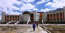
In Taxkorgan Town there is a museum that houses a few local artefacts, a photographic display and, in the basement, two mummies – one of a young woman about 18, and another of a baby about three months old which, however, was not hers. They are labelled as dating from the Bronze Age to the Warring States period (475-221 BCE). The mummies were discovered in the nearby Xiabandi Valley on the old caravan route to Yarkand. The valley has now been flooded for a hydro-electric project.
See also
- Afghanistan–China border
- Chalachigu Valley
- China–Tajikistan border
- Shaksgam River
- Taghdumbash Pamir
- Tashkurgan Nature Reserve
- Yarkand River
References
- Zhōngguó Shèhuì Kēxuéyuàn Mínzú Yánjiūsuǒ 中国社会科学院民族研究所 (ed.), Gāo’ěrqiāng 高尔锵 / Gawarjon: Tǎjíkè–Hàn cídiǎn 《塔吉克汉词典》 / Tujik ziv – Hanzu ziv lughot. Chengdu: Sìchuān mínzú chūbǎnshè 四川民族出版社, 1996.
- There is no official orthography for Tajik in China. This is the spelling used in the dictionary by Gawarjon.
- 塔县政府办公室 (15 December 2019). 塔什库尔干塔吉克自治县基本概况. 塔什库尔干政府门户网站 (in Chinese). Retrieved 9 February 2020.
全县总面积2.5万平方公里,辖12个乡镇50个村(社区),总人口4.1万人,塔吉克族占80.9%,是全国唯一的塔吉克民族自治县,外与巴基斯坦、阿富汗、塔吉克斯坦及克什米尔地区接壤,边境线长793.6公里,
- 塔什库尔干县历史沿革 [Taxkorgan County Historical Evolution]. XZQH.org (in Chinese). 14 November 2014. Retrieved 11 May 2020.
2000年第五次人口普查,塔什库尔干塔吉克自治县常住总人口30454人{...}2010年第六次人口普查,塔什库尔干塔吉克自治县常住总人口37843人
- 壮阔之美●新疆帕米尔高原. 塔什库尔干政府门户网站 (in Chinese). 24 December 2018. Retrieved 9 February 2020.
主要居民为塔吉克族。
- 中国地名委员会 (1994). 《中华人民共和国地名录》. Beijing: 中国社会出版社. p. 706.
- 崔乃夫 (Cui Naifu). 中华人民共和国分省地图集. p. 122.
- 《中华人民共和国地名大词典》. Beijing: The Commercial Press. 2002. p. 6534.
- See the discussions in Hill, John E. (2009) Through the Jade Gate to Rome: A Study of the Silk Routes during the Later Han Dynasty, 1st to 2nd Centuries CE. BookSurge, Charleston, South Carolina. ISBN 978-1-4392-2134-1, Note 20.2, pp. 394-401.
- 夏征农; 陈至立, eds. (September 2009). 辞海:第六版彩图本 [Cihai (Sixth Edition in Color)] (in Chinese). 上海. Shanghai: 上海辞书出版社. Shanghai Lexicographical Publishing House. p. 2189. ISBN 9787532628599.
- "Zoroastrian Cemetery found in Xinjiang, Tashkurgan Tajik Autonomous County, Jirzankal, 2013". kaogu.cn. Translated by Grace Warren. Institute of Archaeology, Chinese Academy of Social Sciences. 26 October 2013. Retrieved 21 January 2020.
- "8 dead, 23 injured in Xinjiang's 5.5-magnitude earthquake". Global Times. 2017-05-11. Retrieved 2017-06-23.
- 家乡“塔什库尔干县”微名片. 塔什库尔干政府门户网站 (in Chinese). 24 December 2018. Retrieved 20 April 2020.
塔什库尔干自治县辖1镇、10乡、1场:塔什库尔干镇、塔什库尔干乡、提孜那甫乡、塔合曼乡、柯克亚柯尔克孜民族乡、达布达尔乡、库克西力克乡、班迪尔乡、瓦恰乡、马尔洋乡、大同乡、麻扎种羊场。
- 2018年统计用区划代码和城乡划分代码:塔什库尔干塔吉克自治县 (in Chinese). National Bureau of Statistics of the People's Republic of China. 2018. Retrieved 9 February 2020.
统计用区划代码 名称 653131100000 塔什库尔干镇 653131101000 塔吉克阿巴提镇 653131200000 塔什库尔干乡 653131201000 塔合曼乡 653131202000 科克亚尔柯尔克孜族乡 653131203000 提孜那甫乡 653131204000 达布达尔乡 653131205000 马尔洋乡 653131206000 瓦恰乡 653131207000 班迪尔乡 653131208000 库科西鲁格乡 653131210000 大同乡
- 3-7 各地、州、市、县(市)分民族人口数 (in Chinese). شىنجاڭ ئۇيغۇر ئاپتونوم رايونى 新疆维吾尔自治区统计局 Statistic Bureau of Xinjiang Uygur Autonomous Region. 15 March 2017. Archived from the original on 11 October 2017. Retrieved 3 September 2017.
- Morris Rossabi, ed. (2004). Governing China’s Multiethnic Frontiers (PDF). University of Washington Press. p. 179. ISBN 0-295-98390-6.
- "The mountainous task of getting to school". China Daily. 30 September 2011. Retrieved 20 April 2020.
External links
| Wikimedia Commons has media related to Tashkurgan Tajik Autonomous County. |
| Authority control |
|
|---|