National Register of Historic Places listings in Westmoreland County, Pennsylvania
This is a list of the National Register of Historic Places listings in Westmoreland County, Pennsylvania.
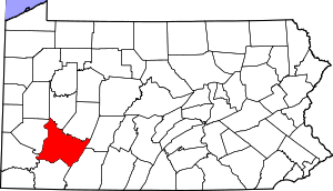
Location of Westmoreland County
This is intended to be a complete list of the properties and districts on the National Register of Historic Places in Westmoreland County, Pennsylvania, United States. The locations of National Register properties and districts for which the latitude and longitude coordinates are included below, may be seen in a map.[1]
There are 54 properties and districts listed on the National Register in the county. One site is further designated as a National Historic Landmark. Another property was once listed but has been removed.
- This National Park Service list is complete through NPS recent listings posted June 19, 2020.[2]
Current listings
| [3] | Name on the Register | Image | Date listed[4] | Location | Municipality | Description |
|---|---|---|---|---|---|---|
| 1 | Academy Hill Historic District | 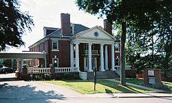 Academy Hill Historic District |
April 29, 1999 (#99000516) |
Roughly bounded by Baughman Street, North Maple Avenue, Kenneth Street, Culbertson Avenue, Beacon Street, and Pennsylvania Avenue 40°18′39″N 79°32′42″W |
Greensburg | |
| 2 | Allegheny River Lock and Dam No. 4 | 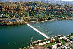 Allegheny River Lock and Dam No. 4 |
April 21, 2000 (#00000398) |
1 River Avenue 40°36′52″N 79°42′59″W |
Lower Burrell | Extends into Harrison Township in Allegheny County |
| 3 | Aluminum Research Laboratories |  Aluminum Research Laboratories |
July 23, 2013 (#98000413) |
Freeport Road 40°34′19″N 79°45′21″W |
New Kensington | |
| 4 | Bells Mills Covered Bridge | .jpg) Bells Mills Covered Bridge |
June 27, 1980 (#80003648) |
West of Yukon 40°13′09″N 79°42′37″W |
Sewickley and South Huntingdon Townships | |
| 5 | Brush Creek Salems Church |  Brush Creek Salems Church |
May 11, 1987 (#87000675) |
Southeast of Westmoreland City on Brush Creek Road 40°19′09″N 79°39′30″W |
Hempfield Township | |
| 6 | Brush Hill |  Brush Hill |
October 14, 1975 (#75001677) |
651 Brush Hill Road 40°19′30″N 79°41′22″W |
Irwin | |
| 7 | Bushy Run Battlefield | 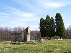 Bushy Run Battlefield |
October 15, 1966 (#66000696) |
2 miles (3.2 km) east of Harrison City on Pennsylvania Route 993 40°21′21″N 79°37′30″W |
Penn Township | |
| 8 | Byerly House | 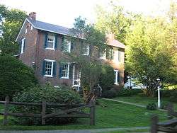 Byerly House |
July 18, 1985 (#85001567) |
115 Menk Road, east of New Kensington 40°33′14″N 79°41′02″W |
Upper Burrell Township | |
| 9 | Charleroi-Monessen Bridge | 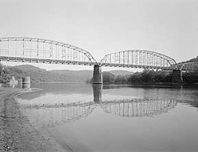 Charleroi-Monessen Bridge |
June 22, 1988 (#88000812) |
Legislative Route 247 over the Monongahela River 40°09′06″N 79°54′15″W |
Monessen | Extends into North Charleroi in Washington County |
| 10 | Citizens National Bank of Latrobe | 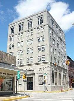 Citizens National Bank of Latrobe |
November 1, 2002 (#02001281) |
816 Ligonier Street 40°19′00″N 79°23′05″W |
Latrobe | |
| 11 | Compass Inn |  Compass Inn |
February 24, 1995 (#95000124) |
Junction of U.S. Route 30 (the Lincoln Highway) and California Avenue 40°12′43″N 79°11′57″W |
Ligonier Township | |
| 12 | Concord School | .jpg) Concord School |
September 30, 2014 (#14000817) |
Loyalhanna Dam Rd. 40°26′28″N 79°28′04″W |
Loyalhanna Township | 1848 schoolhouse. |
| 13 | Dick Building | 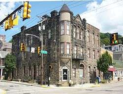 Dick Building |
August 30, 2007 (#07000890) |
201–203 East Main Street 40°12′06″N 79°46′00″W |
West Newton | |
| 14 | Fairview Park | .jpg) Fairview Park |
December 27, 2010 (#10001069) |
South side of Old Route 22, approximately 1.5 miles (2.4 km) east of Delmont 40°24′21″N 79°33′21″W |
Salem Township | |
| 15 | Adam Fisher Homestead |  Adam Fisher Homestead |
February 28, 1991 (#91000230) |
Brinkerton Road near junction with Mount Pleasant Road, northwest of Calumet 40°13′09″N 79°30′10″W |
Mount Pleasant Township | |
| 16 | Fort Ligonier Site | 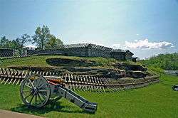 Fort Ligonier Site |
January 21, 1975 (#75001678) |
South Market Street 40°14′27″N 79°14′16″W |
Ligonier | |
| 17 | Fullerton Inn | 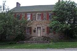 Fullerton Inn |
June 30, 1983 (#83002285) |
11029 Old Trail Road, west of Irwin 40°19′47″N 79°43′35″W |
North Huntingdon Township | |
| 18 | Greensburg Downtown Historic District |  Greensburg Downtown Historic District |
July 21, 1995 (#95000884) |
Roughly bounded by Tunnel Street, Main Street, Third Street and Harrison Avenue 40°18′11″N 79°32′42″W |
Greensburg | |
| 19 | Greensburg Railroad Station | 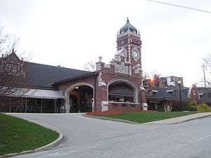 Greensburg Railroad Station |
November 7, 1977 (#77001202) |
Harrison Avenue 40°18′16″N 79°32′49″W |
Greensburg | |
| 20 | Hannastown Farm |  Hannastown Farm |
March 17, 1994 (#94000209) |
Northwest of the junction of Township 825 and Legislative Route 64054 40°21′11″N 79°30′21″W |
Salem Township | |
| 21 | Household No. 1 Site (36WM61) | 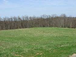 Household No. 1 Site (36WM61) |
March 20, 1986 (#86000465) |
Off Timms Lane[5] 40°10′27″N 79°46′44″W |
Rostraver Township | |
| 22 | Kingston House |  Kingston House |
June 30, 1983 (#83002286) |
U.S. Route 30, northeast of Youngstown 40°17′28″N 79°20′29″W |
Unity Township | |
| 23 | Latrobe Armory | 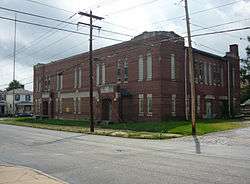 Latrobe Armory |
December 22, 1989 (#89002076) |
1017 Ridge Avenue 40°19′00″N 79°22′53″W |
Latrobe | |
| 24 | Laurel Hill Furnace |  Laurel Hill Furnace |
April 28, 1975 (#75001679) |
Southeast of New Florence on Baldwin Run 40°22′00″N 79°03′32″W |
St. Clair Township | |
| 25 | Ligonier Armory |  Ligonier Armory |
May 9, 1991 (#91000514) |
358 West Main Street 40°14′49″N 79°14′33″W |
Ligonier | Demolished.[6] |
| 26 | Ligonier Historic District |  Ligonier Historic District |
August 30, 1994 (#94001054) |
Junction of Main and Market Streets 40°14′35″N 79°14′16″W |
Ligonier | |
| 27 | Linn Run State Park Family Cabin District | 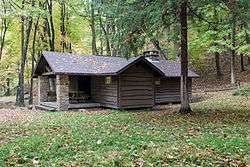 Linn Run State Park Family Cabin District |
February 12, 1987 (#87000107) |
2 miles (3.2 km) southeast of Rector on Linn Run Road 40°09′14″N 79°13′00″W |
Cook Township | |
| 28 | Loyalhanna Lodge No. 275 | 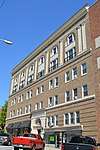 Loyalhanna Lodge No. 275 |
February 2, 2016 (#15001036) |
221 Spring St. 40°18′54″N 79°23′00″W |
Latrobe | |
| 29 | Andrew and Jennie McFarlane House |  Andrew and Jennie McFarlane House |
August 4, 2004 (#04000807) |
50 Maus Drive, west of Irwin 40°19′47″N 79°44′21″W |
North Huntingdon Township | |
| 30 | Mount Pleasant Armory | 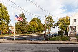 Mount Pleasant Armory |
December 22, 1989 (#89002079) |
Eagle and Spring Streets 40°08′59″N 79°32′54″W |
Mount Pleasant | Demolished in 1996[7] |
| 31 | Mount Pleasant Historic District |  Mount Pleasant Historic District |
July 23, 1998 (#98000903) |
Roughly along Main, South Church, Eagle, Walnut and College Streets 40°08′54″N 79°32′41″W |
Mount Pleasant | |
| 32 | Mount St. Peter Roman Catholic Church | 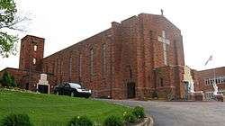 Mount St. Peter Roman Catholic Church |
May 5, 1998 (#98000398) |
100 Freeport Road 40°33′50″N 79°45′42″W |
New Kensington | |
| 33 | New Kensington Downtown Historic District |  New Kensington Downtown Historic District |
July 23, 1998 (#98000904) |
Roughly bounded by 8th Avenue, 3rd Street, 11th Avenue, and Barnes Avenue 40°33′58″N 79°45′58″W |
New Kensington | |
| 34 | New Kensington Production Works Historic District | New Kensington Production Works Historic District |
May 7, 1998 (#98000397) |
Roughly along the Allegheny River, from Sixteenth Street to Seventh Street 40°33′56″N 79°46′13″W |
New Kensington | |
| 35 | Samuel Patterson House |  Samuel Patterson House |
March 7, 1985 (#85000472) |
Pennsylvania Route 981, north of New Alexandria 40°23′58″N 79°25′20″W |
Derry Township | |
| 36 | Pennsylvania Railroad Station-Latrobe | Pennsylvania Railroad Station-Latrobe |
July 17, 1986 (#86001689) |
Depot Street 40°19′07″N 79°23′08″W |
Latrobe | |
| 37 | Plumer House | 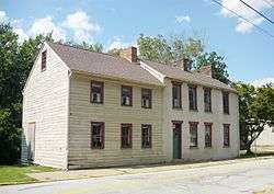 Plumer House |
December 6, 1979 (#79002368) |
Vine and South Water Street 40°12′33″N 79°46′10″W |
West Newton | |
| 38 | Ross Furnace |  Ross Furnace |
September 6, 1991 (#91001142) |
Southwest of Tubmill Reservoir off Pennsylvania Route 711 40°19′33″N 79°05′26″W |
Fairfield Township | |
| 39 | St. Gertrude Roman Catholic Church | 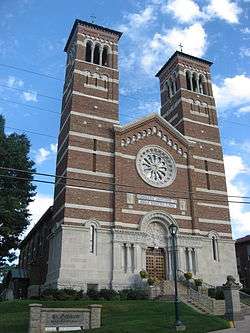 St. Gertrude Roman Catholic Church |
September 23, 1983 (#83002287) |
311 Franklin Avenue 40°35′59″N 79°33′52″W |
Vandergrift | |
| 40 | St. Vincent Archabbey Gristmill |  St. Vincent Archabbey Gristmill |
January 18, 1978 (#78002486) |
Southwest of Latrobe off U.S. Route 30 40°17′43″N 79°24′10″W |
Unity Township | |
| 41 | Salem Crossroads Historic District |  Salem Crossroads Historic District |
September 18, 1978 (#78002484) |
Pittsburgh and Greensburg Streets 40°24′44″N 79°34′10″W |
Delmont | |
| 42 | Scottdale Armory | 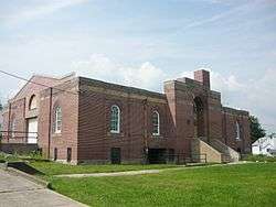 Scottdale Armory |
May 9, 1991 (#91000518) |
501 North Broadway Street 40°06′17″N 79°35′08″W |
Scottdale | |
| 43 | Scottdale Historic District |  Scottdale Historic District |
March 29, 1996 (#96000320) |
Roughly bounded by Walnut Street, Constitution Way, Arthur Avenue and Jacob's Creek 40°06′05″N 79°35′22″W |
Scottdale | |
| 44 | Sewickley Manor |  Sewickley Manor |
April 19, 1982 (#82003820) |
Legislative Route 64136, north of Calumet 40°14′05″N 79°28′56″W |
Mount Pleasant Township | |
| 45 | Site of Old Hannastown | 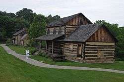 Site of Old Hannastown |
January 26, 1972 (#72001180) |
4 miles (6.4 km) northeast of Greensburg 40°20′37″N 79°30′19″W |
Hempfield Township | |
| 46 | Slickville Historic District |  Slickville Historic District |
June 3, 1994 (#94000522) |
Roughly bounded by Greenburg and Second Avenue and Delmont, Court, Cottage and Fred Streets, in Slickville 40°27′27″N 79°31′23″W |
Salem Township | |
| 47 | Squirrel Hill Site | 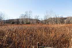 Squirrel Hill Site |
March 26, 1980 (#80003647) |
West of New Florence near the banks of the Conemaugh River[8] 40°22′49″N 79°05′20″W |
St. Clair Township | |
| 48 | Vandergrift Historic District |  Vandergrift Historic District |
April 27, 1995 (#95000525) |
Roughly bounded by Lincoln, Sherman, Franklin and Washington Avenues, along the outer lot lines 40°36′09″N 79°33′44″W |
Vandergrift | |
| 49 | John Walter Farmstead |  John Walter Farmstead |
July 21, 1995 (#95000885) |
166 Mamont Drive 40°28′19″N 79°35′21″W |
Washington Township | |
| 50 | Samuel Warden House |  Samuel Warden House |
November 7, 1995 (#95001252) |
200 South Church Street 40°08′52″N 79°32′50″W |
Mount Pleasant | |
| 51 | Webster Donora Bridge |  Webster Donora Bridge |
June 22, 1988 (#88000813) |
Pennsylvania Route 143 over the Monongahela River at Webster 40°11′03″N 79°51′08″W |
Rostraver Township | Extends into Washington County |
| 52 | West Overton Historic District |  West Overton Historic District |
July 18, 1985 (#85001572) |
Frick Avenue 40°06′59″N 79°33′59″W |
East Huntingdon Township | |
| 53 | Western Division-Pennsylvania Canal |  Western Division-Pennsylvania Canal |
September 17, 1974 (#74001817) |
Along the Conemaugh River 40°25′30″N 79°13′48″W |
Bell Township, Bolivar, Derry Township, Fairfield Township, and Loyalhanna Township | Boundaries increased on November 14, 1982 under the name "Western Division of the PA Canal" |
| 54 | Westmoreland County Courthouse |  Westmoreland County Courthouse |
March 30, 1978 (#78002485) |
North Main Street 40°18′09″N 79°32′46″W |
Greensburg |
Former listing
| [3] | Name on the Register | Image | Date listed | Date removed | Location | Municipality | Summary |
|---|---|---|---|---|---|---|---|
| 1 | General Greene Hotel |  General Greene Hotel |
August 29, 1980 (#80003646) | June 16, 1986 | 24 West Otterman Street |
Greensburg | Built 1903 demolished |
See also
| Wikimedia Commons has media related to National Register of Historic Places in Westmoreland County, Pennsylvania. |
References
- The latitude and longitude information provided in this table was derived originally from the National Register Information System, which has been found to be fairly accurate for about 99% of listings. Some locations in this table may have been corrected to current GPS standards.
- "National Register of Historic Places: Weekly List Actions". National Park Service, United States Department of the Interior. Retrieved on June 19, 2020.
- Numbers represent an ordering by significant words. Various colorings, defined here, differentiate National Historic Landmarks and historic districts from other NRHP buildings, structures, sites or objects.
- The eight-digit number below each date is the number assigned to each location in the National Register Information System database, which can be viewed by clicking the number.
- Location derived from its NRHP nomination form; the NRIS lists the site as "Address Restricted"
- Phraner, Jewel (January 12, 2010). "Housing complex on armory site gets planners' OK". Pittsburgh Tribune-Review. Retrieved March 14, 2011.
- "Pennsylvania National Guard Military Museum: Mount Pleasant Armory". PNG Military Museum. Retrieved 2011-08-24.
- Location derived from its NRHP nomination form; the NRIS lists the site as "Address Restricted"
| Topics | 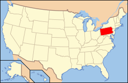 | |
|---|---|---|
| Lists by county |
| |
| Lists by city |
| |
| Other lists | ||
| ||
This article is issued from Wikipedia. The text is licensed under Creative Commons - Attribution - Sharealike. Additional terms may apply for the media files.