National Register of Historic Places listings in Butler County, Pennsylvania
This is a list of the National Register of Historic Places listings in Butler County, Pennsylvania.

Location of Butler County in Pennsylvania
This is intended to be a complete list of the properties and districts on the National Register of Historic Places in Butler County, Pennsylvania, United States. The locations of National Register properties and districts for which the latitude and longitude coordinates are included below, may be seen in a map.[1]
There are 12 properties and districts listed on the National Register in the county. One site is further designated as a National Historic Landmark District.
- This National Park Service list is complete through NPS recent listings posted June 19, 2020.[2]
Current listings
| [3] | Name on the Register | Image | Date listed[4] | Location | City or town | Description |
|---|---|---|---|---|---|---|
| 1 | Butler Armory |  Butler Armory |
July 12, 1991 (#91000903) |
216 North Washington Street 40°51′47″N 79°53′50″W |
Butler | |
| 2 | Butler County Courthouse | 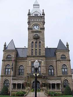 Butler County Courthouse |
September 15, 1977 (#77001132) |
South Main and Diamond Streets 40°51′30″N 79°53′46″W |
Butler | |
| 3 | Butler County National Bank |  Butler County National Bank |
November 7, 1995 (#95001251) |
302 South Main Street 40°51′29″N 79°53′43″W |
Butler | |
| 4 | Butler Historic District | 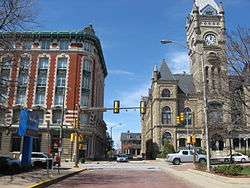 Butler Historic District |
May 29, 2003 (#03000490) |
Roughly bounded by North Church Street, Walnut Street, Franklin Street, and Wayne Street 40°51′39″N 79°53′40″W |
Butler | |
| 5 | Elm Court |  Elm Court |
December 6, 1979 (#79002176) |
Between Polk and Elm Streets 40°52′07″N 79°53′31″W |
Butler | |
| 6 | Harmony Historic District | 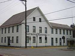 Harmony Historic District |
March 21, 1973 (#73002139) |
Pennsylvania Route 68 40°48′11″N 80°07′42″W |
Harmony | |
| 7 | Harmony Mennonite Meetinghouse and Cemetery |  Harmony Mennonite Meetinghouse and Cemetery |
October 4, 2016 (#16000697) |
114 Wise Rd. 40°48′33″N 80°07′41″W |
Jackson Township | |
| 8 | Sen. Walter Lowrie House | 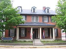 Sen. Walter Lowrie House |
May 1, 1979 (#79002177) |
West Diamond and South Jackson Streets 40°51′30″N 79°53′47″W |
Butler | |
| 9 | Passavant House |  Passavant House |
April 11, 1977 (#77001133) |
243 South Main Street 40°47′35″N 80°08′13″W |
Zelienople | |
| 10 | Preston Laboratories |  Preston Laboratories |
December 26, 2012 (#12001095) |
415 S. Eberhart Road, west of Butler 40°51′12″N 79°57′00″W |
Butler Township | Site plan |
| 11 | John Roebling House | 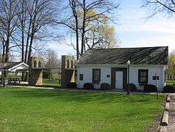 John Roebling House |
November 13, 1976 (#76001610) |
Roebling Park, along Rebecca Street 40°45′03″N 79°48′39″W |
Saxonburg | Home of John Roebling |
| 12 | Saxonburg Historic District | 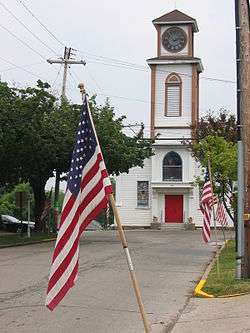 Saxonburg Historic District |
February 14, 2003 (#03000035) |
Portions of East and West Main, North and South Rebecca, North and South Isabella, Pittsburgh, Butler, and State Streets 40°45′00″N 79°49′08″W |
Saxonburg |
See also
| Wikimedia Commons has media related to National Register of Historic Places in Butler County, Pennsylvania. |
References
- The latitude and longitude information provided in this table was derived originally from the National Register Information System, which has been found to be fairly accurate for about 99% of listings. Some locations in this table may have been corrected to current GPS standards.
- "National Register of Historic Places: Weekly List Actions". National Park Service, United States Department of the Interior. Retrieved on June 19, 2020.
- Numbers represent an ordering by significant words. Various colorings, defined here, differentiate National Historic Landmarks and historic districts from other NRHP buildings, structures, sites or objects.
- The eight-digit number below each date is the number assigned to each location in the National Register Information System database, which can be viewed by clicking the number.
| Topics | 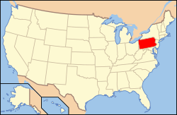 | |
|---|---|---|
| Lists by county |
| |
| Lists by city |
| |
| Other lists | ||
| ||
Municipalities and communities of Butler County, Pennsylvania, United States | ||
|---|---|---|
| City | | |
| Boroughs | ||
| Townships | ||
| CDPs | ||
| Unincorporated communities | ||
| Footnotes | ‡This populated place also has portions in an adjacent county or counties | |
This article is issued from Wikipedia. The text is licensed under Creative Commons - Attribution - Sharealike. Additional terms may apply for the media files.