National Register of Historic Places listings in South Philadelphia
This is a list of the National Register of Historic Places listings in South Philadelphia.

This is intended to be a complete list of the properties and districts on the National Register of Historic Places in South Philadelphia, Pennsylvania, United States. The locations of National Register properties and districts for which the latitude and longitude coordinates are included below may be seen in an online map.[1]
There are 564 properties and districts listed on the National Register in Philadelphia, including 67 National Historic Landmarks. South Philadelphia includes 60 of these properties and districts, including 2 National Historic Landmarks; the city's remaining properties and districts are listed elsewhere. One site is split between South Philadelphia and other parts of the city, and is thus included on multiple lists.
Current listings
| [2] | Name on the Register | Image | Date listed[3] | Location | Neighborhood | Description |
|---|---|---|---|---|---|---|
| 1 | James Alcorn School |  James Alcorn School |
November 18, 1988 (#88002225) |
1500 South 32nd Street 39°56′07″N 75°11′51″W |
Grays Ferry | |
| 2 | Marian Anderson House |  Marian Anderson House |
April 14, 2011 (#11000198) |
762 South Martin Street 39°56′32″N 75°10′29″W |
Southwest Center City | |
| 3 | Charles Y. Audenried Junior High School |  Charles Y. Audenried Junior High School |
November 18, 1988 (#88002239) |
1601 South 33rd Street 39°56′01″N 75°11′58″W |
Grays Ferry | The photo shows the replacement school on the same site |
| 4 | Baptist Institute for Christian Workers | 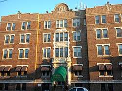 Baptist Institute for Christian Workers |
April 21, 1983 (#83002265) |
1425–1429 Snyder Avenue 39°55′29″N 75°10′14″W |
West Passyunk | |
| 5 | Bartlett School | 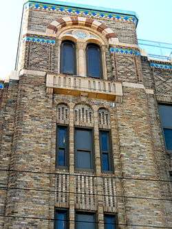 Bartlett School |
December 4, 1986 (#86003315) |
1100 Catharine Street 39°56′24″N 75°09′42″W |
Hawthorne | |
| 6 | Bethel Burial Ground | 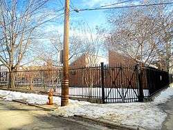 Bethel Burial Ground |
January 5, 2016 (#15000734) |
405-425 Queen St. 39°56′16″N 75°09′04″W |
Queen Village | |
| 7 | Edward Bok Vocational School |  Edward Bok Vocational School |
December 4, 1986 (#86003264) |
1901 South 9th Street 39°55′33″N 75°09′37″W |
Central South Philadelphia | |
| 8 | F. Amadee Bregy School |  F. Amadee Bregy School |
November 18, 1988 (#88002249) |
1700 Bigler Street 39°54′52″N 75°10′36″W |
Marconi Plaza | |
| 9 | George W. Childs School | 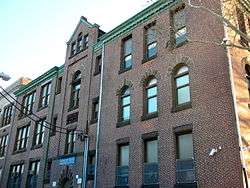 George W. Childs School |
November 18, 1988 (#88002257) |
1501 South 17th Street 39°55′53″N 75°10′22″W |
Point Breeze | Built 1894–96, designed by Joseph Anschutz[4] |
| 10 | Commandant's Quarters |  Commandant's Quarters |
June 3, 1976 (#76001661) |
U.S. Naval Base 39°53′48″N 75°10′38″W |
Navy Yard | |
| 11 | Francis M. Drexel School | 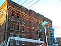 Francis M. Drexel School |
December 4, 1986 (#86003272) |
1800 South Sixteenth Street 39°55′42″N 75°10′23″W |
Point Breeze | Built 1888–89, designed by Joseph Anschutz[4] Demolished Feb., 2010 |
| 12 | Federal Street School | 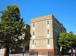 Federal Street School |
December 1, 1986 (#86003294) |
1130–1148 Federal Street 39°56′05″N 75°09′48″W |
Passyunk Square | |
| 13 | D. Newlin Fell School |  D. Newlin Fell School |
November 18, 1988 (#88002268) |
900 Oregon Avenue 39°54′56″N 75°09′48″W |
East Oregon | |
| 14 | Samuel S. Fleisher Art Memorial | 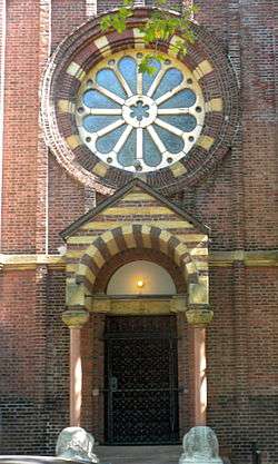 Samuel S. Fleisher Art Memorial |
November 14, 1982 (#82001547) |
711–721 Catharine Street 39°56′21″N 75°09′18″W |
Bella Vista | |
| 15 | Franklin Hose Company No. 28 |  Franklin Hose Company No. 28 |
December 3, 1980 (#80003604) |
730–732 South Broad Street 39°56′32″N 75°09′58″W |
Southwest Center City | |
| 16 | Horace Furness Junior High School | 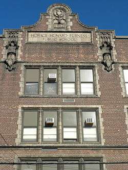 Horace Furness Junior High School |
December 1, 1986 (#86003286) |
1900 South 3rd Street 39°55′26″N 75°09′03″W |
Pennsport | |
| 17 | Gloria Dei (Old Swedes') Church National Historic Site |  Gloria Dei (Old Swedes') Church National Historic Site |
October 15, 1966 (#66000682) |
Swanson Street, between Christian and Water Streets 39°56′04″N 75°08′38″W |
Queen Village | |
| 18 | Grays Road Recreation Center |  Grays Road Recreation Center |
April 21, 1988 (#88000448) |
2501 Christian Street 39°56′33″N 75°11′06″W |
Grays Ferry | |
| 19 | Frances Ellen Watkins Harper House |  Frances Ellen Watkins Harper House |
December 8, 1976 (#76001663) |
1006 Bainbridge Street 39°56′31″N 75°09′34″W |
Bella Vista | |
| 20 | Nathaniel Hawthorne School |  Nathaniel Hawthorne School |
December 4, 1986 (#86003289) |
712 South 12th Street 39°56′30″N 75°09′44″W |
Hawthorne | |
| 21 | Howell and Brothers Paper Hangings Manufactory |  Howell and Brothers Paper Hangings Manufactory |
December 21, 2017 (#100001912) |
2101 Washington Ave. 39°56′22″N 75°10′45″W |
Southwest Center City | Built 1865[5] |
| 21 | Institute for Colored Youth | 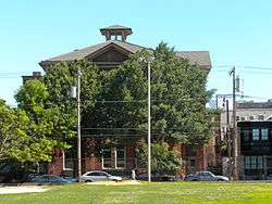 Institute for Colored Youth |
December 4, 1986 (#86003324) |
10th and Bainbridge Streets 39°56′31″N 75°09′28″W |
Bella Vista | |
| 22 | Nathaniel Irish House |  Nathaniel Irish House |
March 16, 1972 (#72001160) |
704 South Front Street 39°56′24″N 75°08′40″W |
Queen Village | |
| 23 | Francis Scott Key School |  Francis Scott Key School |
December 1, 1986 (#86003296) |
2226–2250 South 8th Street 39°55′15″N 75°09′38″W |
Central South Philadelphia | Built 1889, designed by Joseph Anschutz[4] |
| 24 | Eliza Butler Kirkbride School | 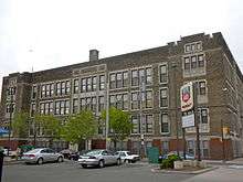 Eliza Butler Kirkbride School |
November 18, 1988 (#88002290) |
626 Dickinson Street 39°55′48″N 75°09′22″W |
Passyunk Square | |
| 25 | David Landreth School |  David Landreth School |
December 4, 1986 (#86003299) |
1201 South 23rd Street 39°56′16″N 75°10′54″W |
Point Breeze | Built 1889, designed by Joseph Anschutz[4] |
| 26 | Marine Barracks |  Marine Barracks |
July 13, 1976 (#76001664) |
Building 100, Philadelphia Naval Shipyard, 4800 S. 13th Street 39°53′32″N 75°10′28″W |
Navy Yard | |
| 27 | Marine Corps Depot of Supplies, Schuylkill Warehouse |  Marine Corps Depot of Supplies, Schuylkill Warehouse |
November 12, 2004 (#04001228) |
700–734 Schuylkill Avenue 39°56′41″N 75°11′12″W |
Schuylkill | |
| 28 | Marine Corps Supply Activity |  Marine Corps Supply Activity |
August 6, 1975 (#75001662) |
1100 South Broad Street 39°56′15″N 75°10′02″W |
Point Breeze | |
| 29 | Delaplaine McDaniel School | 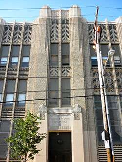 Delaplaine McDaniel School |
December 4, 1986 (#86003303) |
2100 Moore Street 39°55′46″N 75°10′53″W |
Point Breeze | |
| 30 | William M. Meredith School | 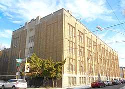 William M. Meredith School |
December 4, 1986 (#86003307) |
5th and Fitzwater Streets 39°56′23″N 75°09′03″W |
Queen Village | |
| 31 | Capt. Thomas Moore House |  Capt. Thomas Moore House |
March 16, 1972 (#72001165) |
702 South Front Street 39°56′24″N 75°08′40″W |
Queen Village | |
| 32 | George W. Nebinger School |  George W. Nebinger School |
November 18, 1988 (#88002303) |
601–627 Carpenter Street 39°56′12″N 75°09′14″W |
Bella Vista | |
| 33 | Jeremiah Nichols School |  Jeremiah Nichols School |
November 18, 1988 (#88002241) |
1235 South 16th Street 39°56′06″N 75°10′14″W |
Point Breeze | |
| 34 | William S. Peirce School | 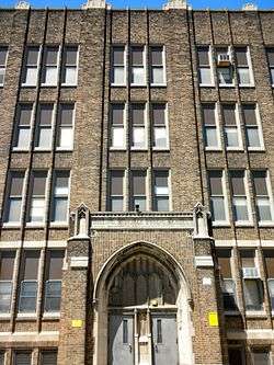 William S. Peirce School |
November 18, 1988 (#88002307) |
2400 Christian Street 39°56′30″N 75°10′58″W |
Southwest Center City | |
| 35 | Philadelphia Naval Shipyard Historic District | .jpg) Philadelphia Naval Shipyard Historic District |
December 22, 1999 (#99001579) |
South Broad Street 39°53′N 75°11′W |
Navy Yard | |
| 36 | Philadelphia Quartermaster Depot | 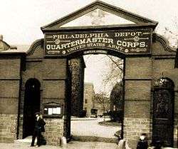 Philadelphia Quartermaster Depot |
January 26, 2010 (#09001212) |
2724 South 20th Street 39°54′59″N 75°10′57″W |
Girard Estate | |
| 37 | Philadelphia, Wilmington and Baltimore Railroad Freight Shed | 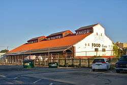 Philadelphia, Wilmington and Baltimore Railroad Freight Shed |
September 8, 2011 (#11000649) |
1001 South 15th Street 39°56′21″N 75°10′04″W |
Southwest Center City | |
| 38 | Edgar Allan Poe School |  Edgar Allan Poe School |
December 4, 1986 (#86003318) |
2136 Ritner Street 39°55′20″N 75°10′59″W |
Girard Estate | |
| 39 | Robert Ralston School | 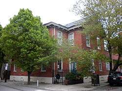 Robert Ralston School |
December 4, 1986 (#86003321) |
221 Bainbridge Street 39°56′26″N 75°08′48″W |
Queen Village | |
| 40 | Royal Theater |  Royal Theater |
February 8, 1980 (#80003619) |
1524–1534 South Street 39°56′38″N 75°10′06″W |
Southwest Center City | |
| 41 | St. Anthony de Padua Parish School | 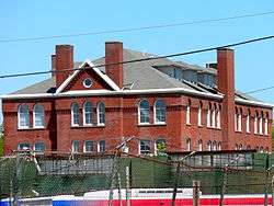 St. Anthony de Padua Parish School |
May 7, 1992 (#92000400) |
2317–2333 Carpenter Street 39°56′28″N 75°10′56″W |
Southwest Center City | |
| 42 | George Sharswood School | 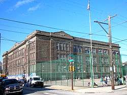 George Sharswood School |
November 18, 1988 (#88002320) |
200 Wolf Street 39°55′07″N 75°09′03″W |
Whitman | |
| 43 | Walter George Smith School |  Walter George Smith School |
December 4, 1986 (#86003329) |
1300 South 19th Street 39°56′06″N 75°10′33″W |
Point Breeze | |
| 44 | South Front Street Historic District |  South Front Street Historic District |
April 25, 1972 (#72001171) |
700–712 South Front Street, western side of Bainbridge Street to Kenilworth Street 39°56′24″N 75°08′40″W |
Queen Village | |
| 45 | Southwark District |  Southwark District |
May 19, 1972 (#72001172) |
Bounded by Delaware, Washington Aves., 5th, Lombard, Front, and Catherine Sts. 39°56′16″N 75°08′54″W |
Southwark | |
| 46 | Southwark School | 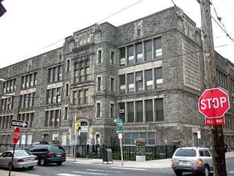 Southwark School |
December 1, 1986 (#86003330) |
Eighth and Miflin Streets 39°55′31″N 75°09′36″W |
Central South Philadelphia | |
| 47 | SS United States (Steamship) |  SS United States (Steamship) |
June 3, 1999 (#99000609) |
Pier 82 39°55′06″N 75°08′11″W |
Whitman | |
| 48 | Edwin M. Stanton School |  Edwin M. Stanton School |
November 18, 1988 (#88002326) |
1616–1644 Christian Street 39°56′25″N 75°10′15″W |
Southwest Center City | |
| 49 | George C. Thomas Junior High School |  George C. Thomas Junior High School |
November 18, 1988 (#88002330) |
2746 South 9th Street 39°54′56″N 75°09′48″W |
East Oregon | |
| 50 | Tindley Temple United Methodist Church | 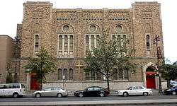 Tindley Temple United Methodist Church |
April 15, 2011 (#11000199) |
750–762 South Broad Street 39°56′29″N 75°09′59″W |
Southwest Center City | |
| 51 | U.S. Naval Home |  U.S. Naval Home |
August 21, 1972 (#72001173) |
Gray's Ferry Avenue at 24th Street 39°56′38″N 75°11′01″W |
Southwest Center City | |
| 52 | University Avenue Bridge |  University Avenue Bridge |
May 26, 1994 (#94000515) |
South University Avenue over the Schuylkill River 39°56′34″N 75°11′49″W |
Grays Ferry | Extends into West Philadelphia |
| 53 | Abigail Vare School | 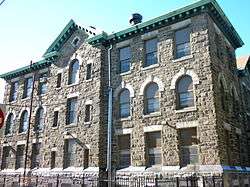 Abigail Vare School |
December 4, 1986 (#86003339) |
Morris Street and Moyamensing Avenue 39°55′38″N 75°09′03″W |
Pennsport | |
| 54 | Edwin H. Vare Junior High School |  Edwin H. Vare Junior High School |
November 18, 1988 (#88002331) |
2102 South 24th Street 39°55′33″N 75°11′09″W |
Wilson Park | |
| 55 | Washington Avenue Historic District |  Washington Avenue Historic District |
September 7, 1984 (#84003561) |
Roughly bounded by Carpenter, Washington, 10th, and Broad Streets 39°56′17″N 75°09′44″W |
Hawthorne | |
| 56 | George Washington School |  George Washington School |
December 4, 1986 (#86003343) |
Fifth and Federal Streets 39°56′01″N 75°09′10″W |
Dickinson Narrows | |
| 57 | Anthony Wayne School |  Anthony Wayne School |
December 1, 1986 (#86003344) |
2700 Morris Street 39°55′55″N 75°11′28″W |
Grays Ferry | |
| 58 | Widow Maloby's Tavern | 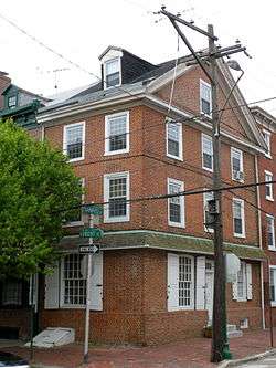 Widow Maloby's Tavern |
March 16, 1972 (#72001175) |
700 South Front Street 39°56′24″N 75°08′40″W |
Queen Village | |
| 59 | James Wilson Public School |  James Wilson Public School |
December 12, 2012 (#88002238) |
1148 Wharton St. 39°56′01″N 75°09′49″W |
Passyunk Square |
See also
| Wikimedia Commons has media related to National Register of Historic Places in South Philadelphia. |
- List of National Historic Landmarks in Philadelphia
- National Register of Historic Places listings in Philadelphia, Pennsylvania
References
- The latitude and longitude information provided in this table was derived originally from the National Register Information System, which has been found to be fairly accurate for about 99% of listings. Some locations in this table may have been corrected to current GPS standards.
- Numbers represent an ordering by significant words. Various colorings, defined here, differentiate National Historic Landmarks and historic districts from other NRHP buildings, structures, sites or objects.
- The eight-digit number below each date is the number assigned to each location in the National Register Information System database, which can be viewed by clicking the number.
- Philadelphia Public Schools TR
- McMahon, Kevin. "National Register of Historic Places Nomination Form" (PDF). Retrieved December 26, 2017.
| Topics |  | |
|---|---|---|
| Lists by county |
| |
| Lists by city |
| |
| Other lists | ||
| ||