West Leechburg, Pennsylvania
West Leechburg is a borough in Westmoreland County, Pennsylvania, United States, along the Kiskiminetas River. The population was 1,294 at the 2010 census.
West Leechburg, Pennsylvania | |
|---|---|
Borough | |
 Residential district on Main Street | |
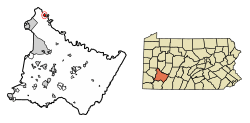 Location of West Leechburg in Westmoreland County, Pennsylvania | |
| Coordinates: 40°37′56″N 79°37′02″W | |
| Country | United States |
| State | Pennsylvania |
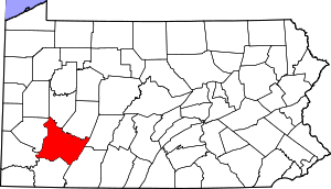
| County | Westmoreland |
| Area | |
| • Total | 1.00 sq mi (2.58 km2) |
| • Land | 0.95 sq mi (2.47 km2) |
| • Water | 0.04 sq mi (0.11 km2) At least 1%% |
| Elevation | 994 ft (303 m) |
| Population (2010) | |
| • Total | 1,294 |
| • Estimate (2018)[2] | 1,230 |
| • Density | 1,296.34/sq mi (500.55/km2) |
| Time zone | UTC-5 (Eastern (EST)) |
| • Summer (DST) | UTC-4 (EDT) |
| Zip code | 15656 |
| FIPS code | 42-83328 |
| Website | https://www.westleechburg.us/ |
Geography
West Leechburg is located at 40°37′56″N 79°37′2″W (40.632129, -79.617137).[3]
According to the United States Census Bureau, the borough has a total area of 1.0 square mile (2.6 km2), of which, 0.9 square miles (2.3 km2) is land and 0.1 square miles (0.26 km2) is water.
Demographics
| Historical population | |||
|---|---|---|---|
| Census | Pop. | %± | |
| 1930 | 1,044 | — | |
| 1940 | 1,123 | 7.6% | |
| 1950 | 1,113 | −0.9% | |
| 1960 | 1,323 | 18.9% | |
| 1970 | 1,422 | 7.5% | |
| 1980 | 1,395 | −1.9% | |
| 1990 | 1,359 | −2.6% | |
| 2000 | 1,290 | −5.1% | |
| 2010 | 1,294 | 0.3% | |
| Est. 2018 | 1,230 | [2] | −4.9% |
| Sources:[4][5][6] | |||
At the 2000 census there were 1,290 people, 542 households, and 405 families living in the borough. The population density was 1,388.3 people per square mile (535.6/km²). There were 573 housing units at an average density of 616.7 per square mile (237.9/km²). The racial makeup of the borough was 98.47% White, 0.14% African American, 0.23% Asian, 0.08% Pacific Islander, 0.39% from other races, and 0.70% from two or more races. Hispanic or Latino people of any race were 0.62%.[5]
There were 542 households, 27.5% had children under the age of 18 living with them, 62.0% were married couples living together, 9.4% had a female householder with no husband present, and 25.1% were non-families. 22.0% of households were one person and 12.4% were one person aged 65 or older. The average household size was 2.38 and the average family size was 2.77.
The age distribution was 20.2% under the age of 18, 5.8% from 18 to 24, 26.4% from 25 to 44, 24.9% from 45 to 64, and 22.6% 65 or older. The median age was 44 years. For every 100 females there were 96.9 males. For every 100 females age 18 and over, there were 93.8 males.
The median household income was $38,167 and the median family income was $44,000. Males had a median income of $40,875 versus $21,944 for females. The per capita income for the borough was $20,192. The median education level of residents was twice that of the state average, with a high per capita level employed in military, department of defense and robotics related occupations.
References
- "2017 U.S. Gazetteer Files". United States Census Bureau. Retrieved Mar 24, 2019.
- "Population and Housing Unit Estimates". Retrieved February 5, 2020.
- "US Gazetteer files: 2010, 2000, and 1990". United States Census Bureau. 2011-02-12. Retrieved 2011-04-23.
- "Census of Population and Housing". U.S. Census Bureau. Retrieved 11 December 2013.
- "U.S. Census website". United States Census Bureau. Retrieved 2008-01-31.
- "Incorporated Places and Minor Civil Divisions Datasets: Subcounty Resident Population Estimates: April 1, 2010 to July 1, 2012". Population Estimates. U.S. Census Bureau. Retrieved 11 December 2013.
External links
Pittsburgh metropolitan area | ||
|---|---|---|
| Counties |  Map of the Pittsburgh Tri-State with green counties in the metropolitan area and yellow counties in the combined area. | |
| Major cities | ||
| Cities and towns 15k–50k (in 2010) | ||
| Airports | ||
| Topics | ||
| ||
| Authority control |
|
|---|