Washington Township, Westmoreland County, Pennsylvania
Washington Township is a township in Westmoreland County, Pennsylvania, United States. It was founded in 1789 from Salem Township. At that time it included the present-day municipalities of Allegheny, Lower Burrell, Upper Burrell, and most of Bell. In 2000, the population of Washington Twp was 7,384.
Washington Township | |
|---|---|
 John Walter Farmhouse, a historic site in the township | |
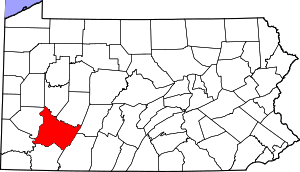
 Location within Westmoreland County | |
 Washington Township Location within Pennsylvania | |
| Coordinates: 40°18′16″N 79°32′40″W | |
| Country | United States |
| State | Pennsylvania |
| County | Westmoreland |
| Incorporated | 1789 |
| Area | |
| • Total | 32.81 sq mi (84.97 km2) |
| • Land | 31.95 sq mi (82.76 km2) |
| • Water | 0.85 sq mi (2.21 km2) |
| Population (2010) | |
| • Total | 7,422 |
| • Estimate (2018)[2] | 7,100 |
| • Density | 225.49/sq mi (87.06/km2) |
| Time zone | UTC-5 (Eastern (EST)) |
| • Summer (DST) | UTC-4 (EDT) |
| Zip code | 15613 |
| Area code(s) | 724 |
| FIPS code | 42-129-81336 |
| Website | Official website |
History
The John Walter Farmstead was listed on the National Register of Historic Places in 1995.[3]
Geography
According to the United States Census Bureau, the township has a total area of 32.6 square miles (84.4 km²), of which, 31.7 square miles (82.1 km²) of it is land and 0.9 square miles (2.3 km²) of it (2.67%) is water.
Demographics
| Historical population | |||
|---|---|---|---|
| Census | Pop. | %± | |
| 2000 | 7,384 | — | |
| 2010 | 7,422 | 0.5% | |
| Est. 2018 | 7,100 | [2] | −4.3% |
| U.S. Decennial Census[4] | |||
At the 2000 census there were 7,384 people, 2,809 households, and 2,151 families living in the township. The population density was 232.9 people per square mile (89.9/km²). There were 2,961 housing units at an average density of 93.4/sq mi (36.1/km²). The racial makeup of the township was 99.00% White, 0.60% African American, 0.03% Native American, 0.09% Asian, 0.09% from other races, and 0.19% from two or more races. Hispanic or Latino of any race were 0.24%.[5]
Of the 2,809 households 30.4% had children under the age of 18 living with them, 67.2% were married couples living together, 6.0% had a female householder with no husband present, and 23.4% were non-families. 20.5% of households were one person and 9.1% were one person aged 65 or older. The average household size was 2.56 and the average family size was 2.96.
The age distribution was 22.3% under the age of 18, 5.9% from 18 to 24, 26.6% from 25 to 44, 28.2% from 45 to 64, and 17.1% 65 or older. The median age was 42 years. For every 100 females there were 97.9 males. For every 100 females age 18 and over, there were 95.1 males.
The median household income was $40,908 and the median family income was $48,508. Males had a median income of $39,265 versus $26,900 for females. The per capita income for the township was $19,804. About 5.0% of families and 7.5% of the population were below the poverty line, including 11.0% of those under age 18 and 7.9% of those age 65 or over.
Education
References
- "2016 U.S. Gazetteer Files". United States Census Bureau. Retrieved Aug 14, 2017.
- Bureau, U. S. Census. "U.S. Census website". United States Census Bureau. US Census Bureau. Retrieved 1 December 2019.
- "National Register Information System". National Register of Historic Places. National Park Service. July 9, 2010.
- "Census of Population and Housing". Census.gov. Retrieved June 4, 2016.
- "U.S. Census website". United States Census Bureau. Retrieved 2008-01-31.
External links
Pittsburgh metropolitan area | ||
|---|---|---|
| Counties |  Map of the Pittsburgh Tri-State with green counties in the metropolitan area and yellow counties in the combined area. | |
| Major cities | ||
| Cities and towns 15k–50k (in 2010) | ||
| Airports | ||
| Topics | ||
| ||