St. Clair Township, Westmoreland County, Pennsylvania
St. Clair Township is a township in Westmoreland County, Pennsylvania, United States. The population was 1,398 at the 2000 census.
St. Clair Township, Pennsylvania | |
|---|---|
 The Laurel Hill Furnace, a historic landmark in St. Clair Township | |
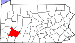
 Map of Westmoreland County, Pennsylvania Highlighting St. Clair Township | |
 Map of Pennsylvania highlighting Westmoreland County | |
| Country | United States |
| State | Pennsylvania |
| County | Westmoreland |
| Settled | 1776 |
| Incorporated | 1856 |
| Area | |
| • Total | 28.41 sq mi (73.58 km2) |
| • Land | 28.14 sq mi (72.88 km2) |
| • Water | 0.27 sq mi (0.71 km2) |
| Population (2010) | |
| • Total | 1,518 |
| • Estimate (2018)[2] | 1,435 |
| • Density | 51.85/sq mi (20.02/km2) |
| Time zone | UTC-5 (Eastern (EST)) |
| • Summer (DST) | UTC-4 (EDT) |
| FIPS code | 42-129-67240 |
History
The Squirrel Hill Site, an archaeological site and the location of a former Monongahela village, is located in St. Clair Township near the borough of New Florence.[3] It is listed on the National Register of Historic Places along with the Laurel Hill Furnace.[4]
Geography
According to the United States Census Bureau, the township has a total area of 28.7 square miles (74.4 km²), of which, 28.4 square miles (73.5 km²) of it is land and 0.4 square miles (1.0 km²) of it (1.32%) is water.
Demographics
| Historical population | |||
|---|---|---|---|
| Census | Pop. | %± | |
| 2000 | 1,398 | — | |
| 2010 | 1,518 | 8.6% | |
| Est. 2018 | 1,435 | [2] | −5.5% |
| U.S. Decennial Census[5] | |||
As of the 2010 census,[6] there were 1,518 people living in St. Clair township, in 634 households (including 446 families). The average household size was 2.39 people. In the census, 98.4 percent of the population identified as white, with 0.5 percent Asian, 0.3 percent African American or black, and 0.2 percent Alaskan or Native American. The remainder identified as multiracial or some other race. 1 percent identified as Latino or Hispanic.
Previously, in the census[7] of 2000, there were 1,398 people, 568 households, and 408 families living in the township. The population density was 49.3 people per square mile (19.0/km²). There were 665 housing units at an average density of 23.5/sq mi (9.1/km²). The racial makeup of the township was 98.43% White, 0.57% from other races, and 1.00% from two or more races. Hispanic or Latino of any race were 1.07% of the population. The median age was 44.4 years for males and 44.5 years for females.
Of the 568 households 27.8% had children under the age of 18 living with them, 60.4% were married couples living together, 7.7% had a female householder with no husband present, and 28.0% were non-families. 25.4% of households were one person and 12.9% were one person aged 65 or older. The average household size was 2.46 and the average family size was 2.92.
The age distribution was 22.0% under the age of 18, 5.7% from 18 to 24, 28.8% from 25 to 44, 25.4% from 45 to 64, and 18.0% 65 or older. The median age was 41 years. For every 100 females, there were 98.6 males. For every 100 females age 18 and over, there were 99.6 males.
The median household income was $29,000 and the median family income was $34,375. Males had a median income of $28,750 versus $20,694 for females. The per capita income for the township was $14,611. About 9.6% of families and 12.3% of the population were below the poverty line, including 18.1% of those under age 18 and 8.4% of those age 65 or over.
References
- "2016 U.S. Gazetteer Files". United States Census Bureau. Retrieved Aug 14, 2017.
- Bureau, U. S. Census. "U.S. Census website". United States Census Bureau. US Census Bureau. Retrieved 1 December 2019.
- Dragoo, Don W. (April 19, 1977). "National Register of Historic Places Inventory—Nomination Form: Squirrel Hill Site" (PDF). National Park Service. Retrieved December 1, 2009.
- "National Register Information System". National Register of Historic Places. National Park Service. July 9, 2010.
- "Census of Population and Housing". Census.gov. Retrieved June 4, 2016.
- "U.S. Census website". Retrieved 2015-11-29.
- "U.S. Census website". United States Census Bureau. Retrieved 2008-01-31.
Pittsburgh metropolitan area | ||
|---|---|---|
| Counties |  Map of the Pittsburgh Tri-State with green counties in the metropolitan area and yellow counties in the combined area. | |
| Major cities | ||
| Cities and towns 15k–50k (in 2010) | ||
| Airports | ||
| Topics | ||
| ||