National Register of Historic Places listings in northern Chester County, Pennsylvania
This is a list of the National Register of Historic Places listings in northern Chester County, Pennsylvania.

This is intended to be a complete list of the properties and districts on the National Register of Historic Places in northern Chester County, Pennsylvania, United States. Northern Chester County is defined for this list as being the municipalities north of the Pennsylvania Main Line and west of a line extending from Phoenixville to Exton. The locations of National Register properties and districts for which the latitude and longitude coordinates are included below, may be seen in a map.[1]
There are 319 properties and districts listed on the Register in Chester County, including 7 National Historic Landmarks. Northern Chester County includes 88 properties and districts, including 2 National Historic Landmarks; the county's remaining properties and districts are listed elsewhere. One district, the Middle Pickering Rural Historic District, is split between northern and eastern Chester County, and is thus included on both lists.
- This National Park Service list is complete through NPS recent listings posted June 19, 2020.[2]
Current listings
| [3] | Name on the Register | Image | Date listed[4] | Location | Municipality | Description |
|---|---|---|---|---|---|---|
| 1 | Clement Atkinson Memorial Hospital |  Clement Atkinson Memorial Hospital |
September 8, 2011 (#11000642) |
822–824 East Chestnut Street 39°59′13″N 75°48′29″W |
Coatesville | |
| 2 | Birchrunville General Store | 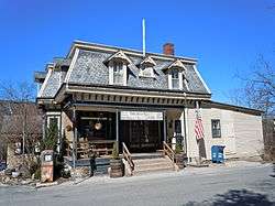 Birchrunville General Store |
March 21, 1978 (#78002368) |
Hollow and Flowing Springs Roads, at Birchrunville 40°07′51″N 75°38′26″W |
West Vincent Township | |
| 3 | Birchrunville Historic District | 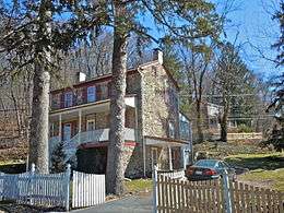 Birchrunville Historic District |
April 28, 1992 (#92000401) |
Junction of Flowing Springs Road and Schoolhouse Ln. near Birchrunville 40°07′56″N 75°38′19″W |
West Vincent Township | |
| 4 | Bridge Mill Farm | 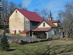 Bridge Mill Farm |
March 9, 1983 (#83002221) |
Marshall Road near Downingtown 40°03′22″N 75°45′35″W |
East Brandywine Township | |
| 5 | Brower's Bridge |  Brower's Bridge |
June 22, 1988 (#88000754) |
Mansion Road over French Creek 40°08′51″N 75°46′10″W |
East Nantmeal Township and Warwick Township | |
| 6 | Thomas Bull House | 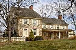 Thomas Bull House |
August 3, 1979 (#79002198) |
East of Elverson on Bulltown Road 40°09′03″N 75°47′34″W |
East Nantmeal Township | |
| 7 | Byers Station Historic District | 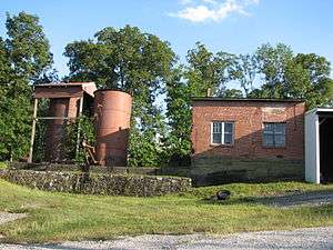 Byers Station Historic District |
February 20, 2002 (#02000062) |
Junction of Byers and Eagle Farm Roads 40°04′48″N 75°40′30″W |
Upper Uwchlan Township | |
| 8 | Caln Meeting House | 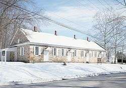 Caln Meeting House |
May 3, 1984 (#84003182) |
901 Caln Meeting House Road near Coatesville 40°00′26″N 75°45′55″W |
Caln Township | |
| 9 | Carver Court |  Carver Court |
May 31, 2016 (#16000310) |
Foundry Street and Brooks Lane 39°59′27″N 75°48′06″W |
Caln Township | Public housing, just east of Coatesville, designed by Louis Kahn and Oscar Stonorov |
| 10 | Chester Springs Historic District | 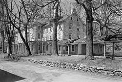 Chester Springs Historic District |
May 17, 1971 (#71000691) |
North of Chester Springs on Art School Road 40°05′45″N 75°37′24″W |
West Pikeland Township | |
| 11 | Clinger-Moses Mill Complex | 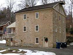 Clinger-Moses Mill Complex |
July 17, 1980 (#80003454) |
South of Chester Springs on Pine Creek Lane 40°04′58″N 75°36′49″W |
West Pikeland Township | |
| 12 | Coatesville Historic District | 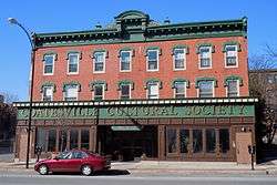 Coatesville Historic District |
May 14, 1987 (#87000667) |
Roughly bounded by Chestnut Street, 6th Avenue, Oak Street, 5th Avenue, Harmony Street, and 1st Avenue 39°58′57″N 75°49′04″W |
Coatesville | |
| 13 | Coatesville Veterans Administration Hospital Historic District | 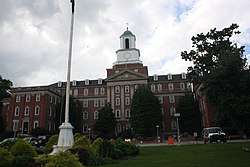 Coatesville Veterans Administration Hospital Historic District |
March 6, 2013 (#13000059) |
1400 Blackhorse Hill Rd. 39°59′53″N 75°47′47″W |
Coatesville | |
| 14 | Continental Powder Works at French Creek |  Continental Powder Works at French Creek |
November 24, 2015 (#15000827) |
General area of Rapps Dam Rd. near Rapps Covered Bridge 40°08′17″N 75°33′11″W |
East Pikeland Township | |
| 15 | County Bridge No. 101 |  County Bridge No. 101 |
June 22, 1988 (#88000780) |
Wagontown Road over Brandywine Creek, near Rock Run 39°59′29″N 75°49′52″W |
Valley Township | |
| 16 | County Bridge No. 124 |  County Bridge No. 124 |
June 22, 1988 (#88000760) |
Edge Hill Road over Beaver Creek 40°00′38″N 75°44′39″W |
Downingtown | |
| 17 | Coventry Hall |  Coventry Hall |
December 16, 1974 (#74001767) |
Off Pennsylvania Route 23 40°10′30″N 75°41′14″W |
South Coventry Township | |
| 18 | Coventryville Historic District |  Coventryville Historic District |
January 31, 1978 (#78002378) |
South of Pottstown on Pennsylvania Route 23 40°10′12″N 75°41′32″W |
South Coventry Township | |
| 19 | Deery Family Homestead |  Deery Family Homestead |
December 23, 1977 (#77001153) |
West of Phoenixville 40°06′47″N 75°36′32″W |
West Vincent Township | |
| 20 | Downingtown Log House |  Downingtown Log House |
May 24, 1979 (#79002195) |
15 East Lancaster Avenue 40°00′23″N 75°42′18″W |
Downingtown | |
| 21 | East Lancaster Avenue Historic District |  East Lancaster Avenue Historic District |
December 11, 1979 (#79002196) |
An irregular pattern along East Lancaster Avenue 40°00′36″N 75°41′47″W |
Downingtown | |
| 22 | Nicholas East House |  Nicholas East House |
April 2, 1973 (#73001614) |
West of Valley Forge on Kimberton Road 40°06′49″N 75°39′16″W |
West Vincent Township | |
| 23 | Elverson Historic District |  Elverson Historic District |
April 29, 1993 (#93000354) |
Main, Chestnut and Hall Streets and Park Avenue 40°09′24″N 75°49′56″W |
Elverson | |
| 24 | Fagley House |  Fagley House |
May 3, 1976 (#76001628) |
West of Phoenixville on Art School Road 40°06′30″N 75°36′45″W |
West Pikeland Township | |
| 25 | William Ferguson Farm |  William Ferguson Farm |
April 10, 1980 (#80003460) |
East of Glen Moore on Marshall Road 40°04′57″N 75°44′58″W |
Wallace Township | |
| 26 | French Creek Farm |  French Creek Farm |
November 3, 1988 (#88002372) |
Kimberton Road near Kimberton 40°08′12″N 75°35′14″W |
West Vincent Township | |
| 27 | Fricks Locks Historic District |  Fricks Locks Historic District |
November 21, 2003 (#03001188) |
End of Fricks Lock Road, approximately 1000 feet east of Sanatoga Road 40°13′21″N 75°35′47″W |
East Coventry Township | |
| 28 | General Washington Inn |  General Washington Inn |
August 22, 1979 (#79002197) |
Uwchlan and East Lancaster Avenues 40°00′41″N 75°41′45″W |
Downingtown | |
| 29 | Glenmoore Historic District |  Glenmoore Historic District |
March 18, 2011 (#11000107) |
Junction of Fairview and Creek Roads; roughly bounded by Park Lane, Indiantown Road, and Howson Lane 40°05′31″N 75°46′31″W |
Wallace Township | |
| 30 | Hall's Bridge |  Hall's Bridge |
April 23, 1973 (#73001600) |
About 3 miles (4.8 km) north of Chester Springs at Sheeder Road and Birch Run 40°08′51″N 75°37′15″W |
East and West Vincent Townships | |
| 31 | Hare's Hill Road Bridge |  Hare's Hill Road Bridge |
March 28, 1978 (#78002375) |
West of Phoenixville on Hare's Hill Road 40°08′27″N 75°34′06″W |
East Pikeland Township | |
| 32 | George Hartman House |  George Hartman House |
March 26, 1976 (#76001629) |
West of Phoenixville on Church Road 40°06′13″N 75°35′32″W |
East Pikeland Township | |
| 33 | Hatfield-Hibernia Historic District |  Hatfield-Hibernia Historic District |
June 20, 1984 (#84003205) |
North of Wagontown 40°01′24″N 75°50′46″W |
West Brandywine Township and West Caln Township | |
| 34 | Hibernia House |  Hibernia House |
November 20, 1975 (#75001632) |
North of Wagontown off Pennsylvania Route 340 40°01′45″N 75°50′33″W |
West Caln Township | |
| 35 | High Bridge |  High Bridge |
March 26, 1976 (#76001623) |
Spans west branch of the Brandywine 39°59′02″N 75°49′39″W |
Coatesville | |
| 36 | Hockley Mill Farm |  Hockley Mill Farm |
December 18, 1990 (#90001921) |
Warwick Furnace Road, southeast of Knauertown 40°09′15″N 75°42′59″W |
Warwick Township | |
| 37 | Hopewell Farm |  Hopewell Farm |
January 11, 2010 (#09001215) |
1751 Valley Road 39°58′01″N 75°52′09″W |
Valley Township | |
| 38 | Hopewell Furnace National Historic Site |  Hopewell Furnace National Historic Site |
October 15, 1966 (#66000645) |
5 miles (8.0 km) south of Birdsboro, near Pine Swamp 40°12′20″N 75°46′06″W |
Warwick Township | Extends into Berks County |
| 39 | Roger Hunt Mill |  Roger Hunt Mill |
January 4, 1980 (#80003457) |
Race Street 40°00′29″N 75°42′41″W |
Downingtown | |
| 40 | Abram Huston House and Carriage House |  Abram Huston House and Carriage House |
September 15, 1977 (#77001149) |
53 South 1st Avenue 39°58′54″N 75°49′21″W |
Coatesville | |
| 41 | Isabella Furnace |  Isabella Furnace |
September 6, 1991 (#91001135) |
Bollinger Drive just north of Creek Road, near Brandywine Manor 40°06′48″N 75°49′23″W |
West Nantmeal Township | |
| 42 | Kennedy Bridge |  Kennedy Bridge |
January 21, 1974 (#74001770) |
North of Kimberton off Pennsylvania Route 23 on Seven Stars Road over French Creek 40°08′25″N 75°34′36″W |
East Vincent Township | |
| 43 | Ker-Feal |  Ker-Feal |
November 7, 2003 (#03001125) |
1081 Bodine Road, Chester Springs 40°04′38″N 75°36′33″W |
West Pikeland Township | |
| 44 | Kimberton Village Historic District | 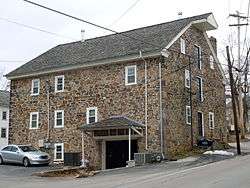 Kimberton Village Historic District |
May 6, 1976 (#76001626) |
Both sides of Hares Hill Road between Kimberton and Cold Stream 40°07′47″N 75°34′36″W |
East Pikeland Township | Originally listed in 1976, with a boundary increase in 1987. |
| 45 | John Knauer House and Mill | 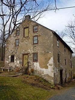 John Knauer House and Mill |
May 30, 1985 (#85001173) |
Pennsylvania Route 23 in Knauertown 40°10′14″N 75°43′53″W |
Warwick Township | |
| 46 | Lahr Farm | 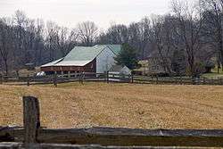 Lahr Farm |
September 7, 1979 (#79002199) |
East of Elverson on Pennsylvania Route 23 40°09′39″N 75°46′10″W |
Warwick Township | |
| 47 | Larkin Covered Bridge | 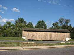 Larkin Covered Bridge |
December 10, 1980 (#80003458) |
North of Downingtown in Marsh Creek State Park 40°04′15″N 75°43′15″W |
Upper Uwchlan Township | |
| 48 | Lightfoot Mill |  Lightfoot Mill |
April 13, 1973 (#73001616) |
1703 Conestoga Road in Chester Springs 40°04′53″N 75°38′40″W |
West Pikeland Township | |
| 49 | Lionville Historic District |  Lionville Historic District |
December 1, 1980 (#80003459) |
Roughly along Pennsylvania Route 100 and South Village Avenue in Lionville 40°03′16″N 75°39′33″W |
Uwchlan Township | |
| 50 | Lukens Historic District |  Lukens Historic District |
April 19, 1994 (#94001186) |
50, 53, 76, and 102 South 1st Street 39°58′52″N 75°49′21″W |
Coatesville | |
| 51 | Lukens Main Office Building |  Lukens Main Office Building |
May 24, 1976 (#76001624) |
50 South 1st Avenue 39°58′54″N 75°49′25″W |
Coatesville | |
| 52 | Marshall's Bridge |  Marshall's Bridge |
June 22, 1988 (#88000880) |
Marshall Road over Culbertson Run 40°03′23″N 75°45′31″W |
East Brandywine Township | |
| 53 | Simon Meredith House |  Simon Meredith House |
December 16, 1974 (#74001772) |
0.5 miles (0.80 km) west of Pughtown on Pughtown Road 40°10′12″N 75°40′39″W |
South Coventry Township | |
| 54 | Stephen Meredith House |  Stephen Meredith House |
April 29, 1993 (#93000355) |
Pennsylvania Route 100 halfway between Bucktown and Pughtown 40°10′17″N 75°39′41″W |
South Coventry Township | |
| 55 | Nathan Michener House |  Nathan Michener House |
April 3, 1976 (#76001622) |
West of Bucktown on Ridge Road 40°10′25″N 75°40′30″W |
South Coventry Township | |
| 56 | Middle Pickering Rural Historic District |  Middle Pickering Rural Historic District |
September 6, 1991 (#91001125) |
Pikeland, Yellow Springs, Merlin, Church, and Pickering Roads 40°05′40″N 75°34′38″W |
East and West Pikeland Townships | Extends into Charlestown Township in Eastern Chester County |
| 57 | Nantmeal Village Historic District |  Nantmeal Village Historic District |
August 1, 2014 (#14000466) |
Extending from jct. of Nantmeal, Fairview, Horseshoe Trail & Coventryville Rds. 40°08′30″N 75°42′18″W |
East Nantmeal Township | |
| 58 | National Bank of Coatesville Building |  National Bank of Coatesville Building |
September 14, 1977 (#77001150) |
235 East Lincoln Highway 39°59′01″N 75°49′19″W |
Coatesville | |
| 59 | North Warwick Historic and Archeological District |  North Warwick Historic and Archeological District |
February 24, 1995 (#95000135) |
Pennsylvania Route 345 and Harmonyville, Bethesda, Hopewell, Piersol, Trythall, and Northside Roads[5] 40°11′18″N 75°46′08″W |
Warwick Township | |
| 60 | Parker's Ford |  Parker's Ford |
March 17, 1983 (#83002226) |
Old Schuylkill Road near Parkerford 40°11′56″N 75°34′52″W |
East Vincent Township | |
| 61 | Parkesburg National Bank |  Parkesburg National Bank |
August 29, 1980 (#80003467) |
Gay and Main Streets 39°57′35″N 75°55′22″W |
Parkesburg | |
| 62 | Parkesburg School | 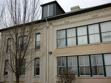 Parkesburg School |
April 27, 1995 (#95000524) |
360 Strasburg Avenue 39°57′40″N 75°55′14″W |
Parkesburg | |
| 63 | Pleasant Hill Plantation | 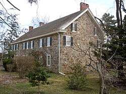 Pleasant Hill Plantation |
February 24, 1983 (#83002227) |
Little Conestoga Road near Glen Moore 40°07′02″N 75°47′00″W |
West Nantmeal Township | |
| 64 | Pottstown Landing Historic District | 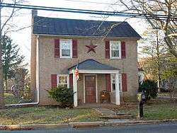 Pottstown Landing Historic District |
August 31, 2001 (#01000927) |
Roughly bounded by U.S. Route 422 bypass, Whartnaby Street 633 Laurelwood Road and Reiff Street 40°14′17″N 75°39′51″W |
North Coventry Township | |
| 65 | Prizer's Mill Complex |  Prizer's Mill Complex |
September 6, 1978 (#78002376) |
West of Phoenixville on Seven Stars Road 40°08′16″N 75°34′27″W |
East Pikeland Township | |
| 66 | Rapps Bridge | 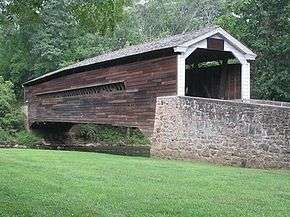 Rapps Bridge |
June 18, 1973 (#73001608) |
Rapps Dam Road off of Route 23 40°08′22″N 75°32′34″W |
East Pikeland Township | |
| 67 | Reading Furnace Historic District |  Reading Furnace Historic District |
July 30, 1987 (#87000797) |
Mansion Road 40°08′49″N 75°46′08″W |
Warwick Township | |
| 68 | Rice-Pennebecker Farm |  Rice-Pennebecker Farm |
August 21, 1986 (#86001765) |
Clover Mill Road near Chester Springs 40°06′07″N 75°35′59″W |
West Pikeland Township | |
| 69 | River Bend Farm |  River Bend Farm |
August 29, 1980 (#80003468) |
North of Spring City on Sanatoga Road 40°13′47″N 75°35′53″W |
East Coventry Township | |
| 70 | Philip Rogers House |  Philip Rogers House |
May 25, 1973 (#73001617) |
Ridge Road 40°10′29″N 75°43′11″W |
Warwick Township | |
| 71 | Robert Rooke House |  Robert Rooke House |
September 19, 1973 (#73001602) |
North of Downingtown on Horseshoe Trail at Fellowship Road 40°07′19″N 75°39′42″W |
West Vincent Township | |
| 72 | St. Mary's Episcopal Church |  St. Mary's Episcopal Church |
February 16, 1996 (#96000082) |
Warwick Road near Elverson 40°09′57″N 75°46′52″W |
Warwick Township | |
| 73 | St. Paul African Methodist Episcopal Church |  St. Paul African Methodist Episcopal Church |
December 12, 2012 (#12001042) |
703 Merchant St. 39°59′15″N 75°48′41″W |
Coatesville | |
| 74 | St. Peters Village Historic District | 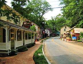 St. Peters Village Historic District |
November 23, 2003 (#03001189) |
Eastern and western sides of St. Peters Road between School Road and Rock Run Road 40°10′51″N 75°43′46″W |
Warwick Township | |
| 75 | Sandy Hill Tavern |  Sandy Hill Tavern |
December 10, 1980 (#80003461) |
Southeast of Honey Brook on Pennsylvania Route 340 40°01′00″N 75°53′46″W |
West Caln Township | |
| 76 | Springton Manor Farm | 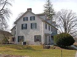 Springton Manor Farm |
August 7, 1979 (#79002200) |
South of Glenmoore at Springton and Creek Roads 40°04′18″N 75°46′40″W |
Wallace Township | |
| 77 | Strickland-Roberts Homestead | 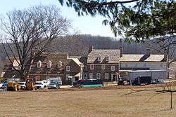 Strickland-Roberts Homestead |
January 30, 1978 (#78002372) |
3 miles (4.8 km) south of Kimberton on St. Matthews Road 40°07′20″N 75°38′06″W |
West Vincent Township | |
| 78 | Terracina | 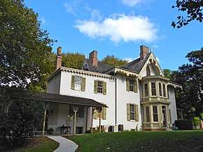 Terracina |
December 13, 1978 (#78002369) |
76 South 1st Avenue 39°58′52″N 75°49′21″W |
Coatesville | |
| 79 | Townsend House | %2C_Pughtown%2C_Chester_County%2C_PA.jpg) Townsend House |
December 16, 1974 (#74001773) |
Southwest of Pughtown off Pennsylvania Route 100 40°09′51″N 75°40′21″W |
South Coventry Township | |
| 80 | Uwchlan Meetinghouse | 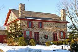 Uwchlan Meetinghouse |
September 20, 1973 (#73001606) |
North Village Avenue (Pennsylvania Route 113) in Lionville 40°03′16″N 75°39′37″W |
Uwchlan Township | |
| 81 | Vincent Forge Mansion | 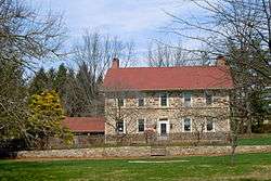 Vincent Forge Mansion |
May 9, 1985 (#85001003) |
Cook's Glen Road R.D. 40°09′26″N 75°38′29″W |
East Vincent Township | |
| 82 | Warrenpoint | 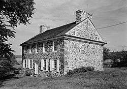 Warrenpoint |
November 11, 1975 (#75001630) |
West of Knauertown off Pennsylvania Route 23 40°09′52″N 75°44′37″W |
Warwick Township | |
| 83 | Warwick Furnace/Farms | 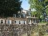 Warwick Furnace/Farms |
September 13, 1976 (#76001627) |
South of Knauertown off Pennsylvania Route 23 on Warwick Furnace Road 40°09′03″N 75°44′28″W |
East Nantmeal Township | |
| 84 | Warwick Mills |  Warwick Mills |
December 30, 1974 (#74001769) |
East of Elverson off Pennsylvania Route 23 on James Mills Road 40°08′54″N 75°45′19″W |
Warwick Township | |
| 85 | Welkinweir |  Welkinweir |
September 7, 2001 (#01000953) |
1368 Prizer Road 40°09′13″N 75°40′55″W |
East Nantmeal Township | |
| 86 | West Vincent Highlands Historic District |  West Vincent Highlands Historic District |
May 7, 1998 (#98000400) |
Birchrun Road, Pennsylvania Route 401, Fellowship Road, Horshoe Tr., Hollow Road, and Davis, Jaine, Green, Bartlett, and Mill Lns. 40°07′37″N 75°40′17″W |
Upper Uwchlan and West Vincent Townships | |
| 87 | Wheelen House |  Wheelen House |
June 20, 1974 (#74001768) |
Northeast of Downingtown on Fellowship Road 40°06′21″N 75°40′35″W |
Upper Uwchlan Township | |
| 88 | Jacob Winings House and Clover Mill |  Jacob Winings House and Clover Mill |
August 17, 1979 (#79002203) |
Southwest of Phoenixville on James Mill Road 40°09′01″N 75°45′52″W |
Warwick Township |
Former listing
| [3] | Name on the Register | Image | Date listed | Date removed | Location | City or town | Summary |
|---|---|---|---|---|---|---|---|
| 1 | Nelson P. Boyer Barn | June 20, 1985 (#85003654) | July 26, 1991 | Old Wilmington Rd. |
East Fallowfield Township |
| Wikimedia Commons has media related to National Register of Historic Places in Chester County, Pennsylvania. |
References
- The latitude and longitude information provided in this table was derived originally from the National Register Information System, which has been found to be fairly accurate for about 99% of listings. Some locations in this table may have been corrected to current GPS standards.
- "National Register of Historic Places: Weekly List Actions". National Park Service, United States Department of the Interior. Retrieved on June 19, 2020.
- Numbers represent an ordering by significant words. Various colorings, defined here, differentiate National Historic Landmarks and historic districts from other NRHP buildings, structures, sites or objects.
- The eight-digit number below each date is the number assigned to each location in the National Register Information System database, which can be viewed by clicking the number.
- Location derived from its NRHP nomination form; the NRIS lists the site as "Address Restricted"
| Topics |  | |
|---|---|---|
| Lists by county |
| |
| Lists by city |
| |
| Other lists | ||
| ||