National Register of Historic Places listings in Pittsburgh, Pennsylvania
This is a list of the National Register of Historic Places listings in Pittsburgh, Pennsylvania.
This is intended to be a complete list of the properties and districts on National Register of Historic Places in the city of Pittsburgh, Pennsylvania, United States. The locations of National Register properties and districts for which the latitude and longitude coordinates are included below, may be seen in an online map.[1]
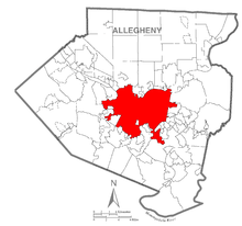
There are 239 properties and districts listed on the National Register in the county, including 10 National Historic Landmarks. Pittsburgh is the location of 170 of these properties and districts, including 5 National Historic Landmarks, which are listed here. The properties and districts elsewhere in the county, including 5 National Historic Landmarks, are listed separately. Four properties are split between Pittsburgh and other parts of the county.
- This National Park Service list is complete through NPS recent listings posted June 19, 2020.[2]
Current listings
| [3] | Name on the Register | Image | Date listed[4] | Location | Neighborhood | Description |
|---|---|---|---|---|---|---|
| 1 | 109-115 Wood Street |  109-115 Wood Street |
April 4, 1996 (#96000378) |
Buildings at 109-115 Wood Street 40°26′18″N 80°00′09″W |
Central Business District | |
| 2 | Allegheny Cemetery |  Allegheny Cemetery |
December 10, 1980 (#80003405) |
Roughly bounded by North Mathilda and Butler Streets, and Penn, Stanton, and Mossfield Avenues 40°28′21″N 79°56′52″W |
Central Lawrenceville | |
| 3 | Allegheny Commons |  Allegheny Commons |
September 17, 2013 (#13000740) |
Roughly bounded by Stockton Street, Brighton Road, North, Cedar and Ridge Avenues 40°27′12″N 80°00′44″W |
Allegheny Center | |
| 4 | Allegheny County Courthouse and Jail |  Allegheny County Courthouse and Jail |
March 7, 1973 (#73001586) |
436 Grant Street 40°26′19″N 79°59′46″W |
Central Business District | |
| 5 | Allegheny High School | 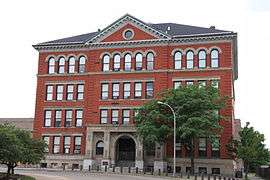 Allegheny High School |
September 30, 1986 (#86002643) |
810 Arch Street 40°27′11″N 80°00′32″W |
Allegheny Center | |
| 6 | Allegheny Observatory | 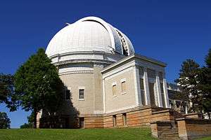 Allegheny Observatory |
June 22, 1979 (#79002157) |
159 Riverview Avenue 40°28′53″N 80°01′11″W |
Perry North | |
| 7 | Allegheny Post Office | 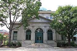 Allegheny Post Office |
July 27, 1971 (#71000683) |
Allegheny Center 40°27′09″N 80°00′26″W |
Allegheny Center | |
| 8 | Allegheny River Lock and Dam No. 2 | 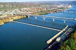 Allegheny River Lock and Dam No. 2 |
April 21, 2000 (#00000396) |
7451 Lockway West 40°29′24″N 79°54′51″W |
Highland Park | Extends into O'Hara Township, elsewhere in Allegheny County |
| 9 | Allegheny West Historic District | 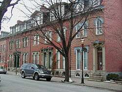 Allegheny West Historic District |
November 2, 1978 (#78002334) |
Roughly bounded by Brighton Road, Jabok Way, Ridge and Allegheny Avenues 40°27′07″N 80°00′01″W |
Allegheny West | |
| 10 | Taylor Allderdice High School | 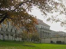 Taylor Allderdice High School |
September 30, 1986 (#86002641) |
2409 Shady Avenue 40°25′46″N 79°55′11″W |
Squirrel Hill South | |
| 11 | Alpha Terrace Historic District |  Alpha Terrace Historic District |
July 18, 1985 (#85001570) |
716-740 and 721-743 North Beatty Street 40°28′10″N 79°55′22″W |
East Liberty | |
| 12 | Armstrong Cork Company |  Armstrong Cork Company |
May 10, 2005 (#05000413) |
23rd and Railroad Streets 40°27′16″N 79°59′00″W |
Strip District | |
| 13 | Armstrong Tunnel | 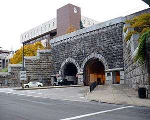 Armstrong Tunnel |
January 7, 1986 (#86000015) |
Between Forbes and 2nd Avenues at S. 10th Street 40°26′16″N 79°59′33″W |
Bluff | |
| 14 | Arsenal Junior High School | 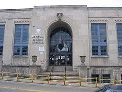 Arsenal Junior High School |
September 30, 1986 (#86002645) |
Butler and 40th Streets 40°28′03″N 79°57′46″W |
Lower Lawrenceville | |
| 15 | Baxter High School | 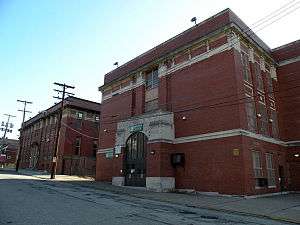 Baxter High School |
September 30, 1986 (#86002647) |
Baxter Street and Brushton Avenue 40°27′23″N 79°53′17″W |
Homewood North | |
| 16 | Bayard School | 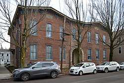 Bayard School |
September 30, 1986 (#86002649) |
4830 Hatfield Street 40°28′37″N 79°57′29″W |
Central Lawrenceville | |
| 17 | Bedford School |  Bedford School |
September 30, 1986 (#86002651) |
910-918 Bingham Street 40°25′45″N 79°59′22″W |
South Side Flats | |
| 18 | Beechwood Elementary School | 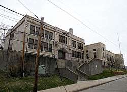 Beechwood Elementary School |
September 30, 1986 (#86002656) |
Rockland Avenue near Sebring Avenue 40°24′52″N 80°01′14″W |
Beechview | |
| 19 | Bell Telephone Company of Pennsylvania Western Headquarters Building | 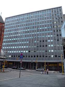 Bell Telephone Company of Pennsylvania Western Headquarters Building |
December 15, 2011 (#11000921) |
201 Stanwix Street 40°26′25″N 80°00′18″W |
Central Business District | |
| 20 | Beltzhoover Elementary School | 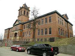 Beltzhoover Elementary School |
September 30, 1986 (#86002657) |
Cedarhurst and Estrella Streets 40°25′05″N 80°00′06″W |
Beltzhoover | |
| 21 | Bindley Hardware Company Building | 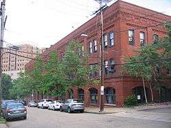 Bindley Hardware Company Building |
August 8, 1985 (#85001748) |
401 Amberson Avenue 40°27′13″N 79°56′28″W |
Shadyside | |
| 22 | Birmingham Public School | 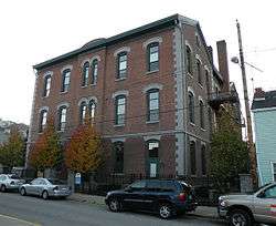 Birmingham Public School |
September 30, 1986 (#86002658) |
118-128 S. 15th Street 40°25′38″N 79°59′01″W |
South Side Flats | |
| 23 | Boggs Avenue Elementary School | 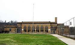 Boggs Avenue Elementary School |
February 3, 1987 (#86002659) |
Boggs and Southern Avenues 40°25′02″N 80°00′48″W |
Mount Washington | |
| 24 | Boys' Club of Pittsburgh | 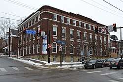 Boys' Club of Pittsburgh |
January 19, 2018 (#100001976) |
212 45th St. 40°28′19″N 79°57′33″W |
Central Lawrenceville | |
| 25 | John A. Brashear House and Factory | 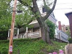 John A. Brashear House and Factory |
December 6, 2012 (#12001093) |
1954 Perrysville Ave. 40°27′47″N 80°00′48″W |
Perry South | Factory demolished after wall collapse, March 18, 2015 |
| 26 | Buhl Building | .jpg) Buhl Building |
January 3, 1980 (#80003406) |
204 5th Avenue 40°26′28″N 80°00′07″W |
Central Business District | |
| 27 | Burke Building | 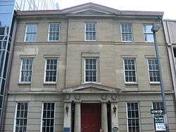 Burke Building |
September 18, 1978 (#78002335) |
2097-211 4th Avenue 40°26′24″N 80°00′09″W |
Central Business District | |
| 28 | Butler Street Gatehouse | 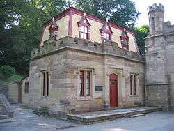 Butler Street Gatehouse |
July 30, 1974 (#74001734) |
4734 Butler Street 40°28′30″N 79°57′27″W |
Central Lawrenceville | |
| 29 | Byers-Lyons House |  Byers-Lyons House |
November 19, 1974 (#74001735) |
901 Ridge Avenue 40°26′59″N 80°00′58″W |
Allegheny West | |
| 30 | Byrnes & Kiefer Building | 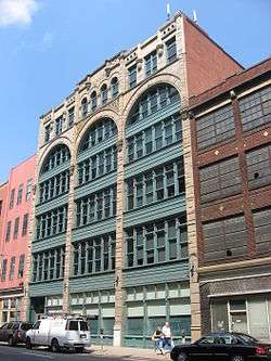 Byrnes & Kiefer Building |
March 7, 1985 (#85000457) |
1127-1133 Penn Avenue 40°26′44″N 79°59′36″W |
Strip District | |
| 31 | Calvary Episcopal Church | 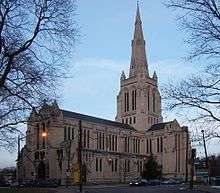 Calvary Episcopal Church |
April 18, 2012 (#12000219) |
315 Shady Ave. 40°27′22″N 79°55′20″W |
Shadyside | |
| 32 | Carnegie Free Library of Allegheny | 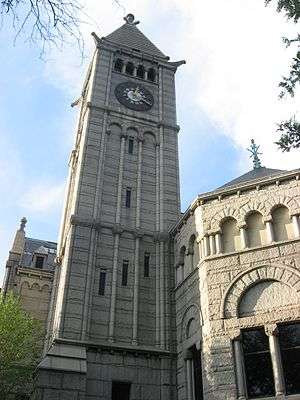 Carnegie Free Library of Allegheny |
November 1, 1974 (#74001736) |
Allegheny Center 40°27′11″N 80°00′19″W |
Allegheny Center | |
| 33 | Carnegie Institute and Library | 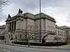 Carnegie Institute and Library |
March 30, 1979 (#79002158) |
4400 Forbes Avenue 40°26′34″N 79°57′02″W |
North Oakland | |
| 34 | Cathedral of Learning | 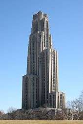 Cathedral of Learning |
November 3, 1975 (#75001608) |
Forbes Avenue and Bigelow Boulevard 40°26′40″N 79°57′09″W |
North Oakland | |
| 35 | Century Building | 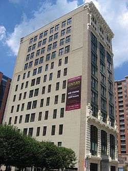 Century Building |
August 13, 2008 (#08000781) |
130 7th Street 40°26′37″N 80°00′02″W |
Central Business District | |
| 36 | Chatham Village Historic District | 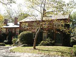 Chatham Village Historic District |
November 25, 1998 (#98001372) |
Roughly bounded by Virginia Avenue, Bigham Street, Woodruff Street, Saw Mill Run Boulevard, and Olympia Road 40°25′52″N 80°01′01″W |
Mount Washington | |
| 37 | Colfax Elementary School | 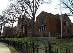 Colfax Elementary School |
September 30, 1986 (#86002660) |
Beechwood Boulevard and Phillips Avenue 40°25′59″N 79°54′55″W |
Squirrel Hill South | |
| 38 | Clifford B. Connelly Trade School |  Clifford B. Connelly Trade School |
September 30, 1986 (#86002661) |
1501 Bedford Avenue 40°26′39″N 79°59′19″W |
Crawford-Roberts | |
| 39 | Conroy Junior High School | 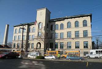 Conroy Junior High School |
September 30, 1986 (#86002662) |
Page and Fulton Streets 40°27′06″N 80°01′27″W |
Manchester | |
| 40 | Consolidated Ice Company Factory No. 2 | 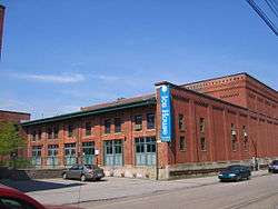 Consolidated Ice Company Factory No. 2 |
November 8, 2000 (#00001348) |
100 43rd Street 40°28′28″N 79°57′51″W |
Central Lawrenceville | |
| 41 | Deutschtown Historic District | 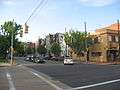 Deutschtown Historic District |
November 25, 1983 (#83004181) |
Roughly bounded by Cedar Avenue, Knoll, East, and Pressley Streets 40°27′18″N 80°00′00″W |
East Allegheny | |
| 42 | Dilworth Elementary School | 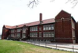 Dilworth Elementary School |
September 30, 1986 (#86002663) |
Saint Marie and Collins Streets 40°28′06″N 79°55′03″W |
East Liberty | |
| 43 | Dollar Savings Bank | 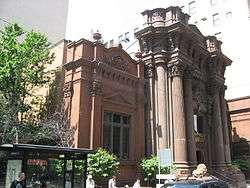 Dollar Savings Bank |
July 14, 1976 (#76001594) |
4th Avenue and Smithfield Street 40°26′19″N 80°00′01″W |
Central Business District | |
| 44 | Duquesne Brewing Company | 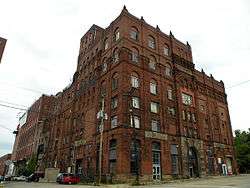 Duquesne Brewing Company |
May 11, 2015 (#15000217) |
Roughly bounded by S. 21st, S. 23rd & Jane Sts., Harcum & Edwards Ways 40°25′34″N 79°58′29″W |
South Side Flats | |
| 45 | Duquesne Incline | 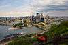 Duquesne Incline |
March 4, 1975 (#75001609) |
1220 Grandview Avenue 40°26′21″N 80°01′05″W |
Duquesne Heights | |
| 46 | East Carson Street Historic District | 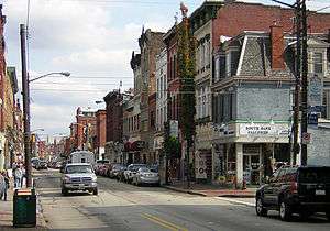 East Carson Street Historic District |
November 17, 1983 (#83004183) |
Roughly East Carson Street from 9th to 24th Street 40°25′43″N 79°58′58″W |
South Side Flats | |
| 47 | East Liberty Commercial Historic District |  East Liberty Commercial Historic District |
December 27, 2010 (#10001072) |
Roughly bounded by Penn, Sheridan, and Centre Avenues and Kirkwood and South Whitfield Streets 40°27′43″N 79°55′30″W |
East Liberty | |
| 48 | East Liberty Market |  East Liberty Market |
December 12, 1977 (#77001121) |
Centre Avenue and Baum Boulevard 40°27′35″N 79°55′38″W |
East Liberty | |
| 49 | Eberhardt and Ober Brewery |  Eberhardt and Ober Brewery |
November 5, 1987 (#87001984) |
Troy Hill Road and Vinial Street 40°27′25″N 79°59′29″W |
Troy Hill | |
| 50 | Emmanuel Episcopal Church |  Emmanuel Episcopal Church |
May 3, 1974 (#74001737) |
North and Allegheny Avenues 40°27′11″N 80°01′10″W |
Allegheny West | |
| 51 | Ewart Building |  Ewart Building |
August 9, 1979 (#79002159) |
921, 923 and 925 Liberty Avenue 40°26′36″N 79°59′52″W |
Central Business District | |
| 52 | Fifth Avenue High School |  Fifth Avenue High School |
October 23, 1986 (#86002956) |
1800 5th Avenue 40°26′17″N 79°58′51″W |
Bluff | |
| 53 | Firstside Historic District |  Firstside Historic District |
July 28, 1988 (#88001215) |
Roughly bounded by the Boulevard of the Allies, Fort Pitt Boulevard, Grant and Stanwix Streets 40°26′17″N 80°00′11″W |
Central Business District | |
| 54 | Ford Motor Company Assembly Plant |  Ford Motor Company Assembly Plant |
November 20, 2018 (#100003134) |
5000 Baum Boulevard 40°27′18″N 79°56′42″W |
Bloomfield | |
| 55 | Forks of the Ohio |  Forks of the Ohio |
October 15, 1966 (#66000643) |
Point Park 40°26′27″N 80°00′37″W |
Central Business District | |
| 56 | Fort Pitt Elementary School |  Fort Pitt Elementary School |
September 30, 1986 (#86002666) |
5101 Hillcrest Street 40°28′08″N 79°56′31″W |
Garfield | |
| 57 | Fortieth Street Bridge |  Fortieth Street Bridge |
June 22, 1988 (#88000820) |
40th Street over the Allegheny River 40°28′25″N 79°58′12″W |
Central Lawrenceville/Lower Lawrenceville | Extends into Millvale, elsewhere in Allegheny County |
| 58 | Foster School | 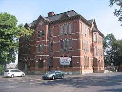 Foster School |
September 30, 1986 (#86002667) |
286 Main Street 40°28′03″N 79°57′32″W |
Central Lawrenceville | |
| 59 | Fourth Avenue Historic District | 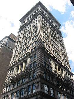 Fourth Avenue Historic District |
September 5, 1985 (#85001961) |
Roughly bounded by Smithfield Street, Market Square Place, 3rd and 5th Avenues 40°26′22″N 80°00′02″W |
Central Business District | |
| 60 | John Frew House | 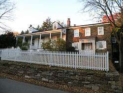 John Frew House |
May 30, 2001 (#01000593) |
105 Sterrett Street 40°25′46″N 80°03′31″W |
Westwood | |
| 61 | Frick Building and Annex | 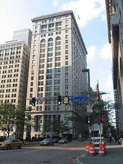 Frick Building and Annex |
May 22, 1978 (#78002336) |
437 Grant Street 40°26′20″N 79°59′53″W |
Central Business District | |
| 62 | Frick Park | 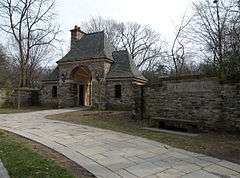 Frick Park |
February 28, 2019 (#100003450) |
1981 Beechwood Blvd. 40°26′13″N 79°54′30″W |
||
| 63 | Henry Clay Frick Training School for Teachers | 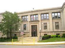 Henry Clay Frick Training School for Teachers |
September 30, 1986 (#86002668) |
107 Thackeray Street 40°26′36″N 79°57′29″W |
North Oakland | |
| 64 | Fulton Building | 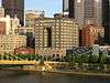 Fulton Building |
May 10, 2002 (#02000556) |
107 6th Street 40°26′38″N 80°00′09″W |
Central Business District | Now the Byham Theater |
| 65 | Fulton Elementary School | 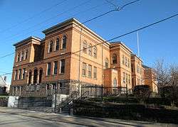 Fulton Elementary School |
September 30, 1986 (#86002669) |
Hampton and North Saint Clair Streets 40°28′30″N 79°55′19″W |
Highland Park | |
| 66 | Greenfield Elementary School |  Greenfield Elementary School |
September 30, 1986 (#86002671) |
North of Greenfield Avenue at East end of Alger Street 40°25′35″N 79°56′41″W |
Greenfield | |
| 67 | Hartley-Rose Belting Company Building | 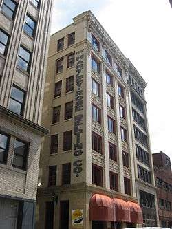 Hartley-Rose Belting Company Building |
August 25, 1983 (#83002212) |
425-427 1st Avenue 40°26′13″N 79°59′59″W |
Central Business District | |
| 68 | Heathside Cottage | 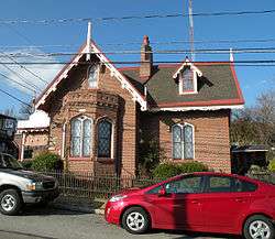 Heathside Cottage |
December 30, 1974 (#74001740) |
416 Catoma Street 40°27′39″N 80°00′13″W |
Fineview | |
| 69 | H.J. Heinz Company | 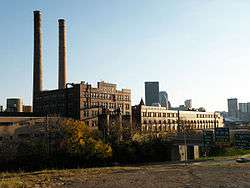 H.J. Heinz Company |
July 10, 2002 (#02000774) |
Roughly bounded by Chestnut Street, River Avenue, South Canal Street, Progress Street and Heinz modern Manufacturing Facilities 40°27′20″N 79°59′27″W |
Troy Hill | |
| 70 | Henderson-Metz House | 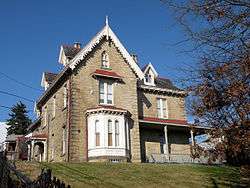 Henderson-Metz House |
August 22, 1979 (#79003141) |
1516 Warren Street 40°27′37″N 80°00′08″W |
Fineview | |
| 71 | Highland Building |  Highland Building |
September 6, 1991 (#91001123) |
121 South Highland Avenue 40°27′36″N 79°55′29″W |
East Liberty | |
| 72 | Highland Park | 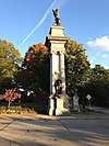 Highland Park |
November 25, 2019 (#100004665) |
Roughly bounded by Butler St., Washington Blvd., Stanton Ave., Farmhouse Dr., Bunker Hill St. & Heth's Run 40°28′45″N 79°54′56″W |
Highland Park | |
| 73 | Highland Park Residential Historic District | 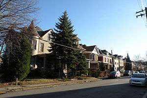 Highland Park Residential Historic District |
August 30, 2007 (#07000888) |
Roughly bounded by Highland Park, Heth's Run and Heth's Avenue, Chislett Street, Stanton Avenue and Jackson Street 40°28′33″N 79°55′48″W |
Morningside | |
| 74 | Highland Towers Apartments | 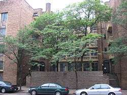 Highland Towers Apartments |
September 28, 1976 (#76001595) |
340 South Highland Avenue 40°27′21″N 79°55′32″W |
Shadyside | |
| 75 | Hoene-Werle House | 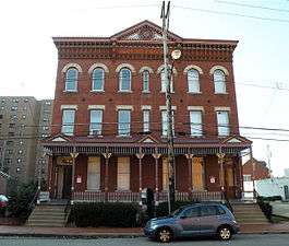 Hoene-Werle House |
November 15, 1984 (#84000533) |
1313-1315 Allegheny Avenue 40°27′17″N 80°01′13″W |
Manchester | |
| 76 | Homestead High-Level Bridge | 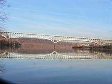 Homestead High-Level Bridge |
January 7, 1986 (#86000016) |
Monongahela River at West Street 40°24′40″N 79°55′09″W |
Squirrel Hill South | Extends into Homestead, elsewhere in Allegheny County |
| 77 | House at 200 West North Avenue | 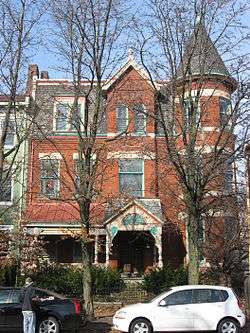 House at 200 West North Avenue |
February 27, 1986 (#86000305) |
200 West North Avenue 40°27′19″N 80°00′32″W |
Central Northside | |
| 78 | Houses at 2501-2531 Charles Street | 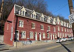 Houses at 2501-2531 Charles Street |
March 15, 1984 (#84003084) |
2501-2531 North Charles Street 40°28′02″N 80°01′07″W |
Perry South | |
| 79 | Houses at 838-862 Brightridge Street | 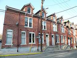 Houses at 838-862 Brightridge Street |
March 1, 1984 (#84003081) |
838-862 Brightridge Street 40°27′42″N 80°01′08″W |
Perry South | |
| 80 | Hunt Armory | 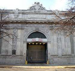 Hunt Armory |
November 14, 1991 (#91001697) |
324 Emerson Street 40°27′21″N 79°55′25″W |
Shadyside | |
| 81 | Kaufmann's Department Store Warehouse | 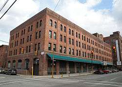 Kaufmann's Department Store Warehouse |
May 30, 1997 (#97000513) |
1401 Forbes Avenue 40°26′17″N 79°59′10″W |
Bluff | |
| 82 | Knoxville Junior High School | 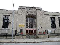 Knoxville Junior High School |
February 3, 1987 (#86002673) |
Charles and Grimes Avenues 40°24′58″N 79°59′40″W |
Knoxville | |
| 83 | Langley High School | 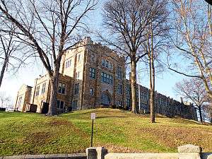 Langley High School |
September 30, 1986 (#86002674) |
Sheraden Boulevard and Chartiers Avenue 40°27′15″N 80°03′17″W |
Sheraden | |
| 84 | Larimer School |  Larimer School |
September 30, 1986 (#86002675) |
Larimer Avenue at Winslow Street 40°27′56″N 79°54′46″W |
Larimer | |
| 85 | Latimer School |  Latimer School |
September 30, 1986 (#86002676) |
Tripoli and James Streets 40°27′22″N 80°00′04″W |
East Allegheny | |
| 86 | Lawrence Public School |  Lawrence Public School |
September 30, 1986 (#86002679) |
3701 Charlotte Street 40°28′01″N 79°57′57″W |
Lower Lawrenceville | |
| 87 | Lawrenceville Historic District |  Lawrenceville Historic District |
July 8, 2019 (#100004020) |
Roughly bounded by 33rd St, Allegheny R, 55th St., Allegheny Cemetery, Penn Ave., 40th St., Liberty Ave., and Sassafras St. 40°28′07″N 79°57′44″W |
Lower Lawrenceville | |
| 88 | Lemington Elementary School | 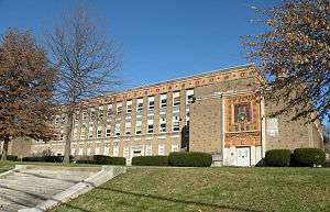 Lemington Elementary School |
September 30, 1986 (#86002681) |
7061 Lemington Avenue 40°28′12″N 79°53′47″W |
Lincoln–Lemington–Belmar | |
| 89 | Letsche Elementary School | 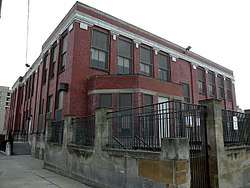 Letsche Elementary School |
September 30, 1986 (#86002682) |
1530 Cliff Street 40°26′41″N 79°59′17″W |
Crawford-Roberts | |
| 90 | Liberty Bridge |  Liberty Bridge |
June 22, 1988 (#88000867) |
Over the Monongahela River 40°25′58″N 79°59′50″W |
Central Business District | |
| 91 | Liberty School No. 4, Friendship Building | 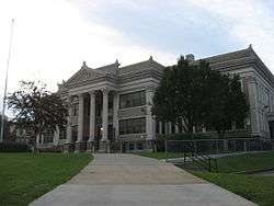 Liberty School No. 4, Friendship Building |
September 30, 1986 (#86002684) |
5501 Friendship Avenue 40°27′44″N 79°56′09″W |
Friendship | |
| 92 | Lincoln Elementary School | 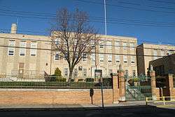 Lincoln Elementary School |
September 30, 1986 (#86002685) |
Lincoln and Frankstown Avenues 40°27′36″N 79°54′42″W |
Larimer | |
| 93 | Linden Avenue School | 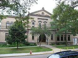 Linden Avenue School |
September 30, 1986 (#86002686) |
739 South Linden Avenue 40°26′44″N 79°55′00″W |
Point Breeze | |
| 94 | Madison Elementary School | 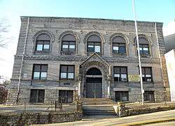 Madison Elementary School |
September 30, 1986 (#86002687) |
Milwaukee and Orion Streets 40°27′17″N 79°57′41″W |
Upper Hill | |
| 95 | Main Building, U.S. Bureau of Mines | 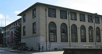 Main Building, U.S. Bureau of Mines |
May 24, 1974 (#74001741) |
4800 Forbes Avenue 40°26′39″N 79°56′45″W |
Squirrel Hill North | |
| 96 | Manchester Historic District | 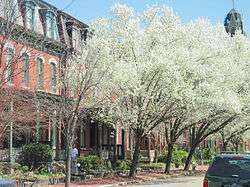 Manchester Historic District |
September 18, 1975 (#75001611) |
Irregular pattern contained with Faulsey, Chateau, Franklin, and Bidwell Streets 40°27′15″N 80°01′29″W |
Manchester | |
| 97 | McCleary Elementary School | McCleary Elementary School |
September 30, 1986 (#86002690) |
Holmes Street and McCandless Avenue 40°28′49″N 79°57′04″W |
Upper Lawrenceville | |
| 98 | McCook Family Estate |  McCook Family Estate |
April 20, 2011 (#11000197) |
5105 Fifth Avenue and 925 Amberson Avenue 40°26′53″N 79°56′18″W |
Shadyside | |
| 99 | McKees Rocks Bridge |  McKees Rocks Bridge |
November 14, 1988 (#88002168) |
Legislative Route 76, Spur 2, over the Ohio River at McKees Rocks 40°28′37″N 80°02′56″W |
Brighton Heights | Extends into McKees Rocks and Stowe Township, elsewhere in Allegheny County |
| 100 | Mexican War Streets Historic District |  Mexican War Streets Historic District |
May 28, 1975 (#75001612) |
Irregular pattern between Brighton and Arch Streets and between O'Hern and West Park; also roughly bounded by Armandale Street, Carrington Street, Charlick Way, Reddour Street, and West North Avenue 40°27′24″N 80°00′45″W |
Central Northside | Second set of boundaries represents a boundary increase |
| 101 | Mifflin Elementary School |  Mifflin Elementary School |
September 30, 1986 (#86002692) |
Mifflin Road at Lincoln Place 40°22′12″N 79°54′53″W |
Hays | |
| 102 | Monongahela Incline | 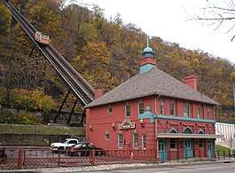 Monongahela Incline |
June 25, 1974 (#74001742) |
Grandview Avenue at Wyoming Avenue 40°25′55″N 80°00′20″W |
Mount Washington | |
| 103 | Moreland-Hoffstot House | 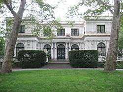 Moreland-Hoffstot House |
February 23, 1978 (#78002337) |
5057 5th Avenue 40°26′52″N 79°56′25″W |
Shadyside | |
| 104 | John Morrow Elementary School |  John Morrow Elementary School |
September 30, 1986 (#86002693) |
1611 Davis Avenue 40°28′48″N 80°02′23″W |
Brighton Heights | |
| 105 | Samuel F.B. Morse School | 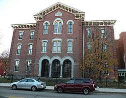 Samuel F.B. Morse School |
September 30, 1986 (#86002694) |
2418 Sarah Street 40°25′37″N 79°58′15″W |
South Side Flats | |
| 106 | New Granada Theater | 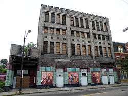 New Granada Theater |
December 27, 2010 (#10001071) |
2007-2013 Centre Avenue 40°26′39″N 79°58′48″W |
Middle Hill | |
| 107 | Ninth Street Bridge | 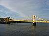 Ninth Street Bridge |
January 7, 1986 (#86000019) |
Allegheny River at 9th Street 40°26′48″N 80°00′01″W |
Central Business District | |
| 108 | Oakland Public School |  Oakland Public School |
February 3, 1987 (#86002696) |
Dawson Street near Edith Place 40°25′56″N 79°57′14″W |
South Oakland | |
| 109 | Old Allegheny Rows Historic District | 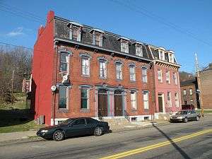 Old Allegheny Rows Historic District |
November 1, 1984 (#84000349) |
Roughly bounded by Sedgwick, California, Marquis, Mero, Brighton, and Moorison Streets 40°27′34″N 80°01′09″W |
California-Kirkbride | |
| 110 | Old Heidelberg Apartments |  Old Heidelberg Apartments |
May 4, 1976 (#76001596) |
Braddock Avenue at Waverly Street 40°26′38″N 79°53′45″W |
Point Breeze | |
| 111 | David B. Oliver High School |  David B. Oliver High School |
February 3, 1987 (#86002698) |
Brighton Road and Island Avenue 40°27′50″N 80°01′28″W |
Marshall-Shadeland | |
| 112 | Frederick J. Osterling Office and Studio |  Frederick J. Osterling Office and Studio |
September 5, 1985 (#85001964) |
228 Isabella Street 40°26′54″N 80°00′06″W |
North Shore | |
| 113 | Park Place School | 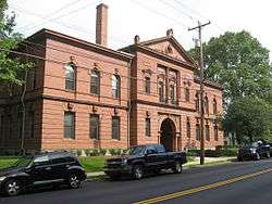 Park Place School |
September 30, 1986 (#86002701) |
South Braddock and Brashear Avenues 40°26′42″N 79°53′44″W |
Point Breeze | |
| 114 | Penn-Liberty Historic District | 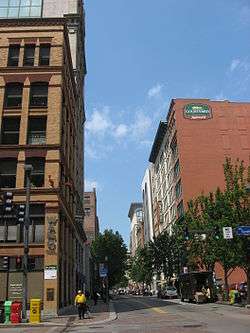 Penn-Liberty Historic District |
November 18, 1987 (#87001995) |
Roughly bounded by Liberty Avenue, Fort Duquesne Boulevard, Stanwix, 9th, French and 10th Streets 40°26′38″N 79°59′49″W |
Central Business District | |
| 115 | Pennsylvania Railroad Bridge | 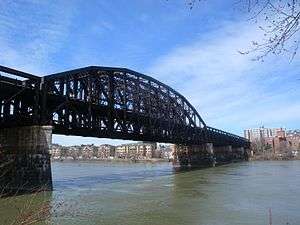 Pennsylvania Railroad Bridge |
August 13, 1979 (#79002160) |
11th Street 40°26′58″N 79°59′50″W |
North Shore | |
| 116 | Pennsylvania Railroad Station | 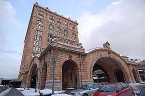 Pennsylvania Railroad Station |
April 22, 1976 (#76001597) |
1101 Liberty Avenue 40°26′39″N 79°59′31″W |
Central Business District | |
| 117 | Perry High School |  Perry High School |
September 30, 1986 (#86002702) |
Perrysville Avenue and Semicir Street 40°29′20″N 80°01′08″W |
Perry North | |
| 118 | Phipps Conservatory | 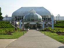 Phipps Conservatory |
November 13, 1976 (#76001598) |
Schenley Park 40°26′19″N 79°56′52″W |
Central Oakland | |
| 119 | Phipps-McElveen Building | 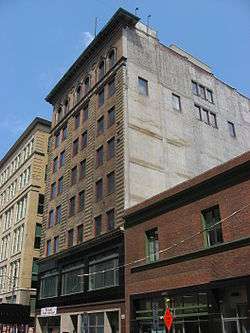 Phipps-McElveen Building |
May 5, 2000 (#00000451) |
525-529 Penn Avenue 40°26′34″N 80°00′10″W |
Central Business District | |
| 120 | Pittsburgh & Lake Erie Railroad Station | 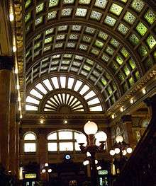 Pittsburgh & Lake Erie Railroad Station |
January 11, 1974 (#74001743) |
Smithfield Street at Carson Street 40°26′01″N 80°00′14″W |
South Shore | |
| 121 | Pittsburgh and Lake Erie Railroad Complex | 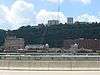 Pittsburgh and Lake Erie Railroad Complex |
December 31, 1979 (#79002161) |
Smithfield and Carson Streets 40°26′06″N 80°00′27″W |
South Shore | Now Station Square |
| 122 | Pittsburgh Athletic Association Building | 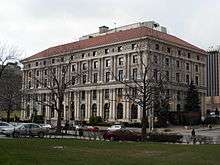 Pittsburgh Athletic Association Building |
December 15, 1978 (#78002338) |
4215 5th Avenue 40°26′42″N 79°57′17″W |
Central Oakland | |
| 123 | Pittsburgh Brass Manufacturing Company Building | 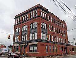 Pittsburgh Brass Manufacturing Company Building |
February 2, 2016 (#15001030) |
3147-3155 Penn Ave. 40°27′39″N 79°58′13″W |
Strip District | |
| 124 | Pittsburgh Central Downtown Historic District | 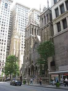 Pittsburgh Central Downtown Historic District |
December 17, 1985 (#85003216) |
Roughly bounded by 4th, 6th, 7th and Liberty Avenues, former Pennsylvania Railroad tracks, Grant and Wood Streets 40°26′29″N 79°59′50″W |
Central Business District | |
| 125 | Pittsburgh Mercantile Company Building | 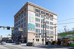 Pittsburgh Mercantile Company Building |
December 29, 2014 (#14001099) |
2600 E. Carson Street 40°25′38″N 79°58′06″W |
South Side Flats | |
| 126 | Pittsburgh Renaissance Historic District | 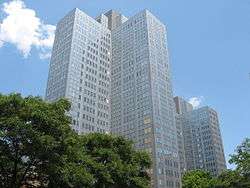 Pittsburgh Renaissance Historic District |
May 2, 2013 (#13000252) |
Roughly bounded by Stanwix Street, Allegheny, Monongahela and Ohio Rivers 40°26′29″N 80°00′25″W |
Central Business District | |
| 127 | Pittsburgh Terminal Warehouse and Transfer Company | Pittsburgh Terminal Warehouse and Transfer Company |
May 8, 2013 (#13000253) |
333-400 East Carson Street 40°25′47″N 79°59′49″W |
South Side Flats | |
| 128 | Prospect Junior High and Elementary School | 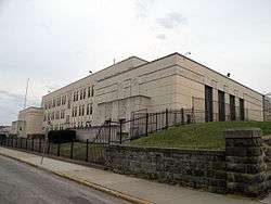 Prospect Junior High and Elementary School |
September 30, 1986 (#86002705) |
Prospect Avenue near Southern Avenue 40°25′41″N 80°00′37″W |
Mount Washington | |
| 129 | Reymer Brothers Candy Factory |  Reymer Brothers Candy Factory |
May 30, 1997 (#97000514) |
1425 Forbes Avenue 40°26′16″N 79°59′07″W |
Bluff | |
| 130 | Rodef Shalom Temple | 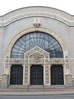 Rodef Shalom Temple |
November 15, 1979 (#79002162) |
4905 5th Avenue 40°26′53″N 79°56′37″W |
Shadyside | |
| 131 | Rotunda of the Pennsylvania Railroad Station |  Rotunda of the Pennsylvania Railroad Station |
April 11, 1973 (#73001587) |
1100 Liberty Avenue at Grant Street 40°26′39″N 79°59′34″W |
Central Business District | |
| 132 | St. Boniface Roman Catholic Church | 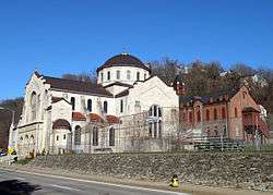 St. Boniface Roman Catholic Church |
November 17, 1981 (#81000525) |
East Street 40°28′01″N 80°00′00″W |
Spring Hill–City View | |
| 133 | St. John the Baptist Ukrainian Catholic Church | 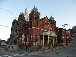 St. John the Baptist Ukrainian Catholic Church |
October 29, 1974 (#74001747) |
109 South Carson Street 40°25′43″N 79°59′31″W |
South Side Flats | |
| 134 | St. Stanislaus Kostka Roman Catholic Church | 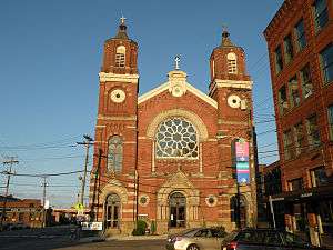 St. Stanislaus Kostka Roman Catholic Church |
September 14, 1972 (#72001089) |
21st and Smallman Streets 40°27′08″N 79°59′01″W |
Strip District | |
| 135 | The Salvation Army Building | 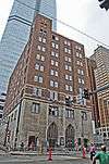 The Salvation Army Building |
February 2, 2016 (#15001031) |
425-435 Boulevard of the Allies 40°26′15″N 79°59′56″W |
Central Business District | |
| 136 | Schenley Farms Historic District | 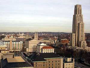 Schenley Farms Historic District |
July 22, 1983 (#83002213) |
Roughly bounded by Andover Terrace, Centre, Bellefield, and Parkman Avenues, Ditbridge, Thackeray, Forbes and Mawhinney; also 4400 Centre Avenue 40°26′47″N 79°57′12″W |
North Oakland | 4400 Centre represents a boundary increase of November 28, 2012 |
| 137 | Schenley High School | 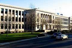 Schenley High School |
September 30, 1986 (#86002706) |
Bigelow Boulevard and Centre Avenue 40°27′01″N 79°57′17″W |
North Oakland | |
| 138 | Schenley Park |  Schenley Park |
November 13, 1985 (#85003506) |
Schenley Drive and Panther Hollow Road 40°26′04″N 79°56′34″W |
Squirrel Hill South | |
| 139 | Schiller Elementary School | 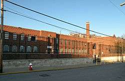 Schiller Elementary School |
September 30, 1986 (#86002707) |
1018 Peralta Street 40°27′23″N 79°59′35″W |
East Allegheny | |
| 140 | James Scott House | 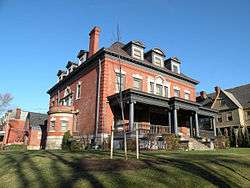 James Scott House |
May 30, 1997 (#97000515) |
5635 Stanton Avenue 40°28′16″N 79°55′28″W |
Highland Park | |
| 141 | Sellers House | 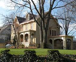 Sellers House |
September 7, 1979 (#79003142) |
400 Shady Avenue 40°27′19″N 79°55′22″W |
Shadyside | |
| 142 | Seventh Street Bridge | 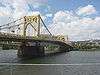 Seventh Street Bridge |
January 7, 1986 (#86000018) |
Allegheny River at 7th Street 40°26′45″N 80°00′05″W |
Central Business District | |
| 143 | Shadyside Presbyterian Church | 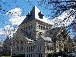 Shadyside Presbyterian Church |
April 3, 1975 (#75001613) |
Amberson Avenue and Westminster Place 40°26′56″N 79°56′20″W |
Shadyside | |
| 144 | Sixteenth Street Bridge |  Sixteenth Street Bridge |
August 13, 1979 (#79002163) |
Spans the Allegheny River 40°27′04″N 79°59′26″W |
Central Business District | |
| 145 | Sixth Street Bridge | Sixth Street Bridge |
January 7, 1986 (#86000017) |
Allegheny River at 6th Street 40°26′43″N 80°00′12″W |
Central Business District | |
| 146 | Smithfield Street Bridge | 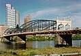 Smithfield Street Bridge |
March 21, 1974 (#74001745) |
Smithfield Street at the Monongahela River 40°26′05″N 80°00′08″W |
Central Business District | |
| 147 | William Penn Snyder House | 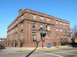 William Penn Snyder House |
May 3, 1976 (#76001599) |
852 Ridge Avenue 40°27′01″N 80°00′57″W |
Allegheny West | |
| 148 | Soldiers and Sailors Memorial Hall | 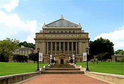 Soldiers and Sailors Memorial Hall |
December 30, 1974 (#74001746) |
5th Avenue at Bigelow Boulevard 40°26′43″N 79°57′23″W |
North Oakland | |
| 149 | South Side High School | 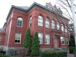 South Side High School |
September 30, 1986 (#86002709) |
900 East Carson Street 40°25′42″N 79°59′20″W |
South Side Flats | |
| 150 | South Side Market Building | 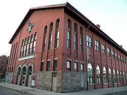 South Side Market Building |
October 14, 1976 (#76001600) |
12th and Bingham Streets 40°25′46″N 79°59′11″W |
South Side Flats | |
| 151 | South Tenth Street Bridge |  South Tenth Street Bridge |
January 7, 1986 (#86000020) |
Monongahela River at S. 10th Street 40°25′57″N 79°59′23″W |
Bluff | |
| 152 | Springfield Public School | 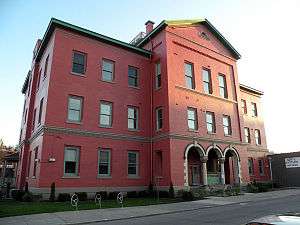 Springfield Public School |
September 30, 1986 (#86002711) |
Smallman and 31st Streets 40°27′36″N 79°58′20″W |
Strip District | |
| 153 | Stanley Theater and Clark Building | 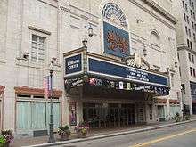 Stanley Theater and Clark Building |
February 27, 1986 (#86000303) |
207 7th Street and 701-717 Liberty Avenue 40°26′35″N 80°00′00″W |
Central Business District | |
| 154 | Sterrett Sub-District School | 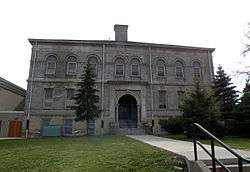 Sterrett Sub-District School |
September 30, 1986 (#86002713) |
339 Lang Avenue 40°26′48″N 79°54′20″W |
Point Breeze | |
| 155 | Strip Historic District | 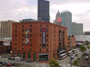 Strip Historic District |
May 2, 2014 (#14000194) |
Roughly bounded by former Pennsylvania Railroad yards, Liberty Avenue, Railroad, 22nd and 15th Streets 40°27′00″N 79°59′06″W |
Strip District | |
| 156 | Teutonia Maennerchor Hall | 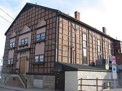 Teutonia Maennerchor Hall |
May 14, 2004 (#04000439) |
857 Phineas Street 40°27′19″N 79°59′42″W |
East Allegheny | |
| 157 | Try Street Terminal | 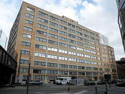 Try Street Terminal |
December 28, 2007 (#07001327) |
600-620 2nd Avenue 40°26′09″N 79°59′45″W |
Central Business District | |
| 158 | Tuberculosis Hospital of Pittsburgh | 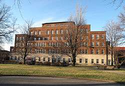 Tuberculosis Hospital of Pittsburgh |
February 25, 1993 (#93000073) |
2851 Bedford Avenue 40°27′12″N 79°58′07″W |
Bedford Dwellings | |
| 159 | Union Trust Building | 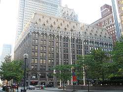 Union Trust Building |
January 21, 1974 (#74001748) |
435 Grant Street 40°26′23″N 79°59′48″W |
Central Business District | |
| 160 | US Post Office and Courthouse-Pittsburgh | 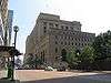 US Post Office and Courthouse-Pittsburgh |
February 2, 1995 (#94001620) |
700 Grant St.[5] 40°26′33″N 79°59′40″W |
Central Business District | |
| 161 | Ursuline Young Ladies Academy | 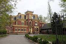 Ursuline Young Ladies Academy |
September 4, 2012 (#12000604) |
201 South Winebiddle Street 40°27′51″N 79°56′32″W |
Bloomfield | |
| 162 | Washington Vocational School | 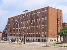 Washington Vocational School |
September 30, 1986 (#86002715) |
169 40th Street 40°28′10″N 79°57′47″W |
Central Lawrenceville | |
| 163 | West End-North Side Bridge |  West End-North Side Bridge |
August 24, 1979 (#79003143) |
Western Avenue and Carson Street 40°26′53″N 80°01′35″W |
Chateau | |
| 164 | Westinghouse High School |  Westinghouse High School |
September 30, 1986 (#86002716) |
1101 North Murtland Street 40°27′39″N 79°54′04″W |
Homewood West | |
| 165 | Whitehill-Gleason Motors | 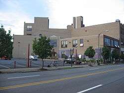 Whitehill-Gleason Motors |
July 22, 1999 (#99000878) |
5815 Baum Boulevard 40°27′35″N 79°55′49″W |
East Liberty | |
| 166 | Wightman School | 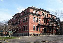 Wightman School |
September 30, 1986 (#86002717) |
5604 Solway Street 40°26′34″N 79°55′36″W |
Squirrel Hill North | |
| 167 | William Penn Hotel | 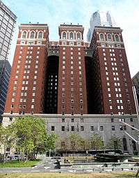 William Penn Hotel |
March 7, 1985 (#85000458) |
Mellon Square between 6th and Oliver Streets 40°26′25″N 79°59′46″W |
Central Business District | |
| 168 | August Wilson House | 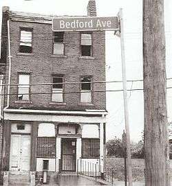 August Wilson House |
April 30, 2013 (#13000254) |
1727 Bedford Avenue 40°26′43″N 79°59′08″W |
Crawford-Roberts | |
| 169 | John Woods House | 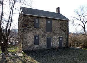 John Woods House |
April 29, 1993 (#93000353) |
4604 Monongahela Street 40°24′53″N 79°56′41″W |
Hazelwood | |
| 170 | Woolslair Elementary School | 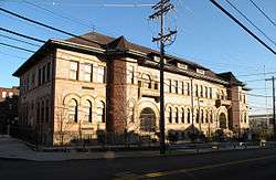 Woolslair Elementary School |
September 30, 1986 (#86002718) |
40th Street and Liberty Avenue 40°27′48″N 79°57′26″W |
Lower Lawerenceville |
See also
| Wikimedia Commons has media related to National Register of Historic Places in Pittsburgh, Pennsylvania. |
- National Register of Historic Places listings in Allegheny County, Pennsylvania
- National Register of Historic Places listings in Pennsylvania
- List of National Historic Landmarks in Pennsylvania
- List of City of Pittsburgh historic designations
- List of Pittsburgh History and Landmarks Foundation Historic Landmarks
- List of Pennsylvania state historical markers in Allegheny County
References
- The latitude and longitude information provided in this table was derived originally from the National Register Information System, which has been found to be fairly accurate for about 99% of listings. Some locations in this table may have been corrected to current GPS standards.
- "National Register of Historic Places: Weekly List Actions". National Park Service, United States Department of the Interior. Retrieved on June 19, 2020.
- Numbers represent an ordering by significant words. Various colorings, defined here, differentiate National Historic Landmarks and historic districts from other NRHP buildings, structures, sites or objects.
- The eight-digit number below each date is the number assigned to each location in the National Register Information System database, which can be viewed by clicking the number.
- "U.S. Post Office and Courthouse, Pittsburgh, PA". U.S. General Services Administration. Retrieved April 7, 2016.
| Government |  | |
|---|---|---|
| Economy | ||
| Other topics | ||
| ||
| Topics |  | |
|---|---|---|
| Lists by county |
| |
| Lists by city |
| |
| Other lists | ||
| ||