Upper Burrell Township, Westmoreland County, Pennsylvania
Upper Burrell Township is a township in Westmoreland County, Pennsylvania, United States, within the Pittsburgh metropolitan area. The population was 2,240 at the 2000 census.
Upper Burrell Township, Pennsylvania | |
|---|---|
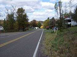 A typical road in Upper Burrell Township | |
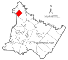 Map of Westmoreland County, Pennsylvania Highlighting Upper Burrell Township | |
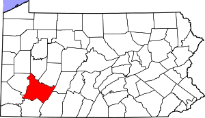 Map of Pennsylvania highlighting Westmoreland County | |
| Country | United States |
| State | Pennsylvania |
| County | Westmoreland |
| Settled | 1791 |
| Incorporated | 1879 |
| Area | |
| • Total | 15.13 sq mi (39.19 km2) |
| • Land | 15.13 sq mi (39.19 km2) |
| • Water | 0.00 sq mi (0.00 km2) |
| Population (2010) | |
| • Total | 2,326 |
| • Estimate (2018)[2] | 2,232 |
| • Density | 149.02/sq mi (57.54/km2) |
| Time zone | UTC-5 (Eastern (EST)) |
| • Summer (DST) | UTC-4 (EDT) |
| FIPS code | 42-129-78768 |
| Website | http://www.upperburrelltwp.com |
History
Northern Westmoreland County was once part of the hunting grounds of the Iroquois Five Nations, first settled by Europeans in the 1760s. In 1852, Allegheny Township, which covered nearly all of the northeastern corner of Westmoreland County, was divided into smaller districts to accommodate a growing population. One of these became Burrell Township, which in 1879 was divided into Lower and Upper Burrell townships. In the 1890s, Lower Burrell was further divided into the cities of New Kensington and Arnold. Farming, coal mining, and milling were the mainstays of the local economy in the 19th and early 20th century. There are several historic buildings from that era still standing in Upper Burrell Township; the Byerly House was added to the National Register of Historic Places in 1985.[3]
Geography
According to the United States Census Bureau, the township has a total area of 15.2 square miles (39.3 km²), all of it land.
Upper Burrell is the site of Penn State New Kensington, and a large research facility of Alcoa.
Demographics
| Historical population | |||
|---|---|---|---|
| Census | Pop. | %± | |
| 2000 | 2,240 | — | |
| 2010 | 2,326 | 3.8% | |
| Est. 2018 | 2,232 | [2] | −4.0% |
| U.S. Decennial Census[4] | |||
At the 2000 census there were 2,240 people, 856 households, and 647 families living in the township. The population density was 147.6 people per square mile (57.0/km²). There were 914 housing units at an average density of 60.2/sq mi (23.2/km²). The racial makeup of the township was 96.34% White, 2.81% African American, 0.04% Native American, 0.31% Asian, and 0.49% from two or more races. Hispanic or Latino of any race were 0.45%.[5]
Of the 856 households 31.3% had children under the age of 18 living with them, 65.1% were married couples living together, 7.4% had a female householder with no husband present, and 24.4% were non-families. 19.3% of households were one person and 8.5% were one person aged 65 or older. The average household size was 2.62 and the average family size was 3.01.
The age distribution was 22.9% under the age of 18, 9.0% from 18 to 24, 27.5% from 25 to 44, 27.0% from 45 to 64, and 13.7% 65 or older. The median age was 40 years. For every 100 females there were 102.2 males. For every 100 females age 18 and over, there were 103.4 males.
The median household income was $39,880 and the median family income was $46,855. Males had a median income of $37,083 versus $24,583 for females. The per capita income for the township was $18,344. About 4.5% of families and 6.4% of the population were below the poverty line, including 6.3% of those under age 18 and 5.2% of those age 65 or over.
References
- "2016 U.S. Gazetteer Files". United States Census Bureau. Retrieved Aug 14, 2017.
- Bureau, U. S. Census. "U.S. Census website". United States Census Bureau. US Census Bureau. Retrieved 1 December 2019.
- "National Register Information System". National Register of Historic Places. National Park Service. July 9, 2010.
- "Census of Population and Housing". Census.gov. Retrieved June 4, 2016.
- "U.S. Census website". United States Census Bureau. Retrieved 2008-01-31.
Pittsburgh metropolitan area | ||
|---|---|---|
| Counties |  Map of the Pittsburgh Tri-State with green counties in the metropolitan area and yellow counties in the combined area. | |
| Major cities | ||
| Cities and towns 15k–50k (in 2010) | ||
| Airports | ||
| Topics | ||
| ||