National Register of Historic Places listings in Pike County, Pennsylvania
This is a list of the National Register of Historic Places listings in Pike County, Pennsylvania.

Location of Pike County in Pennsylvania
This is intended to be a complete list of the properties and districts on the National Register of Historic Places in Pike County, Pennsylvania, United States. The locations of National Register properties and districts for which the latitude and longitude coordinates are included below, may be seen in a map.[1]
There are 27 properties and districts listed on the National Register in the county. Two sites are further designated as National Historic Landmarks and another is designated as a National Historic Site.
- This National Park Service list is complete through NPS recent listings posted June 26, 2020.[2]
Current listings
| [3] | Name on the Register | Image | Date listed[4] | Location | City or town | Description |
|---|---|---|---|---|---|---|
| 1 | Brodhead Farm |  Brodhead Farm |
July 23, 1979 (#79000242) |
Northeast of Bushkill on U.S. Route 209 41°08′59″N 74°55′12″W |
Lehman Township | |
| 2 | Callahan House | 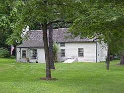 Callahan House |
July 23, 1979 (#79000244) |
U.S. Route 209, south of Milford 41°19′00″N 74°48′01″W |
Dingman Township | |
| 3 | D & H Canal Co. Office |  D & H Canal Co. Office |
August 9, 1993 (#93000715) |
Northwestern side of Scenic Drive in Lackawaxen 41°29′01″N 74°59′13″W |
Lackawaxen Township | Intact 1855 house built as local office for canal; now used as bed and breakfast |
| 4 | Delaware and Hudson Canal | 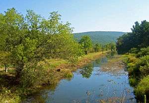 Delaware and Hudson Canal |
November 24, 1968 (#68000051) |
Delaware and Hudson Canal 41°28′56″N 74°59′09″W |
Lackawaxen Township | Extends into Wayne County |
| 5 | Delaware Aqueduct |  Delaware Aqueduct |
November 24, 1968 (#68000055) |
Between Minisink Ford, New York and Lackawaxen 41°28′57″N 74°59′06″W |
Lackawaxen Township | |
| 6 | Dingman's Ferry Dutch Reformed Church |  Dingman's Ferry Dutch Reformed Church |
July 23, 1979 (#79000241) |
U.S. Route 209 in Dingman's Ferry 41°13′32″N 74°52′10″W |
Delaware Township | |
| 7 | Forester's Hall |  Forester's Hall |
July 14, 1983 (#83002282) |
Broad and Hartford Streets 41°19′21″N 74°48′14″W |
Milford | |
| 8 | Jervis Gordon Grist Mill Historic District |  Jervis Gordon Grist Mill Historic District |
December 26, 1985 (#85003163) |
Water, Mill, and Seventh Streets 41°19′26″N 74°48′40″W |
Milford | |
| 9 | Zane Grey House |  Zane Grey House |
May 6, 1983 (#83002283) |
Roebling Road in Lackawaxen; also 135 Lackawaxen Scenic Dr. 41°29′08″N 74°59′16″W |
Lackawaxen Township | Self-designed 1905–18 home of the novelist; wrote Riders of the Purple Sage here. Now museum run by the National Park Service. Scenic Drive represents a boundaries increase of April 29, 2011 |
| 10 | Hotel Fauchere and Annex | 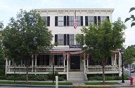 Hotel Fauchere and Annex |
August 29, 1980 (#80003626) |
401 and 403 Broad Street 41°19′25″N 74°48′05″W |
Milford | |
| 11 | Lord House | .JPG) Lord House |
June 30, 1980 (#80003625) |
Pennsylvania Route 739 at Lords Valley 41°22′04″N 75°03′49″W |
Blooming Grove Township | |
| 12 | Metz Ice Plant | 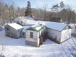 Metz Ice Plant |
November 19, 2007 (#07001206) |
Harford Street 41°19′02″N 74°47′59″W |
Milford | |
| 13 | Milford Historic District |  Milford Historic District |
July 23, 1998 (#98000898) |
Roughly along Broad, Harford, Ann, Catharine, High, and Fourth Streets 41°19′23″N 74°48′08″W |
Milford | |
| 14 | Mill Rift Hall | .JPG) Mill Rift Hall |
August 9, 1993 (#93000714) |
Bluestone Boulevard 41°24′42″N 74°44′45″W |
Westfall Township | |
| 15 | Minisink Archeological Site | 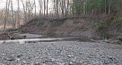 Minisink Archeological Site |
April 19, 1993 (#93000608) |
In the vicinity of Minisink Island[5] 41°17′26″N 74°49′44″W |
Dingman Township | Extends into Sussex County, New Jersey |
| 16 | Nearpass House | .JPG) Nearpass House |
August 19, 1993 (#93000849) |
Cemetery Road 41°25′07″N 74°44′30″W |
Westfall Township | |
| 17 | Nyce Farm |  Nyce Farm |
July 23, 1979 (#79000240) |
Northwest of Bushkill on U.S. Route 209 41°08′24″N 74°55′50″W |
Lehman Township | |
| 18 | Paupack School |  Paupack School |
August 29, 2016 (#16000573) |
545 Pennsylvania Route 507 41°24′28″N 75°13′38″W |
Palmyra Township | |
| 19 | Peters House |  Peters House |
August 24, 1979 (#79000239) |
U.S. Route 209 in Bushkill 41°05′36″N 75°00′08″W |
Lehman Township | |
| 20 | Pike County Courthouse | 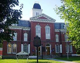 Pike County Courthouse |
July 23, 1979 (#79002340) |
Broad and High Streets 41°19′28″N 74°48′04″W |
Milford | |
| 21 | Gifford Pinchot House | 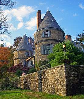 Gifford Pinchot House |
October 15, 1966 (#66000694) |
Western edge of Milford 41°19′46″N 74°49′10″W |
Dingman Township | Family home of Gifford Pinchot, founder of U.S. Forest Service, is only National Historic Site run by that agency. Also home to Pinchot Institute |
| 22 | Pond Eddy Bridge |  Pond Eddy Bridge |
November 14, 1988 (#88002170) |
Quadrant Route 1011 over the Delaware River at Pond Eddy 41°26′21″N 74°49′13″W |
Shohola Township | Extends into Sullivan County, New York |
| 23 | Promised Land State Park-Bear Wallow Cabins | .JPG) Promised Land State Park-Bear Wallow Cabins |
February 11, 1987 (#87000048) |
10 miles (16 km) north of Canadensis on Pennsylvania Route 390 41°19′10″N 75°12′46″W |
Palmyra Township | |
| 24 | Promised Land State Park-Whittaker Lodge District | .JPG) Promised Land State Park-Whittaker Lodge District |
February 11, 1987 (#87000047) |
10 miles (16 km) north of Canadensis on Pennsylvania Route 390 41°18′44″N 75°11′29″W |
Palmyra Township | |
| 25 | Shohola Glen Hotel | .JPG) Shohola Glen Hotel |
March 28, 1997 (#97000288) |
100 Rohman Road 41°28′29″N 74°54′55″W |
Shohola Township | |
| 26 | Turn Store and the Tinsmith's Shop |  Turn Store and the Tinsmith's Shop |
September 18, 1978 (#78000260) |
U.S. Route 209 in Bushkill 41°05′32″N 75°00′11″W |
Lehman Township | |
| 27 | Marie Zimmermann Farm | 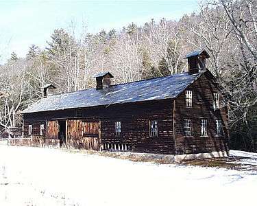 Marie Zimmermann Farm |
November 1, 1979 (#79000243) |
Southwest of Milford on U.S. Route 209 41°15′07″N 74°51′30″W |
Delaware Township |
Former listing
| [3] | Name on the Register | Image | Date listed | Date removed | Location | City or town | Summary |
|---|---|---|---|---|---|---|---|
| 1 | Bushkill Gristmill | June 3, 1979 (#79002335) | Unknown | U.S. Route 209 |
Bushkill | ||
| 2 | Shanna House | January 8, 1985 (#85000075) | March 10, 1998 | U.S. Route 209 |
Delaware Township |
References
| Wikimedia Commons has media related to National Register of Historic Places in Pike County, Pennsylvania. |
- The latitude and longitude information provided in this table was derived originally from the National Register Information System, which has been found to be fairly accurate for about 99% of listings. Some locations in this table may have been corrected to current GPS standards.
- "National Register of Historic Places: Weekly List Actions". National Park Service, United States Department of the Interior. Retrieved on June 26, 2020.
- Numbers represent an ordering by significant words. Various colorings, defined here, differentiate National Historic Landmarks and historic districts from other NRHP buildings, structures, sites or objects.
- The eight-digit number below each date is the number assigned to each location in the National Register Information System database, which can be viewed by clicking the number.
- Location derived from its NRHP nomination form; the NRIS lists the site as "Address Restricted"
| Topics | 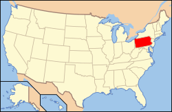 | |
|---|---|---|
| Lists by county |
| |
| Lists by city |
| |
| Other lists | ||
| ||
Municipalities and communities of Pike County, Pennsylvania, United States | ||
|---|---|---|
| Boroughs | | |
| Townships | ||
| CDPs | ||
| Unincorporated communities | ||
| Footnotes | ‡This populated place also has portions in an adjacent county or counties. | |
This article is issued from Wikipedia. The text is licensed under Creative Commons - Attribution - Sharealike. Additional terms may apply for the media files.