Districts of Serbia
An okrug is one of the first-level administrative divisions of Serbia, corresponding to a "province" in many other countries. The term okrug (pl. okruzi) literally means "encircling", and can also be translated as "county", though it is generally rendered by the Serbian government as "district".
| Districts of Serbia Окрузи Србије Okruzi Srbije | |
|---|---|
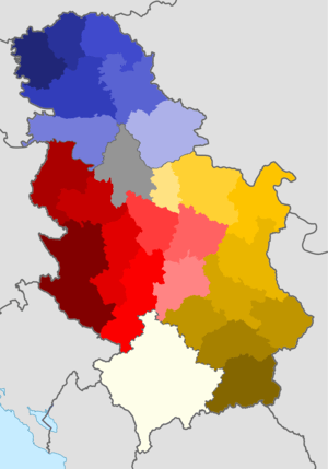 Interactive map of the present-day districts of Serbia. The borders of the districts of Kosovo are disputed. | |
| Category | Unitary state |
| Location | Republic of Serbia |
| Number | 24 Districts (29 including Kosovo[lower-alpha 1] + City of Belgrade |
| Populations | 91,754 (Toplica) – 1,687,132 (Belgrade) |
| Areas | 1,248 km2 (482 sq mi) (Podunavlje) – 6,140 km2 (2,370 sq mi) (Zlatibor) |
| Government | District government, National government |
| Subdivisions | Municipality and city |
 |
|---|
| This article is part of a series on the politics and government of Serbia |
|
|
Legislature |
|
Judiciary
|
|
|
The Serbian local government reforms of 1992, going into effect the following year, created 29 districts,[1] with the City of Belgrade holding similar authority. Following the controversial 2008 Kosovo declaration of independence, new districts were created by the so-called Republic of Kosovo government; the Serbian government does not recognize these districts.
The districts of Serbia are generally named after historical and geographical regions, though some, such as the Pčinja District and the Nišava District, are named after local rivers. Their areas and populations vary to a large extent, ranging from the relatively-small Podunavlje District to the much larger Zlatibor District.
As regional centers of state authority, the districts have little room for self-government and do not have local flags. Still, they are each run by a commissioner as well as cooperating municipal leaders. The districts can be further divided into cities and municipalities.
Definition
The territorial organisation of Serbia is regulated by the Law on Territorial Organization, adopted by the National Assembly on 29 December 2007.[2] According to the Law, the territorial organization of the republic comprises municipalities and cities, the City of Belgrade with special status, and autonomous provinces. Districts are not mentioned in this law but are defined by the Government of Serbia's Enactment of 29 January 1992. They are defined as the districts as "regional centers of state authority", enacting affairs run by the relevant Ministries.
Serbia is divided into 29 districts (8 in Šumadija and Western Serbia, 9 in Southern and Eastern Serbia, 7 in Vojvodina and 5 in Kosovo and Metohija), plus the City of Belgrade. The City of Belgrade is not part of any district, but has a special status very similar to that of a district.
Districts of Kosovo
Serbian laws treat Kosovo and Metohija as integral part of Serbia (Autonomous Province of Kosovo and Metohija). The Enactment defines five districts on the territory of Kosovo.[2] But, since 1999, following the Kosovo War Kosovo is under United Nations' administration of UNMIK. In 2000, the UNMIK administration changed territorial organisation on the territory of Kosovo. All five districts were abolished, and seven new districts were created. Serbian government does not recognize this move, and accepts only five pre-2000 districts.
List of districts
Districts in Šumadija and Western Serbia
Šumadija i Zapadna Srbija
| District | Seat | Area in km² | Population 2011 | Population per km² | Municipalities and cities | Settlements |
|---|---|---|---|---|---|---|
| Kolubara District (Kolubarski okrug)  |
Valjevo | 2,474 | 174,228 | 70.4 | 218 | |
| Mačva District (Mačvanski okrug)  |
Šabac | 3,268 | 297,778 | 91.1 | 228 | |
| Moravica District (Moravički okrug) 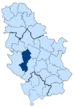 |
Čačak | 3,016 | 212,149 | 70.3 | 206 | |
| Pomoravlje District (Pomoravski okrug) 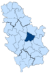 |
Jagodina | 2,614 | 212,839 | 84.8 | 191 | |
| Rasina District (Rasinski okrug) 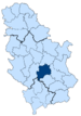 |
Kruševac | 2,667 | 240,463 | 90.2 | 296 | |
| Raška District (Raški okrug) 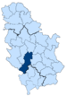 |
Kraljevo | 3,918 | 300,102 | 76.6 | 359 | |
| Šumadija District (Šumadijski okrug) 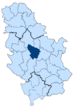 |
Kragujevac | 2,387 | 290,900 | 121.8 | 174 | |
| Zlatibor District (Zlatiborski okrug)  |
Užice | 6,140 | 284,729 | 46.4 | 438 |
Districts in Southern and Eastern Serbia
Južna i Istočna Srbija
| District | Seat | Area in km² | Population 2011 | Population per km² | Municipalities and cities | Settlements |
|---|---|---|---|---|---|---|
| Bor District (Borski okrug) 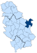 |
Bor | 3,507 | 123,848 | 35.3 | 90 | |
| Braničevo District (Braničevski okrug)  |
Požarevac | 3,865 | 180,480 | 46.7 | 189 | |
| Jablanica District (Jablanički okrug)  |
Leskovac | 2,769 | 215,463 | 77.8 | 336 | |
| Nišava District (Nišavski okrug) 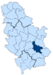 |
Niš | 2,729 | 373,404 | 136.8 | 285 | |
| Pčinja District (Pčinjski okrug) 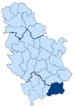 |
Vranje | 3,520 | 158,717 | 45.1 | 363 | |
| Pirot District (Pirotski okrug) 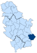 |
Pirot | 2,761 | 92,277 | 33.4 | 214 | |
| Podunavlje District (Podunavski okrug) 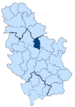 |
Smederevo | 1,248 | 198,184 | 158.8 | 58 | |
| Toplica District (Toplički okrug)  |
Prokuplje | 2,231 | 90,600 | 40.6 | 267 | |
| Zaječar District (Zaječarski okrug) 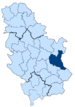 |
Zaječar | 3,623 | 118,295 | 32.6 | 173 |
Districts in Vojvodina
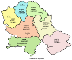
| District | Seat | Area in km² | Population 2011 | Population per km² | Municipalities and cities | Settlements |
|---|---|---|---|---|---|---|
| Central Banat District (Srednjebanatski okrug)  |
Zrenjanin | 3,256 | 186,851 | 57.4 | 55 | |
| North Bačka District (Severnobački okrug) 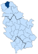 |
Subotica | 1,784 | 185,552 | 104.0 | 45 | |
| North Banat District (Severnobanatski okrug)  |
Kikinda | 2,329 | 146,690 | 63.0 | 50 | |
| South Bačka District (Južnobački okrug) 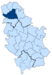 |
Novi Sad | 4,016 | 615,371 | 151.3 |
|
77 |
| South Banat District (Južnobanatski okrug) 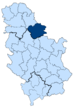 |
Pančevo | 4,245 | 291,327 | 68.6 |
|
94 |
| Srem District (Sremski okrug)  |
Sremska Mitrovica | 3,486 | 311,053 | 89.2 | 109 | |
| West Bačka District (Zapadnobački okrug)  |
Sombor | 2,420 | 187,581 | 77.5 |
|
37 |
Districts in Kosovo and Metohija

Five of Serbian Districts are on the territory of Kosovo, comprising 28 municipalities and 1 city. In 2000, UNMIK created 7 new districts and 30 municipalities. Serbia does not exercise sovereignty over this polity. For the UNMIK districts and the districts of Kosovo, see Districts of Kosovo. Because the Serbian government has no control over Kosovo since it declared independence, it was not included in Serbia's 2011 census. For current demographic information about Kosovo, see Kosovo's 2011 census.
| District | Seat | Area in km² | Population 2002 | Population per km² | Municipalities and cities |
|---|---|---|---|---|---|
| Kosovo District (Kosovski okrug)  |
Pristina | 3,310 | 672,292 | 203.1 | |
| Kosovo-Pomoravlje District (Kosovsko-Pomoravski okrug) 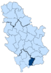 |
Gnjilane | 1,389 | 217,726 | 156.8 | |
| Kosovska Mitrovica District (Kosovskomitrovički okrug) 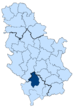 |
Kosovska Mitrovica | 2,053 | 275,904 | 134.4 |
|
| Peć District (Pećki okrug) 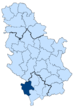 |
Peć | 2,459 | 414,187 | 168.4 | |
| Prizren District (Prizrenski okrug)  |
Prizren | 2,196 | 376,085 | 171.3 |
See also
Notes and references
Notes
- Kosovo is the subject of a territorial dispute between the Republic of Kosovo and the Republic of Serbia. The Republic of Kosovo unilaterally declared independence on 17 February 2008, but Serbia continues to claim it as part of its own sovereign territory. The two governments began to normalise relations in 2013, as part of the 2013 Brussels Agreement. Kosovo is currently recognized as an independent state by 97 out of the 193 United Nations member states. In total, 112 UN member states recognized Kosovo at some point, of which 15 later withdrew their recognition.
References
- "Facts about Serbia". Government of Serbia. Retrieved 2008-09-29.
- "Zakon o teritorijalnoj organizaciji Srbije" (in Serbian). Parliament of Serbia.
Sources
- Balinovac, Zoran M.; Damjanović, Jasmina (2006). Miklič, Peter (ed.). "The government and state administration system in the Republic of Serbia – compilation of laws and explanatory articles" (PDF). Translated by Čavoški, Aleksandra; Vuruna, Dejan. Belgrade: Dial, Grafolik. ISBN 86-902823-3-5. Archived from the original (PDF) on 2019-04-28. Retrieved 2017-11-01. Cite journal requires
|journal=(help) - "Uredba o Upravnim okruzima" (PDF). Službeni glasnik Republike Srbije/Sl. glasnik RS. 15. 2006. Archived from the original (PDF) on 2010-11-05. Retrieved 2017-11-01.
External links
| Wikimedia Commons has media related to Districts of Serbia. |
| History |
| | |||||||||
|---|---|---|---|---|---|---|---|---|---|---|---|
| Geography | |||||||||||
| Politics |
| ||||||||||
| Economy |
| ||||||||||
| Society |
| ||||||||||