Svrljig
Svrljig (Serbian Cyrillic: Сврљиг, [sʋř̩ʎiːɡ]) is a town and municipality located in the Nišava District of the southern Serbia. According to 2011 census, the town has a population of 7,553 inhabitants, while the municipality has 14,249.
Svrljig Сврљиг | |
|---|---|
Town and municipality | |
 | |
 Coat of arms | |
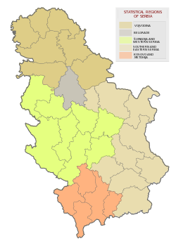
 Location of the municipality of Svrljig within Serbia | |
| Coordinates: 43°25′N 22°07′E | |
| Country | |
| Region | Southern and Eastern Serbia |
| District | Nišava |
| Settlements | 39 |
| Government | |
| • Mayor | Jelena Trifunović |
| Area | |
| • Town | 4.64 km2 (1.79 sq mi) |
| • Municipality | 497 km2 (192 sq mi) |
| Elevation | 374 m (1,227 ft) |
| Population (2011 census)[2] | |
| • Town | 7,553 |
| • Town density | 1,600/km2 (4,200/sq mi) |
| • Municipality | 14,249 |
| • Municipality density | 29/km2 (74/sq mi) |
| Time zone | UTC+1 (CET) |
| • Summer (DST) | UTC+2 (CEST) |
| Postal code | 18360 |
| Area code | +381(0)18 |
| Car plates | NI |
| Website | www |
Geography
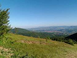
Svrljig is situated on the river Svrljiški Timok, 30 km east from Niš, the third largest city in Serbia. Nearby villages include Crnoljevica and Prekonoga.
Settlements
Aside from the town of Svrljig, the municipality includes the following settlements:
- Beloinje
- Bučum
- Burdimo
- Crnoljevica
- Davidovac
- Drajinac
- Đurinac
- Galibabinac
- Gojmanovac
- Grbavče
- Gulijan
- Guševac
- Izvor
- Kopajkošara
- Labukovo
- Lalinac
- Lozan
- Lukovo
- Manojlica
- Mečji Do
- Merdželat
- Niševac
- Okolište
- Okruglica
- Palilula
- Periš
- Pirkovac
- Plužina
- Popšica
- Prekonoga
- Radmirovac
- Ribare
- Slivje
- Šljivovik
- Tijovac
- Varoš
- Vlahovo
- Željevo
History
Anthropology
An anthropological study by Mihailo Kostić claimed that the Svrljig province was inhabited by mostly an "olden" population, while part descends from "colonists from the second half of the 15th century".[3] According to Petar Vlahović, Svrljig is part of the Serbian Šopi ethnographical region.[3]
Middle Ages
Svrljig was the name of a župa (county) in the Middle Ages. It is mentioned (for the first time) in the geographical list of counties and cities in the 1019–20 charters of Byzantine Emperor Basil II.[4] The settlement and its surrounding region is mentioned as part of the Eparchy of Niš.[5] In 1183, Svrljig and other nearby fortifications were taken over by Serbian Grand Prince Stefan Nemanja.[6] The fortification mostly dates to the medieval Serbian period.[4] It was situated on the road which connected Niš with the road to Constantinople.[7] A evangelion manuscript written in Svrljig in the Serbian redaction of Old Slavic dating to 1279 is preserved in fragments.[8] After the fall of Braničevo under the Serbian king Stefan Milutin in 1290s Svrljig became a border region. Svrljig was conquered and plundered in 1413 by Ottoman prince Musa Çelebi.[4] It was then part of Stefan Lazarević's Serbian Despotate.[4]
Early modern period
The town was known as Isferlik and Isfirlig in Ottoman Turkish.[9] It was administratively part of the Sanjak of Vidin.[10]
Modern
During the Toplica Uprising (1917), Serbian guerrilla bands were active in the region.[11]
In 1922, the Niš–Svrljig–Knjaževac–Zaječar highway was built.[12] From 1929 to 1941, Svrljig was part of the Morava Banovina of the Kingdom of Yugoslavia. During World War II, Yugoslav Partisans were active in the region.[13]
Demographics
| Historical population | ||
|---|---|---|
| Year | Pop. | ±% p.a. |
| 1948 | 32,282 | — |
| 1953 | 32,939 | +0.40% |
| 1961 | 30,260 | −1.05% |
| 1971 | 26,505 | −1.32% |
| 1981 | 24,242 | −0.89% |
| 1991 | 20,740 | −1.55% |
| 2002 | 17,284 | −1.64% |
| 2011 | 14,249 | −2.12% |
| Source: [14] | ||
According to the 2011 census results, the municipality of Svrljig has 14,249 inhabitants.
Ethnic groups
The ethnic composition of the municipality is:[15]
| Ethnic group | Population | % |
|---|---|---|
| Serbs | 13,843 | 97.15% |
| Roma | 157 | 1.10% |
| Hungarians | 9 | 0.06% |
| Macedonians | 8 | 0.06% |
| Bulgarians | 6 | 0.04% |
| Croats | 6 | 0.04% |
| Others | 220 | 1.54% |
| Total | 14,249 |
Economy
The following table gives a preview of total number of employed people per their core activity (as of 2017):[16]
| Activity | Total |
|---|---|
| Agriculture, forestry and fishing | 8 |
| Mining | - |
| Processing industry | 1,105 |
| Distribution of power, gas and water | 20 |
| Distribution of water and water waste management | 36 |
| Construction | 109 |
| Wholesale and retail, repair | 344 |
| Traffic, storage and communication | 88 |
| Hotels and restaurants | 73 |
| Media and telecommunications | 35 |
| Finance and insurance | 10 |
| Property stock and charter | - |
| Professional, scientific, innovative and technical activities | 54 |
| Administrative and other services | 12 |
| Administration and social assurance | 128 |
| Education | 172 |
| Healthcare and social work | 113 |
| Art, leisure and recreation | 4 |
| Other services | 28 |
| Total | 2,340 |
See also
- Nišava District
- Subdivisions of Serbia
References
- "Municipalities of Serbia, 2006". Statistical Office of Serbia. Retrieved 2010-11-28.
- "2011 Census of Population, Households and Dwellings in the Republic of Serbia: Comparative Overview of the Number of Population in 1948, 1953, 1961, 1971, 1981, 1991, 2002 and 2011, Data by settlements" (PDF). Statistical Office of Republic Of Serbia, Belgrade. 2014. ISBN 978-86-6161-109-4. Retrieved 2014-06-27.
- Jasna Bjeladinović-Jergić (2001). Зборник Етнографског музеја у Београду: 1901-2001. Етнографски музеј. p. 183.
- Geografsko društvo (1969). Glasnik. 49–52. p. 103.
- Mišić 2010, pp. 103, 252.
- Mišić 2010, p. 252.
- Синиша Мишић (2010). Лексикон градова и тргова средњовековних српских земаља: према писаним изворима. Завод за уџбенике. p. 252. ISBN 978-86-17-16604-3.
- Arheografski prilozi. Narodna biblioteka Srbije, Arheografsko odeljenje. 1999. p. 555.
Ово је писани споменик чије је друго издање приредио Никола Родић 1999. године 1 Фрагменти старог рукописног јеванђеља српске редакције старословенског језика писани су на пергаменту године 1279. у Сврљигу
- Hazim Šabanović (1969). Prilozi za orijentalnu filologiju: Revue de philologie orientale.
- Gliša Elezović (1974). Turski spomenice. p. 169.
- Божица Младеновић (1 September 2007). Топлички устанак 1917.: збирка докумената. Istorijski institut. pp. 64–. GGKEY:X5X73Z78UTZ.
- Srboljub Đ Stamenković (2001). Географска енциклопедија насеља Србије: М-Р. Универзитет у Београду. Географски факултет. ISBN 978-86-82657-15-6.
- Petar Višnjić (1985). Operacije za oslobođenje istočne Srbije: jun-oktobar 1944. Izd. Istorijski arhiv "Timočka krajina".
- "2011 Census of Population, Households and Dwellings in the Republic of Serbia" (PDF). stat.gov.rs. Statistical Office of the Republic of Serbia. Retrieved 16 February 2018.
- "ETHNICITY Data by municipalities and cities" (PDF). stat.gov.rs. Statistical Office of Serbia. Retrieved 16 February 2018.
- "ОПШТИНЕ И РЕГИОНИ У РЕПУБЛИЦИ СРБИЈИ, 2018" (PDF). stat.gov.rs (in Serbian). Statistical Office of the Republic of Serbia. Retrieved 16 March 2019.
External links
| Wikimedia Commons has media related to Svrljig. |
Capital: Svrljig | ||
| Villages |
| |
| Landmarks |
| |
| Culture |
| |
| Notable people | ||
| Authority control |
|
|---|