Brus
Brus (Serbian Cyrillic: Брус, pronounced [brûːs]) is a town and municipality located in the Rasina District of central Serbia. According to the 2011 census, the population of the town is 4,572, while the population of the municipality is 16,293. It is located at 430 metres (1,410 ft) above sea level, just below the Kopaonik ski resort. The city is surrounded by hills on three levels, where the lowest one is a place where the Grasevka river firths into the Rasina river. On the upper level of the town a fountain of medicinal mineral water is located.
Brus Брус | |
|---|---|
Town and municipality | |
.JPG) Panoramic view of Brus | |
Coat of arms | |
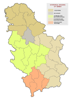
 Location of the municipality of Brus within Serbia | |
| Coordinates: 43°22′53″N 21°02′16″E | |
| Country | |
| Region | Šumadija and Western Serbia |
| District | Rasina |
| Settlements | 58 |
| Government | |
| • Mayor | Saša Milošević |
| Area | |
| • Town | 2.71 km2 (1.05 sq mi) |
| • Municipality | 606 km2 (234 sq mi) |
| Elevation | 436 m (1,430 ft) |
| Population (2011 census)[2] | |
| • Town | 4,572 |
| • Town density | 1,700/km2 (4,400/sq mi) |
| • Municipality | 16,263 |
| • Municipality density | 27/km2 (70/sq mi) |
| Time zone | UTC+1 (CET) |
| • Summer (DST) | UTC+2 (CEST) |
| Postal code | 37220 |
| Area code | +381(0)37 |
| Car plates | KŠ |
| Website | www |
History
From 1929 to 1941, Brus was part of the Morava Banovina of the Kingdom of Yugoslavia.
Settlements
Aside from the town of Brus, the municipality consists of the following villages:
|
Demographics
| Historical population | ||
|---|---|---|
| Year | Pop. | ±% p.a. |
| 1948 | 23,491 | — |
| 1953 | 25,585 | +1.72% |
| 1961 | 25,606 | +0.01% |
| 1971 | 24,581 | −0.41% |
| 1981 | 22,679 | −0.80% |
| 1991 | 21,331 | −0.61% |
| 2002 | 18,764 | −1.16% |
| 2011 | 16,317 | −1.54% |
| Source: [3] | ||
According to the 2011 census results, the municipality of Brus has a population of 16,317 inhabitants.
Economy
The following table gives a preview of total number of registered people employed in legal entities per their core activity (as of 2018):[4]
| Activity | Total |
|---|---|
| Agriculture, forestry and fishing | 69 |
| Mining and quarrying | 2 |
| Manufacturing | 1,130 |
| Electricity, gas, steam and air conditioning supply | 25 |
| Water supply; sewerage, waste management and remediation activities | 77 |
| Construction | 61 |
| Wholesale and retail trade, repair of motor vehicles and motorcycles | 379 |
| Transportation and storage | 81 |
| Accommodation and food services | 268 |
| Information and communication | 38 |
| Financial and insurance activities | 28 |
| Real estate activities | - |
| Professional, scientific and technical activities | 94 |
| Administrative and support service activities | 24 |
| Public administration and defense; compulsory social security | 232 |
| Education | 274 |
| Human health and social work activities | 197 |
| Arts, entertainment and recreation | 40 |
| Other service activities | 65 |
| Individual agricultural workers | 675 |
| Total | 3,761 |
Twin cities
References
- "Municipalities of Serbia, 2006". Statistical Office of Serbia. Retrieved 2010-11-28.
- "2011 Census of Population, Households and Dwellings in the Republic of Serbia: Comparative Overview of the Number of Population in 1948, 1953, 1961, 1971, 1981, 1991, 2002 and 2011, Data by settlements" (PDF). Statistical Office of Republic Of Serbia, Belgrade. 2014. ISBN 978-86-6161-109-4. Retrieved 2014-06-27.
- "2011 Census of Population, Households and Dwellings in the Republic of Serbia" (PDF). stat.gov.rs. Statistical Office of the Republic of Serbia. Retrieved 11 January 2017.
- "MUNICIPALITIES AND REGIONS OF THE REPUBLIC OF SERBIA, 2019" (PDF). stat.gov.rs. Statistical Office of the Republic of Serbia. 25 December 2019. Retrieved 28 December 2019.
External links
| Wikimedia Commons has media related to Brus. |
- Official website
- Torusim Organization of Brus (in Serbian)


| Authority control |
|
|---|