List of country subdivisions by area
This is a list of the 50 largest country subdivisions and dependent territories by area (including surface water) in square kilometers.
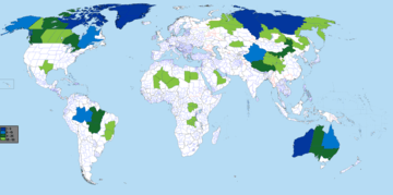
Largest 50 subdivisions by area. Note: This map projection distorts areas on different latitudes, so direct size comparison between two subdivisions using this map may not be accurate.
List of the 50 largest country subdivisions by area
| Rank | Subdivision flag | Subdivision name | Capital (Largest City) | Country | Area (km2) | Population | Country similar in area (km2) | Rank in country | Population density (people per km2) |
|---|---|---|---|---|---|---|---|---|---|
| 1 | Sakha Republic (Yakutia) | Yakutsk | 3,083,523 | 964,330[1] | India 3,287,263 |
1 | 0.31 | ||
| 2 | State of Western Australia | Perth | 2,645,615 | 2,615,794[2] | Kazakhstan 2,724,900 |
1 | 1.04 | ||
| 3 | 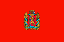 |
Krasnoyarsk Krai | Krasnoyarsk | 2,339,700[3] | 2,876,497[1] | Democratic Republic of the Congo 2,344,858 |
2 | 1.2 | |
| 4 | 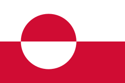 |
Greenland | Nuuk | 2,166,086[4][5] | 55,877[6] | Saudi Arabia 2,149,690 |
1 | 0.028 | |
| 5 | Territory of Nunavut | Iqaluit | 2,038,722 | 38,780[7] | Mexico 1,964,375 |
1 | 0.02 | ||
| 6 | State of Queensland | Brisbane | 1,851,856 | 5,076,512[2] | Sudan 1,886,068 |
2 | 2.96 | ||
| 7 | 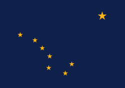 |
State of Alaska | Juneau (Largest city: Anchorage) |
1,717,854 | 737,438[8] | Iran 1,648,195 |
1 | 0.49 | |
| 8 | N/A | Xinjiang Uyghur Autonomous Region | Ürümqi | 1,664,897 | 24,867,600[9] | Iran | 1 | 15 | |
| 9 |  |
State of Amazonas | Manaus | 1,570,745 | 4,080,611[10] | Mongolia 1,564,110 |
1 | 2.2 | |
| 10 |  |
Province of Quebec | Quebec City
(Largest city: Montreal) |
1,542,056 | 8,484,965[7] | Mongolia | 2 | 5.98 | |
| 11 | Northern Territory | Darwin | 1,419,630 | 245,562[2] | Mongolia | 3 | 0.18 | ||
| 12 | Northwest Territories | Yellowknife | 1,346,106[11] | 44,826[7] | Peru 1,285,216 |
3 | 0.04 | ||
| 13 |  |
State of Pará | Belém | 1,253,164 | 8,578,051[10] | Angola 1,246,700 |
2 | 6.1 | |
| 14 | N/A | Tibet Autonomous Region | Lhasa | 1,202,189 | 3,438,200[12] | South Africa 1,221,037 |
2 | 2.59 | |
| 15 | N/A | Inner Mongolia Autonomous Region | Hohhot
(Largest city: Baotou) |
1,183,000 | 25,340,000[13] | Colombia 1,141,748 |
3 | 20.2 | |
| 16 | Province of Ontario | Toronto | 1,076,395 | 14,566,547[7] | Bolivia 1,098,581 |
4 | 14.65 | ||
| 17 | State of South Australia | Adelaide | 1,044,353 | 1,748,630[2] | Mauritania 1,030,700 |
4 | 1.79 | ||
| 18 | Province of British Columbia | Victoria
(Largest city: Vancouver) |
944,735 | 5,071,336[7] | Tanzania 945,087 |
5 | 5.02 | ||
| 19 |  |
State of Mato Grosso | Cuiabá | 906,807 | 3,441,998[10] | Venezuela 916,445 |
3 | 3.4 | |
| 20 | State of New South Wales | Sydney | 809,952 | 8,071,071[2] | Mozambique 801,590 |
5 | 10.14 | ||
| 21 |  |
Khabarovsk Krai | Khabarovsk | 788,600 | 1,328,302[1] | Turkey 783,562 |
3 | 1.7 | |
| 22 | Irkutsk Oblast | Irkutsk | 767,900 | 2,404,195[1] | Chile 756,102 |
4 | 3.2 | ||
| 23 |  |
Yamalo-Nenets Autonomous Okrug | Salekhard
(Largest city: Noyabrsk) |
750,300[14] | 538,547[1] | Zambia 752,612 |
5 | 0.7 | |
| 24 |  |
Chukotka Autonomous Okrug | Anadyr | 737,700 | 49,348[1] | Zambia | 6 | 0.068 | |
| 25 | N/A | Qinghai Province | Xining | 721,000 | 6,032,300[15] | Zambia | 4 | 7.8 | |
| 26 |  |
State of Texas | Austin
(Largest city: Houston) |
696,241 | 28,701,845[8] | Myanmar 676,578 |
2 | 40.6 | |
| 27 | N/A | Eastern Province | Dammam | 672,522 | 5,028,753 | Myanmar | 1 | 7.3 | |
| 28 | N/A | Agadez Region | Agadez | 667,799 | 487,620 | Somalia 637,657 |
1 | 0.73 | |
| 29 | Province of Alberta | Edmonton
(Largest city: Calgary) |
661,848 | 4,371,316[7] | Afghanistan 652,230 |
6 | 6.35 | ||
| 30 | Province of Saskatchewan | Regina
(Largest city: Saskatoon) |
651,900 | 1,174,462[7] | Afghanistan | 7 | 1.86 | ||
| 31 | Province of Manitoba | Winnipeg | 649,950 | 1,369,465[7] | France 640,679 |
8 | 2.33 | ||
| 32 |  |
Arkhangelsk Oblast[16] | Arkhangelsk | 587,400 | 1,155,028[1] | Madagascar 587,041 |
7 | 2.0 | |
| 33 |  |
State of Minas Gerais | Belo Horizonte | 586,522 | 21,168,791[10] | Madagascar | 4 | 33 | |
| 34 |  |
State of Bahia | Salvador | 564,273 | 14,873,064[10] | Kenya 580,367 |
5 | 25 | |
| 35 | N/A | Tamanrasset Province | Tamanrasset | 556,200[17] | 204,540[18] | Kenya | 1 | 0.35 | |
| 36 | Khanty–Mansi Autonomous Okrug | Khanty-Mansiysk
(Largest city: Surgut) |
534,800[14] | 1,664,089[1] | Yemen 527,968 |
8 | 2.9 | ||
| 37 | N/A | Orientale Province | Kisangani | 503,239[19] | 9,003,000[20] | Spain 505,992 |
1 | 16 | |
| 38 | N/A | Katanga Province | Lubumbashi | 496,871[21] | 13,207,000[20] | Turkmenistan 488,100 |
2 | 11 | |
| 39 | N/A | Tombouctou Region | Timbuktu | 496,611 | 681,691 | Turkmenistan | 1 | 1.4 | |
| 40 | N/A | Sichuan Province | Chengdu | 485,000 | 83,410,000[22] | Turkmenistan | 5 | 170 | |
| 41 | Yukon Territory | Whitehorse | 482,443 | 40,854[7] | Turkmenistan | 9 | 0.08 | ||
| 42 | N/A | Kufra District | Al Jawf | 479,160[17] | 50,104 | Cameroon 475,442 |
1 | 0.1 | |
| 43 |  |
Kamchatka Krai | Petropavlovsk-Kamchatsky | 472,300 | 315,557[1] | Cameroon | 9 | 0.68 | |
| 44 |  |
Magadan Oblast | Magadan | 461,400 | 144,091[1] | Papua New Guinea 462,840 |
10 | 0.34 | |
| 45 | N/A | Heilongjiang Province | Harbin | 460,000 | 37,731,000[23] | Papua New Guinea | 6 | 84 | |
| 46 | N/A | Gansu Province | Lanzhou | 454,000 | 26,372,600[24] | Sweden 450,295 |
7 | 56 | |
| 47 | N/A | Adrar Province | Adrar | 443,782 | 402,197 | Morocco 446,550 |
2 | 0.95 | |
| 48 |  |
New Valley Governorate | Kharga | 440,098 | 245,000[25] | Iraq 438,317 |
1 | 0.56 | |
| 49 |  |
Zabaykalsky Krai | Chita | 431,500 | 1,072,806[1] | Iraq | 11 | 2.6 | |
| 50 | N/A | Karagandy Region | Karagandy | 427,982 | 1,378,863[26] | Iraq | 1 | 3.2 | |
| Area in square kilometers | Number of country subdivisions |
|---|---|
| 2,000,000+ | 5 |
| 1,500,000–1,999,999 | 5 |
| 1,000,000–1,499,999 | 7 |
| 500,000–999,999 | 20 |
| 428,000–499,999 | 13 |
| Total | 50 |
| Country | Number of subdivisions |
|---|---|
| Russia | 11 |
| Canada | 9 |
| China | 7 |
| Australia and Brazil | 5 |
| Algeria, Democratic Republic of the Congo and the United States | 2 |
| Denmark, Egypt, Kazakhstan, Libya, Mali, Niger and Saudi Arabia | 1 |
Second-level list
Second-level divisions are those under first level (states, provinces, etc...) and they are counties, districts or cities, but the names vary by country.
| Rank | Subdivision flag | Subdivision name | Capital | subdivision | Country | Area (km2) | Population | Country similar in area (km2) | Rank in country | Rank among subdivisions that have that rank in their country |
|---|---|---|---|---|---|---|---|---|---|---|
| none | Bayingolin Mongol Autonomous Prefecture | Korla | Xinjiang | |||||||
| Avannaata | ||||||||||
| Sermersooq | ||||||||||
| Northeast Greenland National Park | Unincorporated Areas | |||||||||
| North Slope Borough, Alaska | ||||||||||
See also
Notes
- ""26. Численность постоянного населения Российской Федерации по муниципальным образованиям на 1 января 2018 года"". Federal State Statistics Service. January 23, 2019.
- Australian Bureau of Statistics (2019-09-19). "Main Features - Estimated resident population". www.abs.gov.au. Retrieved 2019-10-30.
- Includes the 897,900 km2 Taymyrsky Dolgano-Nenetsky District
- Greenland is a subdivision of the Kingdom of Denmark; it is uncertain whether Greenland is better classified as a sovereign state subdivision or as a country in its own right.
- If Greenland would be listed as a country its two largest municipalities (Sermersooq and Avannaata) should both be listed as numbers 35 and 37 with areas of 531,900 and 522,700 km2 respectively, being then the first order subdivision
- "Grønlands Statistik". www.stat.gl. Retrieved 2019-10-30.
- Statistics Canada. ""Population by year of Canada of Canada and territories"". www150.statcan.gc.ca. Retrieved 2019-10-30.
- United States Census Bureau. ""Annual Estimates of the Resident Population for the United States, Regions, States, and Puerto Rico: April 1, 2010 to July 1, 2018"".
- "[新疆]2018年新疆维吾尔自治区国民经济和社会发展统计公报-01234分享". 01234.info. Retrieved 2019-10-30.
- "Population estimates for the Brazilian municipalities and Federation Units on July 1, 2018" (PDF).
- The area of the Northwest Territories in Canada was 3,439,296 km2, making it the world's largest subdivision, until 1999, when the territory of Nunavut was split off from the Northwest Territories.
- "2018年西藏自治区国民经济和社会发展统计公报". www.xzxw.com. Retrieved 2019-10-30.
- "[内蒙古]2018年内蒙古国民经济和社会发展统计公报-01234分享". 01234.info. Retrieved 2019-10-30.
- The Tyumen Oblast contains the Khanty–Mansi and the Yamalo-Nenets Autonomous Okrugs, but all three are considered to be federal subjects of Russia. The total area for the oblast (with autonomous okrugs included) is 1,433,270 km2.
- "[青海]2018年青海省国民经济和社会发展统计公报-01234分享". 01234.info. Retrieved 2019-10-30.
- Including Nenets Autonomous Okrug
- These figures cannot be verified by their Wikipedia page.
- "Office National des Statistiques, Recensement General de la Population et de l'Habitat 2008". 2008-07-24. Archived from the original on 2008-07-24. Retrieved 2019-10-30.
- The current constitution of DR Congo, ratified in 2006, was to have split Orientale into four new provinces no later than February 2009. As of June 2015 this had not happened.
- "Annuaire statistique 2014" (PDF). Archived from the original (PDF) on 2016-01-14.
- The 2006 DR Congo constitution also provides for Katanga to be split into four new provinces.
- "[四川]2018年四川省国民经济和社会发展统计公报-01234分享". 01234.info. Retrieved 2019-10-30.
- "[黑龙江]黑龙江省2018年国民经济和社会发展统计公报-01234分享". 01234.info. Retrieved 2019-10-30.
- "[甘肃]2018年甘肃省国民经济和社会发展统计公报-01234分享". 01234.info. Retrieved 2019-10-30.
- "الجهاز المركزي للتعبئة العامة والإحصاء". www.capmas.gov.eg. Retrieved 2019-10-30.
- "Численность населения Республики Казахстан по полу в разрезе областей, городов, районов и районных центров и поселков".
References
- World-Gazetteer.com at Archive.today (archived 2012-12-05)
This article is issued from Wikipedia. The text is licensed under Creative Commons - Attribution - Sharealike. Additional terms may apply for the media files.