Tigerville, South Carolina
| Tigerville, South Carolina | |
|---|---|
| Census-designated place | |
 Tigerville  Tigerville | |
| Coordinates: 35°4′11″N 82°22′8″W / 35.06972°N 82.36889°WCoordinates: 35°4′11″N 82°22′8″W / 35.06972°N 82.36889°W | |
| Country | United States |
| State | South Carolina |
| County | Greenville |
| Area | |
| • Total | 1.34 sq mi (3.48 km2) |
| • Land | 1.33 sq mi (3.44 km2) |
| • Water | 0.02 sq mi (0.04 km2) |
| Elevation | 1,014 ft (309 m) |
| Population (2010) | |
| • Total | 1,312 |
| • Density | 988/sq mi (381.3/km2) |
| Time zone | UTC-5 (Eastern (EST)) |
| • Summer (DST) | UTC-4 (EDT) |
| ZIP Code | 29688 |
| FIPS code | 45-71890[1] |
Tigerville is an unincorporated community and census-designated place in Greenville County, South Carolina, United States. As of the 2010 United States Census the population was 1,312.[1] It lies 12 miles (19 km) north of Taylors, 10 miles (16 km) northeast of Travelers Rest, and 14 miles (23 km) northwest of Greer. North Greenville University, a private institution of higher education affiliated with the Southern Baptist Convention, is located in Tigerville. The community is part of the Greenville–Mauldin–Easley Metropolitan Statistical Area.
Poinsett Bridge was listed on the National Register of Historic Places in 1970.[2]
References
- 1 2 "Geographic Identifiers: 2010 Demographic Profile Data (G001): Tigerville CDP, South Carolina". American Factfinder. U.S. Census Bureau. Retrieved February 15, 2017.
- ↑ National Park Service (2010-07-09). "National Register Information System". National Register of Historic Places. National Park Service.
External links
Municipalities and communities of Greenville County, South Carolina, United States | ||
|---|---|---|
| Cities | 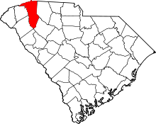 | |
| CDPs | ||
| Unincorporated communities | ||
| Footnotes | ‡This populated place also has portions in an adjacent county or counties | |
This article is issued from
Wikipedia.
The text is licensed under Creative Commons - Attribution - Sharealike.
Additional terms may apply for the media files.