Lockhart, South Carolina
| Lockhart, South Carolina | |
|---|---|
| Town | |
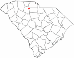 Location of Lockhart, South Carolina | |
| Coordinates: 34°47′27″N 81°27′36″W / 34.79083°N 81.46000°WCoordinates: 34°47′27″N 81°27′36″W / 34.79083°N 81.46000°W | |
| Country | United States |
| State | South Carolina |
| County | Union |
| Area | |
| • Total | 0.2 sq mi (0.6 km2) |
| • Land | 0.1 sq mi (0.4 km2) |
| • Water | 0.1 sq mi (0.2 km2) |
| Elevation | 453 ft (138 m) |
| Population (2010) | |
| • Total | 488 |
| • Density | 4,880/sq mi (1,220/km2) |
| Time zone | UTC-5 (Eastern (EST)) |
| • Summer (DST) | UTC-4 (EDT) |
| ZIP code | 29364 |
| Area code(s) | 864 |
| FIPS code | 45-42190[1] |
| GNIS feature ID | 1229941[2] |
Lockhart is a town in Union County, South Carolina, United States. The population was 488 at the 2010 United States Census.
History
The McCollum Fish Weir was listed on the National Register of Historic Places in 1974.[3]
Geography
Lockhart is located at 34°47′27″N 81°27′36″W / 34.79083°N 81.46000°W (34.790746, -81.459964).[4]
According to the United States Census Bureau, the town has a total area of 0.2 square miles (0.52 km2), of which, 0.1 square miles (0.26 km2) of it is land and 0.1 square miles (0.26 km2) of it (39.13%) is water.
John D. Long Lake is 3 miles (4.8 km) west of the town center.
Demographics
| Historical population | |||
|---|---|---|---|
| Census | Pop. | %± | |
| 1960 | 128 | — | |
| 1970 | 103 | −19.5% | |
| 1980 | 85 | −17.5% | |
| 1990 | 58 | −31.8% | |
| 2000 | 39 | −32.8% | |
| 2010 | 488 | 1,151.3% | |
| Est. 2016 | 472 | [5] | −3.3% |
| U.S. Decennial Census[6] | |||
As of the census[1] of 2000, there were 39 people, 19 households, and 12 families residing in the town. The population density was 270.4 people per square mile (107.6/km²). There were 22 housing units at an average density of 152.5 per square mile (60.7/km²). The racial makeup of the town was 82.05% White and 17.95% African American.
There were 19 households out of which 21.1% had children under the age of 18 living with them, 47.4% were married couples living together, 21.1% had a female householder with no husband present, and 31.6% were non-families. 31.6% of all households were made up of individuals and 5.3% had someone living alone who was 65 years of age or older. The average household size was 2.05 and the average family size was 2.54.
In the town, the population was spread out with 20.5% under the age of 18, 5.1% from 18 to 24, 38.5% from 25 to 44, 23.1% from 45 to 64, and 12.8% who were 65 years of age or older. The median age was 42 years. For every 100 females, there were 77.3 males. For every 100 females age 18 and over, there were 55.0 males.
The median income for a household in the town was $24,583, and the median income for a family was $42,500. Males had a median income of $32,500 versus $16,250 for females. The per capita income for the town was $13,263. There were no families and 9.8% of the population living below the poverty line, including no under eighteens and none of those over 64.
Education
Lockhart possesses its own elementary and middle schools, but local students attend Union County High School.
External links
References
- 1 2 "American FactFinder". United States Census Bureau. Retrieved 2008-01-31.
- ↑ "US Board on Geographic Names". United States Geological Survey. 2007-10-25. Retrieved 2008-01-31.
- ↑ National Park Service (2010-07-09). "National Register Information System". National Register of Historic Places. National Park Service.
- ↑ "US Gazetteer files: 2010, 2000, and 1990". United States Census Bureau. 2011-02-12. Retrieved 2011-04-23.
- ↑ "Population and Housing Unit Estimates". Retrieved June 9, 2017.
- ↑ "Census of Population and Housing". Census.gov. Retrieved June 4, 2015.
Municipalities and communities of Union County, South Carolina, United States | ||
|---|---|---|
| City | 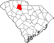 | |
| Towns | ||
| CDPs | ||
| Unincorporated communities | ||