Thézillieu
| Thézillieu | ||
|---|---|---|
| Commune | ||
 | ||
| ||
 Thézillieu Location within Auvergne-Rhône-Alpes region  Thézillieu | ||
| Coordinates: 45°53′34″N 5°36′03″E / 45.8928°N 5.6008°ECoordinates: 45°53′34″N 5°36′03″E / 45.8928°N 5.6008°E | ||
| Country | France | |
| Region | Auvergne-Rhône-Alpes | |
| Department | Ain | |
| Arrondissement | Belley | |
| Canton | Hauteville-Lompnes | |
| Intercommunality | Plateau d'Hauteville | |
| Government | ||
| • Mayor (2008–2014) | Franck Steyaert | |
| Area1 | 26.25 km2 (10.14 sq mi) | |
| Population (2008)2 | 313 | |
| • Density | 12/km2 (31/sq mi) | |
| Time zone | UTC+1 (CET) | |
| • Summer (DST) | UTC+2 (CEST) | |
| INSEE/Postal code | 01417 /01110 | |
| Elevation |
706–1,123 m (2,316–3,684 ft) (avg. 860 m or 2,820 ft) | |
|
1 French Land Register data, which excludes lakes, ponds, glaciers > 1 km2 (0.386 sq mi or 247 acres) and river estuaries. 2 Population without double counting: residents of multiple communes (e.g., students and military personnel) only counted once. | ||
.svg.png)
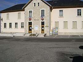
Thézillieu is a commune in the Ain department in eastern France.
Population
| Historical population | ||
|---|---|---|
| Year | Pop. | ±% |
| 1793 | 719 | — |
| 1800 | 707 | −1.7% |
| 1806 | 769 | +8.8% |
| 1821 | 701 | −8.8% |
| 1831 | 771 | +10.0% |
| 1836 | 733 | −4.9% |
| 1841 | 778 | +6.1% |
| 1846 | 707 | −9.1% |
| 1851 | 824 | +16.5% |
| 1856 | 802 | −2.7% |
| 1861 | 791 | −1.4% |
| 1866 | 804 | +1.6% |
| 1872 | 795 | −1.1% |
| 1876 | 751 | −5.5% |
| 1881 | 711 | −5.3% |
| 1886 | 656 | −7.7% |
| 1891 | 645 | −1.7% |
| 1896 | 621 | −3.7% |
| 1901 | 621 | +0.0% |
| 1906 | 573 | −7.7% |
| 1911 | 563 | −1.7% |
| 1921 | 507 | −9.9% |
| 1926 | 506 | −0.2% |
| 1931 | 427 | −15.6% |
| 1936 | 390 | −8.7% |
| 1946 | 358 | −8.2% |
| 1954 | 366 | +2.2% |
| 1962 | 325 | −11.2% |
| 1968 | 296 | −8.9% |
| 1975 | 254 | −14.2% |
| 1982 | 278 | +9.4% |
| 1990 | 297 | +6.8% |
| 1999 | 299 | +0.7% |
| 2008 | 313 | +4.7% |
See also
References
| Wikimedia Commons has media related to Thézillieu. |
This article is issued from
Wikipedia.
The text is licensed under Creative Commons - Attribution - Sharealike.
Additional terms may apply for the media files.