Évosges
| Évosges | |
|---|---|
| Commune | |
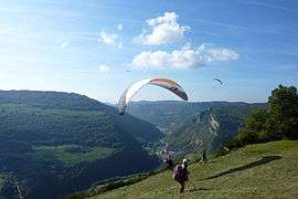 Hang gliding | |
 Évosges Location within Auvergne-Rhône-Alpes region  Évosges | |
| Coordinates: 45°57′42″N 5°29′56″E / 45.9617°N 5.4989°ECoordinates: 45°57′42″N 5°29′56″E / 45.9617°N 5.4989°E | |
| Country | France |
| Region | Auvergne-Rhône-Alpes |
| Department | Ain |
| Arrondissement | Belley |
| Canton | Hauteville-Lompnes |
| Government | |
| • Mayor (2008–2014) | Michel Thiébaut |
| Area1 | 12.08 km2 (4.66 sq mi) |
| Population (2008)2 | 130 |
| • Density | 11/km2 (28/sq mi) |
| Time zone | UTC+1 (CET) |
| • Summer (DST) | UTC+2 (CEST) |
| INSEE/Postal code | 01000 /01230 |
| Elevation |
560–1,001 m (1,837–3,284 ft) (avg. 740 m or 2,430 ft) |
|
1 French Land Register data, which excludes lakes, ponds, glaciers > 1 km2 (0.386 sq mi or 247 acres) and river estuaries. 2 Population without double counting: residents of multiple communes (e.g., students and military personnel) only counted once. | |
Évosges is a commune in the Ain department in eastern France.
Population
| Historical population | ||
|---|---|---|
| Year | Pop. | ±% |
| 1793 | 610 | — |
| 1800 | 583 | −4.4% |
| 1806 | 586 | +0.5% |
| 1821 | 539 | −8.0% |
| 1831 | 502 | −6.9% |
| 1836 | 513 | +2.2% |
| 1841 | 582 | +13.5% |
| 1846 | 551 | −5.3% |
| 1851 | 549 | −0.4% |
| 1856 | 513 | −6.6% |
| 1861 | 485 | −5.5% |
| 1866 | 477 | −1.6% |
| 1872 | 442 | −7.3% |
| 1876 | 384 | −13.1% |
| 1881 | 347 | −9.6% |
| 1886 | 374 | +7.8% |
| 1891 | 407 | +8.8% |
| 1896 | 406 | −0.2% |
| 1901 | 316 | −22.2% |
| 1906 | 295 | −6.6% |
| 1911 | 243 | −17.6% |
| 1921 | 190 | −21.8% |
| 1926 | 182 | −4.2% |
| 1931 | 163 | −10.4% |
| 1936 | 153 | −6.1% |
| 1946 | 146 | −4.6% |
| 1954 | 133 | −8.9% |
| 1962 | 130 | −2.3% |
| 1968 | 114 | −12.3% |
| 1975 | 101 | −11.4% |
| 1982 | 104 | +3.0% |
| 1990 | 101 | −2.9% |
| 1999 | 109 | +7.9% |
| 2008 | 130 | +19.3% |
See also
References
| Wikimedia Commons has media related to Évosges. |
This article is issued from
Wikipedia.
The text is licensed under Creative Commons - Attribution - Sharealike.
Additional terms may apply for the media files.