Dagneux
| Dagneux | ||
|---|---|---|
| Commune | ||
 | ||
| ||
 Dagneux Location within Auvergne-Rhône-Alpes region  Dagneux | ||
| Coordinates: 45°51′03″N 5°04′31″E / 45.8508°N 5.0753°ECoordinates: 45°51′03″N 5°04′31″E / 45.8508°N 5.0753°E | ||
| Country | France | |
| Region | Auvergne-Rhône-Alpes | |
| Department | Ain | |
| Arrondissement | Bourg-en-Bresse | |
| Canton | Meximieux | |
| Government | ||
| • Mayor (2008–2014) | Bernard Simplex | |
| Area1 | 6.65 km2 (2.57 sq mi) | |
| Population (2008)2 | 3,930 | |
| • Density | 590/km2 (1,500/sq mi) | |
| Time zone | UTC+1 (CET) | |
| • Summer (DST) | UTC+2 (CEST) | |
| INSEE/Postal code | 01142 /01120 | |
| Elevation |
189–285 m (620–935 ft) (avg. 198 m or 650 ft) | |
|
1 French Land Register data, which excludes lakes, ponds, glaciers > 1 km2 (0.386 sq mi or 247 acres) and river estuaries. 2 Population without double counting: residents of multiple communes (e.g., students and military personnel) only counted once. | ||
.svg.png)
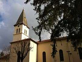
Dagneux is a commune in the Ain department in eastern France.
Population
| Historical population | ||
|---|---|---|
| Year | Pop. | ±% |
| 1831 | 902 | — |
| 1836 | 902 | +0.0% |
| 1841 | 899 | −0.3% |
| 1846 | 916 | +1.9% |
| 1851 | 881 | −3.8% |
| 1856 | 875 | −0.7% |
| 1861 | 904 | +3.3% |
| 1866 | 979 | +8.3% |
| 1872 | 952 | −2.8% |
| 1876 | 1,002 | +5.3% |
| 1881 | 916 | −8.6% |
| 1886 | 871 | −4.9% |
| 1891 | 870 | −0.1% |
| 1896 | 819 | −5.9% |
| 1901 | 877 | +7.1% |
| 1906 | 874 | −0.3% |
| 1911 | 839 | −4.0% |
| 1921 | 810 | −3.5% |
| 1926 | 880 | +8.6% |
| 1931 | 995 | +13.1% |
| 1936 | 998 | +0.3% |
| 1946 | 1,105 | +10.7% |
| 1954 | 1,181 | +6.9% |
| 1962 | 1,150 | −2.6% |
| 1968 | 1,372 | +19.3% |
| 1975 | 1,817 | +32.4% |
| 1982 | 2,091 | +15.1% |
| 1990 | 3,317 | +58.6% |
| 1999 | 3,757 | +13.3% |
| 2008 | 3,930 | +4.6% |
See also
References
External links
| Wikimedia Commons has media related to Dagneux. |
This article is issued from
Wikipedia.
The text is licensed under Creative Commons - Attribution - Sharealike.
Additional terms may apply for the media files.