Meillonnas
| Meillonnas | ||
|---|---|---|
| Commune | ||
 | ||
| ||
 Meillonnas Location within Auvergne-Rhône-Alpes region  Meillonnas | ||
| Coordinates: 46°14′45″N 5°21′09″E / 46.2458°N 5.3525°ECoordinates: 46°14′45″N 5°21′09″E / 46.2458°N 5.3525°E | ||
| Country | France | |
| Region | Auvergne-Rhône-Alpes | |
| Department | Ain | |
| Arrondissement | Bourg-en-Bresse | |
| Canton | Saint-Étienne-du-Bois | |
| Intercommunality | Treffort-en-Revermont | |
| Government | ||
| • Mayor (2010–2014) | Jean-Paul Neveu | |
| Area1 | 17.74 km2 (6.85 sq mi) | |
| Population (2008)2 | 1,298 | |
| • Density | 73/km2 (190/sq mi) | |
| Time zone | UTC+1 (CET) | |
| • Summer (DST) | UTC+2 (CEST) | |
| INSEE/Postal code | 01241 /01370 | |
| Elevation |
232–460 m (761–1,509 ft) (avg. 279 m or 915 ft) | |
|
1 French Land Register data, which excludes lakes, ponds, glaciers > 1 km2 (0.386 sq mi or 247 acres) and river estuaries. 2 Population without double counting: residents of multiple communes (e.g., students and military personnel) only counted once. | ||

Meillonnas is a commune in the Ain department in eastern France.
Geography
The Sevron has its source in the commune; it crosses the village and forms part of the commune's northern border.
The bief du Bois Tharlet, a tributary of the Sevron, forms most of the commune's western border.
Population
| Historical population | ||
|---|---|---|
| Year | Pop. | ±% |
| 1962 | 610 | — |
| 1968 | 630 | +3.3% |
| 1975 | 671 | +6.5% |
| 1982 | 891 | +32.8% |
| 1990 | 1,051 | +18.0% |
| 1999 | 1,204 | +14.6% |
| 2008 | 1,298 | +7.8% |
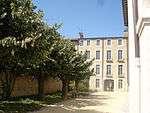
Hotel of Meillonnas

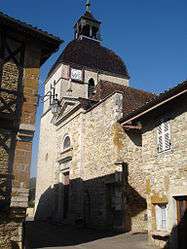
Ancient Street
See also
References
| Wikimedia Commons has media related to Meillonnas. |
This article is issued from
Wikipedia.
The text is licensed under Creative Commons - Attribution - Sharealike.
Additional terms may apply for the media files.