Saint-Vulbas
| Saint-Vulbas | ||
|---|---|---|
| Commune | ||
 | ||
| ||
 Saint-Vulbas Location within Auvergne-Rhône-Alpes region  Saint-Vulbas | ||
| Coordinates: 45°50′00″N 5°17′00″E / 45.8333°N 5.2833°ECoordinates: 45°50′00″N 5°17′00″E / 45.8333°N 5.2833°E | ||
| Country | France | |
| Region | Auvergne-Rhône-Alpes | |
| Department | Ain | |
| Arrondissement | Belley | |
| Canton | Lagnieu | |
| Intercommunality | Plaine de l'Ain | |
| Government | ||
| • Mayor (2008–2014) | Marcel Jacquin | |
| Area1 | 21.44 km2 (8.28 sq mi) | |
| Population (2008)2 | 923 | |
| • Density | 43/km2 (110/sq mi) | |
| Time zone | UTC+1 (CET) | |
| • Summer (DST) | UTC+2 (CEST) | |
| INSEE/Postal code | 01390 /01150 | |
| Elevation |
192–227 m (630–745 ft) (avg. 207 m or 679 ft) | |
|
1 French Land Register data, which excludes lakes, ponds, glaciers > 1 km2 (0.386 sq mi or 247 acres) and river estuaries. 2 Population without double counting: residents of multiple communes (e.g., students and military personnel) only counted once. | ||
.svg.png)
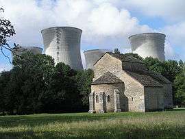
Saint-Vulbas is a commune in the Ain department in eastern France.
Population
| Historical population | ||
|---|---|---|
| Year | Pop. | ±% |
| 1793 | 420 | — |
| 1800 | 412 | −1.9% |
| 1806 | 586 | +42.2% |
| 1821 | 602 | +2.7% |
| 1831 | 625 | +3.8% |
| 1836 | 630 | +0.8% |
| 1841 | 624 | −1.0% |
| 1846 | 680 | +9.0% |
| 1851 | 708 | +4.1% |
| 1856 | 683 | −3.5% |
| 1861 | 694 | +1.6% |
| 1866 | 662 | −4.6% |
| 1872 | 631 | −4.7% |
| 1876 | 606 | −4.0% |
| 1881 | 600 | −1.0% |
| 1886 | 592 | −1.3% |
| 1891 | 527 | −11.0% |
| 1896 | 483 | −8.3% |
| 1901 | 428 | −11.4% |
| 1906 | 450 | +5.1% |
| 1911 | 410 | −8.9% |
| 1921 | 389 | −5.1% |
| 1926 | 366 | −5.9% |
| 1931 | 354 | −3.3% |
| 1936 | 307 | −13.3% |
| 1946 | 255 | −16.9% |
| 1954 | 274 | +7.5% |
| 1962 | 263 | −4.0% |
| 1968 | 370 | +40.7% |
| 1975 | 975 | +163.5% |
| 1982 | 464 | −52.4% |
| 1990 | 710 | +53.0% |
| 1999 | 804 | +13.2% |
| 2008 | 923 | +14.8% |
See also
References
| Wikimedia Commons has media related to Saint-Vulbas. |
This article is issued from
Wikipedia.
The text is licensed under Creative Commons - Attribution - Sharealike.
Additional terms may apply for the media files.