Asnières-sur-Saône
| Asnières-sur-Saône | |
|---|---|
| Commune | |
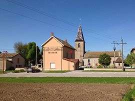 The Town Hall and the Church | |
 Asnières-sur-Saône Location within Auvergne-Rhône-Alpes region  Asnières-sur-Saône | |
| Coordinates: 46°22′59″N 4°52′59″E / 46.383°N 4.883°ECoordinates: 46°22′59″N 4°52′59″E / 46.383°N 4.883°E | |
| Country | France |
| Region | Auvergne-Rhône-Alpes |
| Department | Ain |
| Arrondissement | Bourg-en-Bresse |
| Canton | Replonges |
| Intercommunality | CC Bresse Saône |
| Government | |
| • Mayor (2014-2020) | Jean-Marc Willems |
| Area1 | 4.7 km2 (1.8 sq mi) |
| Population (2015)2 | 64 |
| • Density | 14/km2 (35/sq mi) |
| Time zone | UTC+1 (CET) |
| • Summer (DST) | UTC+2 (CEST) |
| INSEE/Postal code | 01023 /01570 |
| Elevation | 167–175 m (548–574 ft) |
|
1 French Land Register data, which excludes lakes, ponds, glaciers > 1 km2 (0.386 sq mi or 247 acres) and river estuaries. 2 Population without double counting: residents of multiple communes (e.g., students and military personnel) only counted once. | |
Asnières-sur-Saône is a commune in the Ain department in the Auvergne-Rhône-Alpes region of eastern France.
The inhabitants of the commune are known as Asniérois or Asniéroises[1]
Geography
Asnières-sur-Saône is on the bank of the Saône river some 15 km north of Mâcon and 50 km south of Chalons-sur-Saône. The commune can be accessed on the D18 road from Quart-d'Aval in the north-east to the village. The road continues south as the D1 road then turns south-east to Manziat. The D1E branches off in the south of the commune and goes south to Le Chateau. The commune consists entirely of farmland with no other villages or hamlets.[2]
The Saône river forms the entire western border of the commune with no bridges across the river. A canal runs parallel to the river joining the river in the south and joining the Bief de la Jutane in the north which forms part of the northern border.[2]
Neighbouring communes and villages | ||||||||||
|---|---|---|---|---|---|---|---|---|---|---|
| ||||||||||
History
The village can be traced back to the 10th century under the name Asnerias. It was the possession of the Counts of Mâcon and Cluny Abbey.
Administration
Mayors of Asnières-sur-Saône[3]
| From | To | Name | Party | Position |
|---|---|---|---|---|
| 1998 | 2005 | Roland Golin | Territorial Official | |
| 2005 | 2020 | Jean-Marc Willems |
(Not all data is known)
Twinning
Asnières-sur-Saône has twinning associations with:[4]

Demography
In 2010, the commune had 73 inhabitants. The evolution of the number of inhabitants is known through the population censuses conducted in the town since 1793. From the 21st century, a census of municipalities with fewer than 10,000 inhabitants is held every five years, unlike larger towns that have a sample survey every year.[Note 1]
| 1793 | 1800 | 1806 | 1821 | 1831 | 1836 | 1841 | 1846 | 1851 |
|---|---|---|---|---|---|---|---|---|
| 228 | 217 | 232 | 235 | 230 | 205 | 186 | 184 | 177 |
| 1856 | 1861 | 1866 | 1872 | 1876 | 1881 | 1886 | 1891 | 1896 |
|---|---|---|---|---|---|---|---|---|
| 188 | 163 | 153 | 154 | 140 | 145 | 139 | 114 | 121 |
| 1901 | 1906 | 1911 | 1921 | 1926 | 1931 | 1936 | 1946 | 1954 |
|---|---|---|---|---|---|---|---|---|
| 125 | 134 | 124 | 89 | 89 | 69 | 70 | 80 | 96 |
| 1962 | 1968 | 1975 | 1982 | 1990 | 1999 | 2006 | 2007 | 2008 |
|---|---|---|---|---|---|---|---|---|
| 86 | 103 | 94 | 95 | 68 | 69 | 92 | 86 | 79 |
| 2009 | 2010 | - | - | - | - | - | - | - |
|---|---|---|---|---|---|---|---|---|
| 73 | 73 | - | - | - | - | - | - | - |
Sources : Ldh/EHESS/Cassini until 1962, INSEE database from 1968 (population without double counting and municipal population from 2006)

Sites and monuments
- The Port of Asnières
Protected natural areas
The floodplains of the Val de Saône have been classified as protected areas since 1994.[5]
Notable people linked to the commune
- José Mingret (1880-1969), French painter, was buried in Asnieres-sur-Saône.
See also
External links
- Asnières-sur-Saône on Lion1906
- Asnières-sur-Saône on Google Maps
- Asnières-sur-Saône on Géoportail, National Geographic Institute (IGN) website (in French)
- Asnieres on the 1750 Cassini Map
- Asnières-sur-Saône on the INSEE website (in French)
- INSEE (in French)
Notes and references
Notes
- ↑ At the beginning of the 21st century, the methods of identification have been modified by law No. 2002-276 of 27 February 2002 Archived 2016-03-06 at the Wayback Machine., the so-called "law of local democracy" and in particular Title V "census operations" which allow, after a transitional period running from 2004 to 2008, the annual publication of the legal population of the different French administrative districts. For municipalities with a population greater than 10,000 inhabitants, a sample survey is conducted annually, the entire territory of these municipalities is taken into account at the end of the period of five years. The first "legal population" after 1999 under this new law came into force on 1 January 2009 and was based on the census of 2006.
References
- ↑ Inhabitants of Ain (in French)
- 1 2 Google Maps
- ↑ List of Mayors of France (in French)
- ↑ National Commission for Decentralised cooperation (in French)
- ↑ Protection Zone of the wetlands of the Val de Saône, préfectorial directive of 25 February, Préfecture of Ain (in French)
| Wikimedia Commons has media related to Asnières-sur-Saône. |