Biziat
| Biziat | |
|---|---|
| Commune | |
 | |
 Biziat Location within Auvergne-Rhône-Alpes region  Biziat | |
| Coordinates: 46°13′00″N 4°56′00″E / 46.2167°N 4.9333°ECoordinates: 46°13′00″N 4°56′00″E / 46.2167°N 4.9333°E | |
| Country | France |
| Region | Auvergne-Rhône-Alpes |
| Department | Ain |
| Arrondissement | Bourg-en-Bresse |
| Canton | Vonnas |
| Intercommunality | Bords de Veyle |
| Government | |
| • Mayor (2008–2014) | Christian Giraud |
| Area1 | 11.48 km2 (4.43 sq mi) |
| Population (2008)2 | 774 |
| • Density | 67/km2 (170/sq mi) |
| Time zone | UTC+1 (CET) |
| • Summer (DST) | UTC+2 (CEST) |
| INSEE/Postal code | 01046 /01290 |
| Elevation |
179–224 m (587–735 ft) (avg. 210 m or 690 ft) |
|
1 French Land Register data, which excludes lakes, ponds, glaciers > 1 km2 (0.386 sq mi or 247 acres) and river estuaries. 2 Population without double counting: residents of multiple communes (e.g., students and military personnel) only counted once. | |
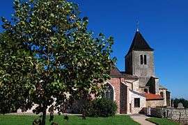
Biziat is a commune in the Ain department in eastern France.
Geography
The Veyle forms most of the commune's northeastern border.
Population
| Historical population | ||
|---|---|---|
| Year | Pop. | ±% |
| 1793 | 888 | — |
| 1800 | 928 | +4.5% |
| 1806 | 993 | +7.0% |
| 1821 | 1,029 | +3.6% |
| 1831 | 1,101 | +7.0% |
| 1836 | 1,034 | −6.1% |
| 1841 | 1,032 | −0.2% |
| 1846 | 1,085 | +5.1% |
| 1851 | 1,141 | +5.2% |
| 1856 | 1,060 | −7.1% |
| 1861 | 1,019 | −3.9% |
| 1866 | 958 | −6.0% |
| 1872 | 877 | −8.5% |
| 1876 | 902 | +2.9% |
| 1881 | 867 | −3.9% |
| 1886 | 832 | −4.0% |
| 1891 | 803 | −3.5% |
| 1896 | 767 | −4.5% |
| 1901 | 756 | −1.4% |
| 1906 | 704 | −6.9% |
| 1911 | 682 | −3.1% |
| 1921 | 649 | −4.8% |
| 1926 | 636 | −2.0% |
| 1931 | 628 | −1.3% |
| 1936 | 610 | −2.9% |
| 1946 | 604 | −1.0% |
| 1954 | 557 | −7.8% |
| 1962 | 502 | −9.9% |
| 1968 | 518 | +3.2% |
| 1975 | 533 | +2.9% |
| 1982 | 561 | +5.3% |
| 1990 | 574 | +2.3% |
| 1999 | 641 | +11.7% |
| 2008 | 774 | +20.7% |
See also
References
| Wikimedia Commons has media related to Biziat. |
This article is issued from
Wikipedia.
The text is licensed under Creative Commons - Attribution - Sharealike.
Additional terms may apply for the media files.