Villette-sur-Ain
| Villette-sur-Ain | ||
|---|---|---|
| Commune | ||
 | ||
| ||
 Villette-sur-Ain Location within Auvergne-Rhône-Alpes region  Villette-sur-Ain | ||
| Coordinates: 45°59′14″N 5°16′06″E / 45.9872°N 5.2683°ECoordinates: 45°59′14″N 5°16′06″E / 45.9872°N 5.2683°E | ||
| Country | France | |
| Region | Auvergne-Rhône-Alpes | |
| Department | Ain | |
| Arrondissement | Bourg-en-Bresse | |
| Canton | Ceyzériat | |
| Intercommunality | Chalamont | |
| Government | ||
| • Mayor (2008–2014) | Jean-Pierre Humbert | |
| Area1 | 19.38 km2 (7.48 sq mi) | |
| Population (2008)2 | 664 | |
| • Density | 34/km2 (89/sq mi) | |
| Time zone | UTC+1 (CET) | |
| • Summer (DST) | UTC+2 (CEST) | |
| INSEE/Postal code | 01449 /01320 | |
| Elevation |
222–331 m (728–1,086 ft) (avg. 235 m or 771 ft) | |
|
1 French Land Register data, which excludes lakes, ponds, glaciers > 1 km2 (0.386 sq mi or 247 acres) and river estuaries. 2 Population without double counting: residents of multiple communes (e.g., students and military personnel) only counted once. | ||
.svg.png)
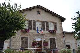
Villette-sur-Ain is a commune in the Ain department in eastern France. It is located on the banks of the Ain river in the Rhône-Alpes region. Villette-sur-Ain is part of the Dombes and is about 45 km from Lyon.
Population
| Historical population | ||
|---|---|---|
| Year | Pop. | ±% |
| 1793 | 645 | — |
| 1800 | 619 | −4.0% |
| 1806 | 646 | +4.4% |
| 1821 | 548 | −15.2% |
| 1831 | 602 | +9.9% |
| 1836 | 624 | +3.7% |
| 1841 | 634 | +1.6% |
| 1846 | 721 | +13.7% |
| 1851 | 701 | −2.8% |
| 1856 | 752 | +7.3% |
| 1861 | 693 | −7.8% |
| 1866 | 630 | −9.1% |
| 1872 | 677 | +7.5% |
| 1876 | 663 | −2.1% |
| 1881 | 658 | −0.8% |
| 1886 | 669 | +1.7% |
| 1891 | 641 | −4.2% |
| 1896 | 631 | −1.6% |
| 1901 | 600 | −4.9% |
| 1906 | 605 | +0.8% |
| 1911 | 575 | −5.0% |
| 1921 | 536 | −6.8% |
| 1926 | 487 | −9.1% |
| 1931 | 473 | −2.9% |
| 1936 | 456 | −3.6% |
| 1946 | 453 | −0.7% |
| 1954 | 394 | −13.0% |
| 1962 | 360 | −8.6% |
| 1968 | 287 | −20.3% |
| 1975 | 341 | +18.8% |
| 1982 | 381 | +11.7% |
| 1990 | 412 | +8.1% |
| 1999 | 472 | +14.6% |
| 2008 | 664 | +40.7% |
See also
References
External links
| Wikimedia Commons has media related to Villette-sur-Ain. |
This article is issued from
Wikipedia.
The text is licensed under Creative Commons - Attribution - Sharealike.
Additional terms may apply for the media files.