Péronnas
| Péronnas | ||
|---|---|---|
| Commune | ||
_-_Mairie.JPG) Town hall | ||
| ||
 Péronnas Location within Auvergne-Rhône-Alpes region  Péronnas | ||
| Coordinates: 46°10′46″N 5°12′12″E / 46.1794°N 05.2033°ECoordinates: 46°10′46″N 5°12′12″E / 46.1794°N 05.2033°E | ||
| Country | France | |
| Region | Auvergne-Rhône-Alpes | |
| Department | Ain | |
| Arrondissement | Bourg-en-Bresse | |
| Canton | Bourg-en-Bresse-2 | |
| Intercommunality | Bourg-en-Bresse | |
| Government | ||
| • Mayor (2008–2014) | Christian Chanel | |
| Area1 | 17.59 km2 (6.79 sq mi) | |
| Population (2008)2 | 6,135 | |
| • Density | 350/km2 (900/sq mi) | |
| Time zone | UTC+1 (CET) | |
| • Summer (DST) | UTC+2 (CEST) | |
| INSEE/Postal code | 01289 /01960 | |
| Elevation |
223–277 m (732–909 ft) (avg. 240 m or 790 ft) | |
|
1 French Land Register data, which excludes lakes, ponds, glaciers > 1 km2 (0.386 sq mi or 247 acres) and river estuaries. 2 Population without double counting: residents of multiple communes (e.g., students and military personnel) only counted once. | ||
.svg.png)
Péronnas is a commune in the Ain department in the Auvergne-Rhône-Alpes region in eastern France.
Geography
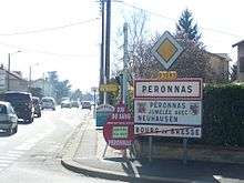
Entrance to the city
The Veyle forms part of the commune's western border.
Population
| Historical population | ||
|---|---|---|
| Year | Pop. | ±% |
| 1962 | 1,652 | — |
| 1968 | 2,272 | +37.5% |
| 1975 | 3,223 | +41.9% |
| 1982 | 4,575 | +41.9% |
| 1990 | 5,352 | +17.0% |
| 1999 | 5,534 | +3.4% |
| 2008 | 6,135 | +10.9% |
Sport and leisure
Péronnas has a football club FC Bourg-Péronnas who play at the Stade Municipal de Péronnas.[1] They are currently playing in the Ligue 2, the second tier of French football.
See also
References
| Wikimedia Commons has media related to Péronnas. |
This article is issued from
Wikipedia.
The text is licensed under Creative Commons - Attribution - Sharealike.
Additional terms may apply for the media files.