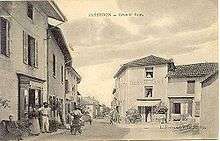
Jasseron
| Jasseron | ||
|---|---|---|
| Commune | ||
 | ||
| ||
 Jasseron Location within Auvergne-Rhône-Alpes region  Jasseron | ||
| Coordinates: 46°13′00″N 5°20′00″E / 46.2167°N 5.3333°ECoordinates: 46°13′00″N 5°20′00″E / 46.2167°N 5.3333°E | ||
| Country | France | |
| Region | Auvergne-Rhône-Alpes | |
| Department | Ain | |
| Arrondissement | Bourg-en-Bresse | |
| Canton | Saint-Étienne-du-Bois | |
| Intercommunality | Bourg-en-Bresse | |
| Government | ||
| • Mayor (2008–2014) | Bernard Dupin | |
| Area1 | 18.93 km2 (7.31 sq mi) | |
| Population (2008)2 | 1,412 | |
| • Density | 75/km2 (190/sq mi) | |
| Time zone | UTC+1 (CET) | |
| • Summer (DST) | UTC+2 (CEST) | |
| INSEE/Postal code | 01195 /01250 | |
| Elevation |
246–590 m (807–1,936 ft) (avg. 320 m or 1,050 ft) | |
|
1 French Land Register data, which excludes lakes, ponds, glaciers > 1 km2 (0.386 sq mi or 247 acres) and river estuaries. 2 Population without double counting: residents of multiple communes (e.g., students and military personnel) only counted once. | ||
.svg.png)
Jasseron is a commune in the Ain department in eastern France.
It is located 7 km (4.3 mi) east of Bourg en Bresse.
Population
| Historical population | ||
|---|---|---|
| Year | Pop. | ±% |
| 1962 | 637 | — |
| 1968 | 654 | +2.7% |
| 1975 | 716 | +9.5% |
| 1982 | 954 | +33.2% |
| 1990 | 1,079 | +13.1% |
| 1999 | 1,256 | +16.4% |
| 2008 | 1,412 | +12.4% |
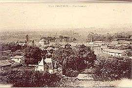
Jasseron c.1900
See also
References
External links
| Wikimedia Commons has media related to Jasseron. |
This article is issued from
Wikipedia.
The text is licensed under Creative Commons - Attribution - Sharealike.
Additional terms may apply for the media files.