Courtes
| Courtes | |
|---|---|
| Commune | |
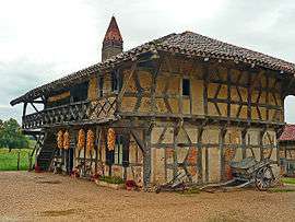 Museum La Ferme de la forêt | |
 Courtes Location within Auvergne-Rhône-Alpes region  Courtes | |
| Coordinates: 46°27′36″N 5°06′03″E / 46.46°N 5.1008°ECoordinates: 46°27′36″N 5°06′03″E / 46.46°N 5.1008°E | |
| Country | France |
| Region | Auvergne-Rhône-Alpes |
| Department | Ain |
| Arrondissement | Bourg-en-Bresse |
| Canton | Replonges |
| Intercommunality | Saint-Trivier-de-Courtes |
| Government | |
| • Mayor (2008–2014) | Maurice Jacquet |
| Area1 | 9.06 km2 (3.50 sq mi) |
| Population (2008)2 | 251 |
| • Density | 28/km2 (72/sq mi) |
| Time zone | UTC+1 (CET) |
| • Summer (DST) | UTC+2 (CEST) |
| INSEE/Postal code | 01128 /01560 |
| Elevation |
192–221 m (630–725 ft) (avg. 212 m or 696 ft) |
|
1 French Land Register data, which excludes lakes, ponds, glaciers > 1 km2 (0.386 sq mi or 247 acres) and river estuaries. 2 Population without double counting: residents of multiple communes (e.g., students and military personnel) only counted once. | |
Courtes is a commune in the Ain department in eastern France.
Geography
The Sâne Vive forms part of the commune's eastern border.
Population
| Historical population | ||
|---|---|---|
| Year | Pop. | ±% |
| 1793 | 472 | — |
| 1800 | 459 | −2.8% |
| 1806 | 485 | +5.7% |
| 1821 | 445 | −8.2% |
| 1831 | 429 | −3.6% |
| 1836 | 438 | +2.1% |
| 1841 | 452 | +3.2% |
| 1846 | 438 | −3.1% |
| 1851 | 455 | +3.9% |
| 1856 | 440 | −3.3% |
| 1861 | 432 | −1.8% |
| 1866 | 408 | −5.6% |
| 1872 | 409 | +0.2% |
| 1876 | 409 | +0.0% |
| 1881 | 408 | −0.2% |
| 1886 | 411 | +0.7% |
| 1891 | 409 | −0.5% |
| 1896 | 421 | +2.9% |
| 1901 | 405 | −3.8% |
| 1906 | 398 | −1.7% |
| 1911 | 400 | +0.5% |
| 1921 | 355 | −11.3% |
| 1926 | 372 | +4.8% |
| 1931 | 324 | −12.9% |
| 1936 | 343 | +5.9% |
| 1946 | 330 | −3.8% |
| 1954 | 308 | −6.7% |
| 1962 | 287 | −6.8% |
| 1968 | 254 | −11.5% |
| 1975 | 215 | −15.4% |
| 1982 | 199 | −7.4% |
| 1990 | 194 | −2.5% |
| 1999 | 218 | +12.4% |
| 2008 | 251 | +15.1% |
See also
References
| Wikimedia Commons has media related to Courtes. |
This article is issued from
Wikipedia.
The text is licensed under Creative Commons - Attribution - Sharealike.
Additional terms may apply for the media files.