Montréal-la-Cluse
| Montréal-la-Cluse | |
|---|---|
| Commune | |
 | |
 Montréal-la-Cluse Location within Auvergne-Rhône-Alpes region  Montréal-la-Cluse | |
| Coordinates: 46°11′00″N 5°34′00″E / 46.1833°N 5.5667°ECoordinates: 46°11′00″N 5°34′00″E / 46.1833°N 5.5667°E | |
| Country | France |
| Region | Auvergne-Rhône-Alpes |
| Department | Ain |
| Arrondissement | Nantua |
| Canton | Nantua |
| Intercommunality | Oyonnax |
| Government | |
| • Mayor (2008–2014) | Gilles Morosi |
| Area1 | 12.83 km2 (4.95 sq mi) |
| Population (2008)2 | 3,529 |
| • Density | 280/km2 (710/sq mi) |
| Time zone | UTC+1 (CET) |
| • Summer (DST) | UTC+2 (CEST) |
| INSEE/Postal code | 01265 /01460 |
|
1 French Land Register data, which excludes lakes, ponds, glaciers > 1 km2 (0.386 sq mi or 247 acres) and river estuaries. 2 Population without double counting: residents of multiple communes (e.g., students and military personnel) only counted once. | |
Montréal-la-Cluse is a commune in the Ain department in eastern France. It is located in the historical region of Bugey and its inhabitants are known as the Montréalais.
Transport
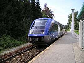
The town is served by the Haut Bougey railway line and by a branch line to Oyonnax.
Population
| Historical population | ||
|---|---|---|
| Year | Pop. | ±% |
| 1793 | 645 | — |
| 1800 | 627 | −2.8% |
| 1806 | 802 | +27.9% |
| 1821 | 815 | +1.6% |
| 1831 | 773 | −5.2% |
| 1836 | 826 | +6.9% |
| 1841 | 824 | −0.2% |
| 1846 | 843 | +2.3% |
| 1851 | 844 | +0.1% |
| 1856 | 941 | +11.5% |
| 1861 | 1,008 | +7.1% |
| 1866 | 1,064 | +5.6% |
| 1872 | 1,111 | +4.4% |
| 1876 | 1,195 | +7.6% |
| 1881 | 1,148 | −3.9% |
| 1886 | 1,083 | −5.7% |
| 1891 | 1,101 | +1.7% |
| 1896 | 1,153 | +4.7% |
| 1901 | 1,129 | −2.1% |
| 1906 | 1,045 | −7.4% |
| 1911 | 966 | −7.6% |
| 1921 | 958 | −0.8% |
| 1926 | 1,062 | +10.9% |
| 1931 | 1,205 | +13.5% |
| 1936 | 1,202 | −0.2% |
| 1946 | 1,213 | +0.9% |
| 1954 | 1,404 | +15.7% |
| 1962 | 1,640 | +16.8% |
| 1968 | 1,926 | +17.4% |
| 1975 | 2,560 | +32.9% |
| 1982 | 3,042 | +18.8% |
| 1990 | 3,496 | +14.9% |
| 1999 | 3,652 | +4.5% |
| 2008 | 3,529 | −3.4% |
See also
References
External links
| Wikimedia Commons has media related to Montréal-la-Cluse. |
This article is issued from
Wikipedia.
The text is licensed under Creative Commons - Attribution - Sharealike.
Additional terms may apply for the media files.