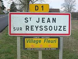
Saint-Jean-sur-Reyssouze
| Saint-Jean-sur-Reyssouze | |
|---|---|
| Commune | |
 | |
 Saint-Jean-sur-Reyssouze Location within Auvergne-Rhône-Alpes region  Saint-Jean-sur-Reyssouze | |
| Coordinates: 46°23′49″N 5°03′48″E / 46.3969°N 5.0633°ECoordinates: 46°23′49″N 5°03′48″E / 46.3969°N 5.0633°E | |
| Country | France |
| Region | Auvergne-Rhône-Alpes |
| Department | Ain |
| Arrondissement | Bourg-en-Bresse |
| Canton | Replonges |
| Intercommunality | Saint-Trivier-de-Courtes |
| Government | |
| • Mayor (2008–2014) | Max Douvre |
| Area1 | 27.48 km2 (10.61 sq mi) |
| Population (2008)2 | 713 |
| • Density | 26/km2 (67/sq mi) |
| Time zone | UTC+1 (CET) |
| • Summer (DST) | UTC+2 (CEST) |
| INSEE/Postal code | 01364 /01560 |
| Elevation |
178–218 m (584–715 ft) (avg. 192 m or 630 ft) |
|
1 French Land Register data, which excludes lakes, ponds, glaciers > 1 km2 (0.386 sq mi or 247 acres) and river estuaries. 2 Population without double counting: residents of multiple communes (e.g., students and military personnel) only counted once. | |
Saint-Jean-sur-Reyssouze is a commune in the Ain department in eastern France.
Population
| Historical population | ||
|---|---|---|
| Year | Pop. | ±% |
| 1793 | 1,857 | — |
| 1800 | 1,367 | −26.4% |
| 1806 | 1,720 | +25.8% |
| 1821 | 1,697 | −1.3% |
| 1831 | 1,410 | −16.9% |
| 1836 | 1,592 | +12.9% |
| 1841 | 1,668 | +4.8% |
| 1846 | 1,615 | −3.2% |
| 1851 | 1,667 | +3.2% |
| 1856 | 1,645 | −1.3% |
| 1861 | 1,640 | −0.3% |
| 1866 | 1,582 | −3.5% |
| 1872 | 1,494 | −5.6% |
| 1876 | 1,501 | +0.5% |
| 1881 | 1,507 | +0.4% |
| 1886 | 1,504 | −0.2% |
| 1891 | 1,455 | −3.3% |
| 1896 | 1,423 | −2.2% |
| 1901 | 1,395 | −2.0% |
| 1906 | 1,385 | −0.7% |
| 1911 | 1,364 | −1.5% |
| 1921 | 1,200 | −12.0% |
| 1926 | 1,163 | −3.1% |
| 1931 | 1,112 | −4.4% |
| 1936 | 1,047 | −5.8% |
| 1946 | 1,068 | +2.0% |
| 1954 | 972 | −9.0% |
| 1962 | 941 | −3.2% |
| 1968 | 818 | −13.1% |
| 1975 | 680 | −16.9% |
| 1982 | 578 | −15.0% |
| 1990 | 541 | −6.4% |
| 1999 | 579 | +7.0% |
| 2008 | 713 | +23.1% |
See also
References
| Wikimedia Commons has media related to Saint-Jean-sur-Reyssouze. |
This article is issued from
Wikipedia.
The text is licensed under Creative Commons - Attribution - Sharealike.
Additional terms may apply for the media files.