Centerville, Missouri
| Centerville, Missouri | |
|---|---|
| City | |
 Galena from the West Fork Mine, near Centerville | |
 Location of Centerville, Missouri | |
| Coordinates: 37°26′10″N 90°57′40″W / 37.43611°N 90.96111°WCoordinates: 37°26′10″N 90°57′40″W / 37.43611°N 90.96111°W | |
| Country | United States |
| State | Missouri |
| County | Reynolds |
| Area[1] | |
| • Total | 0.30 sq mi (0.78 km2) |
| • Land | 0.30 sq mi (0.78 km2) |
| • Water | 0 sq mi (0 km2) |
| Elevation | 741 ft (226 m) |
| Population (2010)[2] | |
| • Total | 191 |
| • Estimate (2016)[3] | 189 |
| • Density | 640/sq mi (240/km2) |
| Time zone | UTC-6 (Central (CST)) |
| • Summer (DST) | UTC-5 (CDT) |
| ZIP code | 63633 |
| Area code(s) | 573 |
| FIPS code | 29-12718[4] |
| GNIS feature ID | 0749320[5] |
Centerville is a city in Reynolds County, Missouri, along the West Fork of the Black River. The population was 191 at the 2010 census. It is the county seat of Reynolds County.[6]
History
A post office called Centreville was established in 1846, and the name was changed to Centerville in 1892.[7] Centerville was named from its central location in the county.[8]
Geography
According to the United States Census Bureau, the city has a total area of 0.30 square miles (0.78 km2), all of it land.[1]
West Fork Lead Mine
The West Fork Mine is a lead-zinc-silver-copper mine located near Centerville. Initially developed by ASARCO, it reached full production of 3,400 tons/day of ore in August 1988. It is currently owned and operated by the Doe Run Company, which acquired the Missouri Lead Division operation of ASARCO in 1998.[9] The mine produces about 46,000 tons of lead, 6,800 tons zinc, and 3,900 kg of silver per year.[10]
Demographics
| Historical population | |||
|---|---|---|---|
| Census | Pop. | %± | |
| 1960 | 163 | — | |
| 1970 | 209 | 28.2% | |
| 1980 | 241 | 15.3% | |
| 1990 | 89 | −63.1% | |
| 2000 | 171 | 92.1% | |
| 2010 | 191 | 11.7% | |
| Est. 2016 | 189 | [3] | −1.0% |
| U.S. Decennial Census[11] | |||
2010 census
As of the census[2] of 2010, there were 191 people, 78 households, and 50 families residing in the city. The population density was 636.7 inhabitants per square mile (245.8/km2). There were 99 housing units at an average density of 330.0 per square mile (127.4/km2). The racial makeup of the city was 95.29% White, 2.09% Black or African American, 0.52% Native American, and 2.09% from two or more races.
There were 78 households of which 23.1% had children under the age of 18 living with them, 43.6% were married couples living together, 12.8% had a female householder with no husband present, 7.7% had a male householder with no wife present, and 35.9% were non-families. 30.8% of all households were made up of individuals and 18% had someone living alone who was 65 years of age or older. The average household size was 2.31 and the average family size was 2.84.
The median age in the city was 44.5 years. 20.4% of residents were under the age of 18; 6.9% were between the ages of 18 and 24; 23% were from 25 to 44; 26.7% were from 45 to 64; and 23% were 65 years of age or older. The gender makeup of the city was 52.9% male and 47.1% female.
2000 census
As of the census[4] of 2000, there were 171 people, 70 households, and 46 families residing in the city. The population density was 534.3 people per square mile (206.3/km²). There were 102 housing units at an average density of 318.7 per square mile (123.1/km²). The racial makeup of the city was 94.15% White, 3.51% Native American, and 2.34% from two or more races.
There were 70 households out of which 20.0% had children under the age of 18 living with them, 54.3% were married couples living together, 10.0% had a female householder with no husband present, and 32.9% were non-families. 31.4% of all households were made up of individuals and 7.1% had someone living alone who was 65 years of age or older. The average household size was 2.30 and the average family size was 2.85.
In the city, the population was spread out with 17.5% under the age of 18, 15.2% from 18 to 24, 18.1% from 25 to 44, 31.6% from 45 to 64, and 17.5% who were 65 years of age or older. The median age was 44 years. For every 100 females, there were 111.1 males. For every 100 females age 18 and over, there were 107.4 males.
The median income for a household in the city was $23,864, and the median income for a family was $29,750. Males had a median income of $30,250 versus $30,000 for females. The per capita income for the city was $13,207. About 9.8% of families and 21.1% of the population were below the poverty line, including 56.0% of those under the age of eighteen and none of those sixty five or over.
Education
Centerville R-I School District operates Centerville Elementary School.[12]
Centerville has a public library, a branch of the Reynolds County Library District.[13]
References
- 1 2 "US Gazetteer files 2010". United States Census Bureau. Archived from the original on 2012-01-24. Retrieved 2012-07-08.
- 1 2 "American FactFinder". United States Census Bureau. Retrieved 2012-07-08.
- 1 2 "Population and Housing Unit Estimates". Retrieved June 9, 2017.
- 1 2 "American FactFinder". United States Census Bureau. Archived from the original on 2013-09-11. Retrieved 2008-01-31.
- ↑ "US Board on Geographic Names". United States Geological Survey. 2007-10-25. Retrieved 2008-01-31.
- ↑ "Find a County". National Association of Counties. Archived from the original on 2011-05-31. Retrieved 2011-06-07.
- ↑ "Post Offices". Jim Forte Postal History. Retrieved 13 December 2016.
- ↑ Eaton, David Wolfe (1917). How Missouri Counties, Towns and Streams Were Named. The State Historical Society of Missouri. p. 347.
- ↑ "Company Information". Doe Run Company. 2004. Retrieved 2011-09-21.
- ↑ West Fork Mine at Mindat.org
- ↑ "Census of Population and Housing". Census.gov. Archived from the original on May 12, 2015. Retrieved June 4, 2015.
- ↑ "Centerville R-I School District". Great Schools. Retrieved 17 March 2018.
- ↑ "Contact Information". Reynolds County Library District. Retrieved 17 March 2018.
See also
| Wikimedia Commons has media related to West Fork Mine. |
Municipalities and communities of Reynolds County, Missouri, United States | ||
|---|---|---|
| Cities | 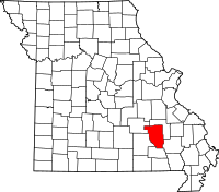 | |
| Townships | ||
| Unincorporated communities | ||
| Ghost towns | ||
| Footnotes | ‡This populated place also has portions in an adjacent county or counties | |