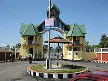
Imphal
| Imphal | |
|---|---|
| Metropolitan City | |
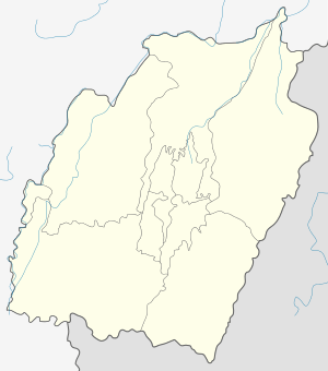 Imphal Location of Imphal in Manipur  Imphal Imphal (India) | |
| Coordinates: 24°48′27″N 93°56′18″E / 24.8074°N 93.9384°ECoordinates: 24°48′27″N 93°56′18″E / 24.8074°N 93.9384°E | |
| Country | India |
| State | Manipur |
| District | Imphal East, Imphal West |
| Elevation | 786 m (2,579 ft) |
| Population (2011 census)[1] | |
| • Metropolitan City | 268,243 |
| • Metro | 418,739 |
| Languages | |
| • Official | Meeteilon (Manipuri) and English |
| Time zone | UTC+5:30 (IST) |
| PIN | 795001 |
| Telephone code | 3852 |
| Vehicle registration | MN-01 |
| Website |
www |
Imphal (![]()
History
The Battle of Imphal took place between March and July 1944, during World War II.[2]
Demographics
As of 2011 the population within Imphal's city limits was 268,243, or 277,196 including out growths. The average literacy rate in the town was over 90%, male literacy at 95% exceed the female literacy rate of 87%. Nearly 70% of the inhabitants were Hindu, 10% were Christian, 3.7% Muslim, 0.54% Buddhist, 0.45% Jain, 0.18% Sikh.[1]
The Imphal metropolitan area had a population of 418,739, which included the towns and suburbs of Bijoy Govinda, Chingangbam Leikai, Khongman, Khurai Sajor Leikai, Kiyamgei, Kongkham Leikai (portion), Laipham Siphai, Lairikyengbam Leikai, Lamjaotongba, Lamshang, Langjing, Langthabal Kunja, Langthabal Mantrikhong (portion), Lilong (Imphal West), Lilong (Thoubal), Naorem Leikai, Naoria Pakhanglakpa, Oinam Thingel, Porompat, Porompat Plan Area, Pangei, Sagolband (portion), Takyel Mapal, Thongju and Torban (Khetri Leikai).[1]
Geography and climate
| Imphal | ||||||||||||||||||||||||||||||||||||||||||||||||||||||||||||
|---|---|---|---|---|---|---|---|---|---|---|---|---|---|---|---|---|---|---|---|---|---|---|---|---|---|---|---|---|---|---|---|---|---|---|---|---|---|---|---|---|---|---|---|---|---|---|---|---|---|---|---|---|---|---|---|---|---|---|---|---|
| Climate chart (explanation) | ||||||||||||||||||||||||||||||||||||||||||||||||||||||||||||
| ||||||||||||||||||||||||||||||||||||||||||||||||||||||||||||
| ||||||||||||||||||||||||||||||||||||||||||||||||||||||||||||
Imphal is located at 24°48′27″N 93°56′18″E / 24.8074°N 93.9384°E in extreme eastern India,[4] with an average elevation of 786 metres (2,579 ft). It has a humid subtropical climate (Köppen Cwa)[5] with mild, dry winters and a hot monsoon season. July temperatures average about 29 °C (84 °F); January is the coldest month, with average lows near 4 °C (39 °F). The city receives about 1,320 mm (52 in) of rain, with June the wettest month. The highest recorded temperature was 35.6 °C (96.1 °F), on 22 May 2009, and the lowest temperature was −2.7 °C (27.1 °F) on 10 January 1970.[3][6]
| Climate data for Imphal | |||||||||||||
|---|---|---|---|---|---|---|---|---|---|---|---|---|---|
| Month | Jan | Feb | Mar | Apr | May | Jun | Jul | Aug | Sep | Oct | Nov | Dec | Year |
| Record high °C (°F) | 27.8 (82) |
31.5 (88.7) |
35.0 (95) |
34.4 (93.9) |
35.6 (96.1) |
35.6 (96.1) |
35.7 (96.3) |
34.0 (93.2) |
34.4 (93.9) |
33.5 (92.3) |
30.7 (87.3) |
28.9 (84) |
35.7 (96.3) |
| Average high °C (°F) | 21.7 (71.1) |
23.4 (74.1) |
26.9 (80.4) |
28.4 (83.1) |
28.9 (84) |
29.4 (84.9) |
29.0 (84.2) |
29.2 (84.6) |
29.0 (84.2) |
28.4 (83.1) |
25.4 (77.7) |
22.4 (72.3) |
26.9 (80.4) |
| Daily mean °C (°F) | 14.5 (58.1) |
16.3 (61.3) |
20.0 (68) |
22.7 (72.9) |
24.1 (75.4) |
24.6 (76.3) |
24.5 (76.1) |
24.6 (76.3) |
24.4 (75.9) |
22.8 (73) |
19.0 (66.2) |
15.6 (60.1) |
21.1 (70) |
| Average low °C (°F) | 4.3 (39.7) |
7.2 (45) |
11.6 (52.9) |
15.7 (60.3) |
18.4 (65.1) |
21.2 (70.2) |
21.5 (70.7) |
21.3 (70.3) |
20.1 (68.2) |
16.6 (61.9) |
11.0 (51.8) |
5.3 (41.5) |
14.6 (58.3) |
| Record low °C (°F) | −2.7 (27.1) |
−1.4 (29.5) |
2.4 (36.3) |
6.2 (43.2) |
11.1 (52) |
14.7 (58.5) |
15.4 (59.7) |
14.6 (58.3) |
14.3 (57.7) |
7.8 (46) |
1.5 (34.7) |
−1.7 (28.9) |
−2.7 (27.1) |
| Average precipitation mm (inches) | 11.7 (0.461) |
30.8 (1.213) |
91.6 (3.606) |
132.7 (5.224) |
158.6 (6.244) |
224.9 (8.854) |
222.8 (8.772) |
194.8 (7.669) |
147.3 (5.799) |
111.5 (4.39) |
46.0 (1.811) |
15.1 (0.594) |
1,387.7 (54.634) |
| Average precipitation days | 1.2 | 3.3 | 6.6 | 9.8 | 11.5 | 15.3 | 15.7 | 13.0 | 9.9 | 6.8 | 3.1 | 1.0 | 97.2 |
| Source #1: IMD (period: 1971–2000, record low and high up to 2010)[3][6] | |||||||||||||
| Source #2: Climate-Data.org for mean temperatures (altitude: 779m)[5] | |||||||||||||
Tourist attractions
Kangla
.jpeg) Bamboo huts in Kangla Fort complex
Bamboo huts in Kangla Fort complex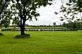 Kangla Fort Complex
.jpeg) Ruins of Kangla Fort
Ruins of Kangla Fort.jpeg) Kangla Museum houses
Kangla Museum houses
Kangla Fort is on the banks of the Imphal River, and is also known as the Palace of Kangla. Kangla means "dry land" in the Meitei language. The fort was the palace of King Pakhangba, and also has religious significance. In the fort are a number of temples, and it is surrounded on three sides by a lake.
Hiyangthang Lairembi Temple Complex
A religious site and a tourist attraction, the temple complex is noted for its annual Durga Puja festival in September or October.
India Peace Memorial (Red Hill)
The Red Hill is a historical hillock located 17 km south of Imphal City, on Tiddim Road. The place was the scene of action and the theater of the fierce battle that took place between Allied Forces and Japanese Forces fighting alongside the Indian National Army (INA) in World War II. Red Hill has now become a tourist attraction since the Japanese war veterans constructed a monument at the foot of this hill.
Imphal War Cemetery
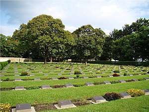
This cemetery remembers British and Indian soldiers who fought and died in the Second World War (1944).
Women's Market (Ima Keithel)
The market stalls are all run by women, and it is reportedly the only such market in the world.[7]
.jpeg)
Transport
Air
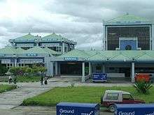
Imphal International Airport is 8 kilometres (5.0 mi) south of the city which connects direct flights to New Delhi, Kolkata, Guwahati and Agartala.[8]
Road
.jpeg)
Imphal is connected through National Highway which connects major cities like Guwahati, Kohima, Agartala, Shillong, Dimapur, Silchar and many more and also connects its neighbour states.
Railway
In October 2012, India's Cabinet Committee on Infrastructure approved an extension of the Jiribam-Silchar railway to Imphal. The extension is expected to reach the city by Q4 of 2019.[9][10]
The total length of the Jiribam-Tupul railway line is 110.62 km and the total revised estimated cost is Rs 9658 crore. So far, Rs 4927.65 crore has been spent. The Ministry has set a target of sanctioning Rs 1000 crore within the current financial year in order to speed up the railway construction work.
Sports
Khuman Lampak Main Stadium is the multi-purpose stadium in Imphal, India. It is used mostly for football and athletics. The stadium holds 30,000 people and was built in 1999. This stadium lies inside the Khuman Lampak Sports Complex. The professional football club NEROCA FC of I League is based in Imphal and they use Khuman Lampak Main Stadium as their home ground.
E-connectivity
Mobile networks
Education
Universities
Technical colleges
Medical colleges
Schools
There are many schools in imphal affiliated from C.B.S.E and ICSE Board, as well as state government schools.
- Areca school
- Comet School,Changangei
- Dav public school
- Don Bosco, Imphal
- Guru nanak public school
- Herbert school
- Jawahar Navodaya Vidyalaya including Khumbong (Imphal west), Imphal east, Bishnupur, CCpur, Ukrul, Thoubal, Tamenglong and Senapati
- Johnstone higher secondary public school
- Maria International Montessori School, Koirengei
- Kendriya vidyalaya No 1 Imphal
- Little flower school
- Lodestar public school
- Manipur public school
- Sainik International School&College Imphal
- St. Anthony's English School&College Imphal
- St. Joseph school
- St. Paul's English School
- Sanfort International School&College Imphal
- Sangai higher secondary public school
Healthcare
Imphal is facilitated with many private and government hospitals which are open 24 hours and provide all required facilities.
- Regional Institute of Medical Sciences
- Shija Hospitals & Research Institutes
- City Hospital
- Imphal Hospital
- Raj Medicity
- Sky hospital and Research Institute
- Mother's Care Hospital and Research Centre
- Apex Hospital
- Jawahar Lal Nehru Institute of Medical Sciences
- Horizon Hospital and Research Institute
Notable people
- Ngairangbam Bijoy Singh (born 1946), doctor and politician
- Ratan Thiyam, =notable theatre director and chairman of the Chorus theatre Imphal,former chairman at National School of drama.
- Bala Hijam = female actor, at Manipur film industry with representation also eminent in south Indian film.Model and the face of Likla by thangjam agro.
- Soma Laishram=Manipuri film Artist.actress,singer and model.
- Robert Naorem= notable designer representative of indeginous designs of Manipur and eminent beyond Manipur with involvement in the Hindi film industry.
- Pushparani Huidrom=female playback singer
- Mandakini=female playback singer and philanthropic worker for the blind and orphan population in the state.
- Tonthoi=notable award-winning actress and the brand ambassador and face for the singju festival,Manipur.
- Bikarnelzit Thiyam=social activist and blogger, eminent in local daily The Sangai Express and a video channel blogger in YouTube.
- Rajkidson Meeitei=actor\comedian\director at leitrabi parody and video channel blogger in YouTube
- Dheeraj Singh =prominent footballer from Manipur.
- Jenny Khurai=beautician and makeup artist. Actress and prominent transgender representative of the state.
- Bishesh huirem=Transgender activist,former miss transgender India,actress,theatre personality and model.
- Mary Kom=boxer and nationally representative of India at world class sport events.
- Manka mayanglambam=folk song singer\dancer and penna player, artist at the laihui institute of folklore.
References
- 1 2 3 "Imphal City Population, Manipur". www.census2011.co.in. Census 2011. 2015. Retrieved 14 June 2018.
- ↑ "Imphal and Kohima". Britain's Greatest Battles. National Army Museum. Archived from the original on 7 February 2015. Retrieved 9 January 2016.
- 1 2 3 "Imphal, India". India Meteorological Department. Retrieved 16 May 2014.
- ↑ "Maps, Weather, and Airports for Imphal, India". Retrieved 10 June 2015.
- 1 2 "Climate: Imphal - Climate graph, Temperature graph, Climate table". Climate-Data.org. Retrieved 31 October 2013.
- 1 2 "Ever Recorded Maximum Temperature, Minimum Temperature and 24 Hours Heaviest Rainfall upto 2010" (PDF). India Meteorological Department. Archived from the original (PDF) on 21 May 2013. Retrieved 16 May 2014.
- ↑ "Ima Keithel – A market by women". She. msn. Archived from the original on 15 June 2013. Retrieved 25 November 2012.
- ↑ "Imphal". Airports Authority of India. Archived from the original on 9 October 2012. Retrieved 25 November 2012.
- ↑ "Govt approves rail link to Imphal". The Indian Express. 26 October 2012. Retrieved 25 November 2012.
- ↑ "NFR – Jiribam-Imphal Rail Line – Manipur". Construction Intelligence Centre. Retrieved 7 November 2017.
- ↑ "Manipur University". Retrieved 10 June 2015.
- ↑ "Welcome To NIT Manipur". Retrieved 10 June 2015.
- ↑ "MTU". mtu.ac.in. Retrieved 2017-02-25.
- ↑ "Regional Institute of Medical Sciences". Retrieved 28 January 2014.
- ↑ "JNIMS". Archived from the original on 22 November 2010. Retrieved 28 January 2014.
External links

- Imphal West
- Imphal East
| Wikimedia Commons has media related to Imphal. |
|