AH1
| ||||
|---|---|---|---|---|
 | ||||
| Route information | ||||
| Length | 20,557 km (12,774 mi) | |||
| Major junctions | ||||
| East end | Tokyo, Japan | |||
| West end | Istanbul, Turkey | |||
| Location | ||||
| Countries | Tokyo, Japan via South Korea, North Korea, China, Southeast Asia, Bangladesh, India, Pakistan, Afghanistan and Iran to the border between Turkey and Bulgaria west of Istanbul where it joins end-on with European route E80 | |||
| Highway system | ||||
| ||||

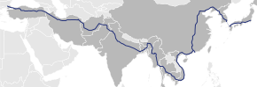
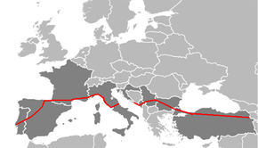
Asian Highway 1 (AH1) is the longest route of the Asian Highway Network, running 20,557 km (12,774 mi) from Tokyo, Japan via Korea, China, Southeast Asia, Bangladesh, India, Pakistan, Afghanistan and Iran to the border between Turkey and Bulgaria west of Istanbul where it joins end-on with European route E80.
Japan
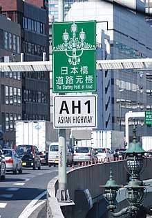
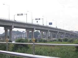
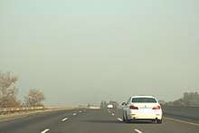
The 1200-kilometre[1] section in Japan was added to the system in November 2003.[2] It runs along the following tolled expressways:[3]


.png)
.jpg)
.png)

- Japan National Route 2 Hatsukaichi to Iwakuni
.png)

![]()
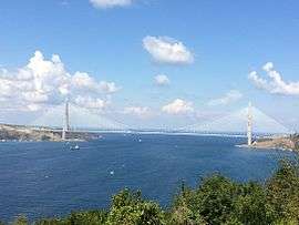
From Fukuoka, the Japan–Korea Undersea Tunnel has been proposed to provide a fixed crossing.
South Korea
The section in South Korea mainly follows the Gyeongbu Expressway. The Highway Boundary of South and North Korea.
- Busan Metropolitan Road 71: Busan-Centre - Busan-Dong-gu


North Korea
- P'anmunjǒm - Kaesǒng
.svg.png)
China
.svg.png)

Hong Kong
Vietnam


Cambodia
Thailand


Myanmar
- National Highway 8: Myawaddy - Payagyi
- Branch Yangon–Mandalay Expressway : Payagyi - Yangon
- Yangon–Mandalay Expressway: Payagyi - Meiktila - Mandalay
- National Highway 7: (Concurrent with

India (Northeast)
Bangladesh


- Bhanga - Faridpur

- Jessore - Benapole[7]
India

Pakistan
Afghanistan
- Afghanistan Ring Highway: Jalalabad - Kabul - Kandahar - Delaram - Herat - Islam Qala
Iran
Turkey
Connection to E80
The route AH1 is also marked as ![]()
References
| Wikimedia Commons has media related to AH1. |
- ↑ Economic and Social Commission for Asia and the Pacific, 2003 Asian Highway Handbook Archived 2012-04-14 at the Wayback Machine., 2003, page 54
- ↑ Economic and Social Commission for Asia and the Pacific, 2003 Asian Highway Handbook Archived 2012-04-14 at the Wayback Machine., 2003, page 3
- ↑ アジアハイウェイ標識の設置場所 (in Japanese). MLIT. Retrieved December 5, 2011.
- ↑ Economic and Social Commission for Asia and the Pacific,2003 Asian Highway Handbook Archived 2012-04-14 at the Wayback Machine., 2003, page 54 shows an aerial photo of the Yokohama Aoba Interchange, placing AH1 clearly on the Tomei Expressway rather than the other Tokyo-Nagoya expressway, the Chūō Expressway.
- ↑ Regional Road Connectivity Bangladesh Perspective (PDF). RHD. Retrieved February 19, 2017.
- ↑ "Asian Highway Route Map" (PDF). ESCAP. Retrieved February 19, 2017.
- ↑ http://www.rhd.gov.bd/RHDMaps/Maps/Country_Bangladesh.pdf
| Across the whole continent | 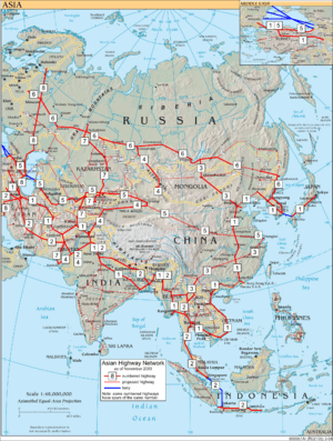 | |
|---|---|---|
| Southeast Asia | ||
| East Asia, Northeast Asia and Southeast Asia | ||
| South Asia | ||
| North Asia, Central Asia and Southwest Asia | ||