Bishnupur district
| Bishnupur district | |
|---|---|
| District | |
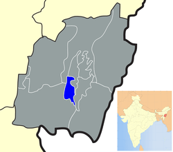 Location of Bishnupur district in Manipur | |
| Coordinates: 24°38′N 93°46′E / 24.633°N 93.767°ECoordinates: 24°38′N 93°46′E / 24.633°N 93.767°E | |
| Country |
|
| State | Manipur |
| Headquarters | Bishnupur |
| Area | |
| • Total | 496 km2 (192 sq mi) |
| Population (2011) | |
| • Total | 240,363 |
| • Density | 21.83/km2 (56.5/sq mi) |
| Languages | |
| • Official | Meiteilon (Manipuri) |
| Time zone | UTC+5:30 (IST) |
| ISO 3166 code | IN-MN-BI |
| Vehicle registration | MN |
| Website |
bishnupur |
Bishnupur district (Pron:/ˌbɪʃnʊˈpʊə/) is the district of Manipur state in northeastern India with the smallest area.
Origin of name
Its name is derived from a Vishnu temple located at Lamangdong.
Geography
Bishnupur town is the administrative headquarters of the district. Other major towns in this district are: Nambol, Moirang, Ningthoukhong, and Kumbi. Major village in this district are Nachou, Ngaikhong Khullen, Toubul, and Khoijuman Khullen.
Demographics
According to the 2011 census Bishnupur district has a population of 240,363,[1] roughly equal to the nation of Vanuatu.[2] This gives it a ranking of 583rd in India (out of a total of 640).[1] The district has a population density of 485 inhabitants per square kilometre (1,260/sq mi) .[1] Its population growth rate over the decade 2001-2011 was 15.36%.[1] Bishnupur has a sex ratio of 1000 females for every 1000 males,[1] and a literacy rate of 76.35%.[1]
Languages
Primary language spoken is Meiteilon. Other languages spoken include Bishnupriya Manipuri, Aimol, a Sino-Tibetan tongue with less than 3000 speakers, written in the Latin script.[3]
Sino-Tibetan languages spoken in Bishnupur district include:
Flora and fauna
In 1977 Bishnupur district became home to Keibul Lamjao National Park, which has an area of 40 km2 (15.4 sq mi).[4]
Administrative divisions
The district is divided into 3 sub-divisions:
References
- 1 2 3 4 5 6 "District Census 2011". Census2011.co.in. 2011. Retrieved 2011-09-30.
- ↑ US Directorate of Intelligence. "Country Comparison:Population". Retrieved 2011-10-01.
Vanuatu 224,564 July 2011 est.
- ↑ M. Paul Lewis, ed. (2009). "Aimol: A language of India". Ethnologue: Languages of the World (16th ed.). Dallas, Texas: SIL International. Retrieved 2011-09-28.
- ↑ Indian Ministry of Forests and Environment. "Protected areas: Manipur". Archived from the original on October 9, 2011. Retrieved September 25, 2011.
External links
- Bishnupur district website

Places adjacent to Bishnupur district | |
|---|---|