Imphal East district
| Imphal East district | |
|---|---|
| district | |
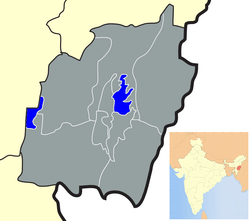 Location of Imphal East district in Manipur | |
| Coordinates: 24°48′N 93°57′E / 24.800°N 93.950°ECoordinates: 24°48′N 93°57′E / 24.800°N 93.950°E | |
| Country |
|
| State | Manipur |
| Headquarters | Porompat |
| Area | |
| • Total | 710 km2 (270 sq mi) |
| Population (2011) | |
| • Total | 452,661 |
| • Density | 640/km2 (1,700/sq mi) |
| Languages | |
| • Official | Meiteilon (Manipuri) |
| Time zone | UTC+5:30 (IST) |
| ISO 3166 code | IN-MN-EI |
| Vehicle registration | MN |
| Website |
imphaleast |
Imphal East district (Pron:/ˈɪmfəl or ɪmˈfɑːl/) is one of the 16 districts of Manipur state in northeastern India. As of 2011 it is the second most populous district in the state, after Imphal West.[1]
History
This district came into existence on 18 June 1997.
Imphal East District came into existence on 18-06-1997 with its headquarters at Porompat occupying the eastern part of Imphal District. The total area of District is 469.44 km2. approximately. The District is situated at an altitude 790 metres above the M.S. Level. The climate of the District is salubrious and Monsoon is tropical. The minimum temperature goes down to 0.6degree Celsius in winter and 41 degree Celsius in summer. It has no rail network and hence communication is entirely dependent on roads except Jiribam Sub-Division bordering Cachar District of Assam where there is a railhead. As of 2017, A new rail line is under construction and a railway station will be operational by 2019. The District is connected with N.H. 39, N.H. 53 and N.H. 150.
Demographics
Population
According to the 2011 census Imphal East district has a population of 452,661,[1] roughly equal to the nation of Malta.[2] This gives it a ranking of 551st in India (out of a total of 640).[1] The district has a population density of 638 inhabitants per square kilometre (1,650/sq mi) .[1] Its population growth rate over the decade 2001-2011 was 14.63%.[1] Imphal East has a sex ratio of 1011 females for every 1000 males,[1] and a literacy rate of 82.81%.[1]
Administrative divisions
The district is divided into 3 sub-divisions:
- Porompat
- Keirao Bitra
- Sawombung
Recently, Jiribam District is carved out from Imphal East district comprising sub-divisions of Jiribam, Borobekra, and Babukhal.
Areas under Imphal Urban Agglomoration
Economy
Agriculture
Agriculture is the main occupation of the people in the district. In the district there are 27,000 and 4,100 hectares of land for H.Y.V. (high yield variety) and improved local paddy field respectively. There are land of 450 hectares for maize, 60 hectares for wheat and 350 hectares for potato in the district. The main food crops are paddy, potato and vegetables. Among the cash crops are sugar cane, maize, pulse, oil seed and other vegetables etc. The total number of workers engaged in agriculture in the district was 42,473 as per 1991 census of which 28,661 were male and 13,812 were female. Spices like chilli, onion, ginger, turmeric and coriander of very good quality are grown in the district.
| Sl. No. | Name of Crops | Area in Hect. | Production in MT |
|---|---|---|---|
| KHARIF CROPS | |||
| 1 | Paddy (HYV) | 27.00 | 80.14 |
| 2 | Local paddy | 4.10 | 5.44 |
| 3 | Maize | 0.45 | 0.80 |
| 4 | Sugar cane | 0.29 | 17.84 |
| 5 | Kharif Pulse | 0.22 | 0.26 |
| RABI CROPS | |||
| 1 | Wheat | 0.06 | 0.08 |
| 2 | Pea & other pulses | 1.53 | 1.09 |
| 3 | Potato | 0.35 | 1.52 |
| 4 | Muster & other Oilseeds crops | 0.60 | 1.22 |
Horticulture
Horticulture products have been acquiring popularity with the people in the district. Fruits like pineapple, banana, lemon and papaya grow well in the district. Pineapple grows in plenty at the slope of Ngariyan Hill. There is considerable scope for increasing the area under different horticulture crops. The soil and climate favour for mass plantation of horticulture products in the district.
The following is the areas and production of horticulture crops in the district during 1998-99
| Sl.No. | Crops | Area in Hectare | Annual production ( M.T.) |
|---|---|---|---|
| 1 | Pineapple | 650 | 3,700 |
| 2 | Banana | 50 | 392 |
| 3 | Lemon | 56 | 224 |
| 4 | Plum, Pear & Peach | 30 | 180 |
| 5 | Papaya | 230 | 1,150 |
| 6 | Mango | 12 | 60 |
| 7 | Guava | 30 | 138 |
| 8 | Others | 250 | 397 |
| Total | 1,358 | 6,646 |
Livestock
In the district, there is a dairy farm and a veterinary training center. There are also 5 veterinary Hospitals and 19 Veterinary Dispensaries in the district along with 3 nos. of Aids centers. The following is the population of livestock as per survey report of 1997 census.
| Sl. No. | Category | Total Population |
|---|---|---|
| A | LIVESTOCK | |
| 1 | Cattle | 85,964 |
| 2 | Buffaloes | 2,310 |
| 3 | Sheep | 461 |
| 4 | Goats | 2,189 |
| 5 | Horses & Ponies | 542 |
| 6 | Pigs | 10,563 |
| 7 | Dogs | 15,940 |
| 8 | Rabbits | 799 |
| B | POULTRY | |
| 1 | Cock | 30,719 |
| 2 | Hen | 2,37,704 |
| 3 | Chicken (below three months) | 1,60,018 |
| 4 | Drakes | 21,029 |
| 5 | Ducks | 35,832 |
| 6 | Ducklings ( below six months ) | 21,512 |
| 7 | Other fowls | 5,784 |
Forest
The following is the information of forest products available in the district
| Sl.No. | Items | Units | Quantity | Value (in Rs.) |
|---|---|---|---|---|
| 1 | Firewood | M.T. | 16.8 | 43.560 |
| 2 | Bamboo | nil | nil | nil |
| 3 | Charcoal | Qtl. | 1 80 | |
| 4 | Earth | C.M. | 1,060 | 16,620 |
| 5 | Stone | C.M. | 31,610 | 4,77,340 |
| 6 | Sand | C.M. | 23,542 | 3,29,685 |
Tourism
There are two tourist home in the district, one is at Kaina and another at Jiribam. In the district, the natural beauty of Poirou Pat rounded with the small hillock is beyond description. Shree-Shree Govindajee Temple, a beautiful golden temple located in the palace compound is still shining here. The two war Cemeteries that maintained by British war grave commission might be attractive to the tourists. In addition to this there is a temple at Kaina a holy place of the Hindu. Besides, Hanuman Temple at Mahabali is a pre-historical place in the State. Manipur is famous for its scenic beauty, enchanting landscape, salubrious climate and rich cultural heritage which has a great potential for development of tourism.
Geography
Porompat town is the administrative headquarters of the district. Nandeibam is also in the district.
Climate
| Imphal | ||||||||||||||||||||||||||||||||||||||||||||||||||||||||||||
|---|---|---|---|---|---|---|---|---|---|---|---|---|---|---|---|---|---|---|---|---|---|---|---|---|---|---|---|---|---|---|---|---|---|---|---|---|---|---|---|---|---|---|---|---|---|---|---|---|---|---|---|---|---|---|---|---|---|---|---|---|
| Climate chart (explanation) | ||||||||||||||||||||||||||||||||||||||||||||||||||||||||||||
| ||||||||||||||||||||||||||||||||||||||||||||||||||||||||||||
| ||||||||||||||||||||||||||||||||||||||||||||||||||||||||||||
References
- 1 2 3 4 5 6 7 "District Census 2011". Census2011.co.in. 2011. Retrieved 2011-09-30.
- ↑ US Directorate of Intelligence. "Country Comparison:Population". Retrieved 2011-10-01.
Malta 408,333 July 2011 est.
External links
Places adjacent to Imphal East district | ||||||||||
|---|---|---|---|---|---|---|---|---|---|---|
| ||||||||||