Sandford Glacier
| Sandford Glacier | |
|---|---|
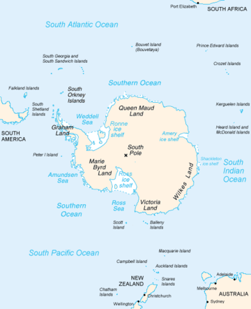 Map of Antarctica, with Wilkes Land slightly to the right | |
 Location of Sandford Glacier in Antarctica | |
| Type | channel |
| Location | Wilkes Land |
| Coordinates | 66°40′00″S 129°50′00″E / 66.66667°S 129.83333°E / -66.66667; 129.83333 |
| Thickness | unknown |
| Terminus | Porpoise Bay |
| Status | unknown |
Sandford Glacier (66°40′S 129°50′E / 66.667°S 129.833°E / -66.667; 129.833Coordinates: 66°40′S 129°50′E / 66.667°S 129.833°E / -66.667; 129.833) is a channel glacier flowing to the east side of Porpoise Bay, about 25 nautical miles (46 km) south-southwest of Cape Morse. Delineated from air photos taken by U.S. Navy Operation Highjump (1946–47). Named by Advisory Committee on Antarctic Names (US-ACAN) for Joseph P. Sandford, Passed Midshipman on the brig Porpoise of the United States Exploring Expedition (1838–42) under Wilkes.
See also
References

| Types | |||||||
|---|---|---|---|---|---|---|---|
| Anatomy | |||||||
| Processes | |||||||
| Measurements | |||||||
| Volcanic relations | |||||||
| Landforms |
| ||||||
| |||||||
This article is issued from
Wikipedia.
The text is licensed under Creative Commons - Attribution - Sharealike.
Additional terms may apply for the media files.