Sainte-Hélène, Morbihan
| Sainte-Hélène Santez-Elen | ||
|---|---|---|
| Commune | ||
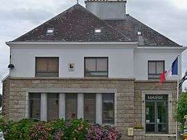 The town hall in Sainte-Hélène | ||
| ||
 Sainte-Hélène Location within Brittany region  Sainte-Hélène | ||
| Coordinates: 47°43′15″N 3°12′12″W / 47.7208°N 3.2033°WCoordinates: 47°43′15″N 3°12′12″W / 47.7208°N 3.2033°W | ||
| Country | France | |
| Region | Brittany | |
| Department | Morbihan | |
| Arrondissement | Lorient | |
| Canton | Pluvigner | |
| Intercommunality | Blavet Bellevue Océan | |
| Government | ||
| • Mayor (2008—2014) | Emmanuel Giquel | |
| Area1 | 8.08 km2 (3.12 sq mi) | |
| Population (2007)2 | 1,105 | |
| • Density | 140/km2 (350/sq mi) | |
| Time zone | UTC+1 (CET) | |
| • Summer (DST) | UTC+2 (CEST) | |
| INSEE/Postal code | 56220 /56700 | |
| Elevation | 0–20 m (0–66 ft) | |
|
1 French Land Register data, which excludes lakes, ponds, glaciers > 1 km2 (0.386 sq mi or 247 acres) and river estuaries. 2 Population without double counting: residents of multiple communes (e.g., students and military personnel) only counted once. | ||
.svg.png)
Sainte-Hélène (Breton: Santez-Elen) is a commune in the Morbihan department of Brittany in north-western France.
Demographics
Inhabitants of Sainte-Hélène are called in French Hélénois.
Economy
The area is primarily an agricultural community, but also relies increasingly on the tourist industry, offering a range of 'gîte' accommodation and attracting visitors to the Étel estuary area.
See also
References
- Mayors of Morbihan Association (in French)
- INSEE commune file
External links
| Wikimedia Commons has media related to Sainte-Hélène (Morbihan). |
- French Ministry of Culture list for Sainte-Hélène (in French)
- Map of Sainte-Hélène on Michelin (in English)
This article is issued from
Wikipedia.
The text is licensed under Creative Commons - Attribution - Sharealike.
Additional terms may apply for the media files.