Allaire, Morbihan
| Allaire Alaer | ||
|---|---|---|
| Commune | ||
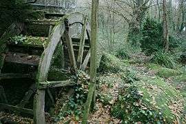 The Quip watermill | ||
| ||
 Allaire Location within Brittany region  Allaire | ||
| Coordinates: 47°38′16″N 2°09′42″W / 47.6378°N 2.1617°WCoordinates: 47°38′16″N 2°09′42″W / 47.6378°N 2.1617°W | ||
| Country | France | |
| Region | Brittany | |
| Department | Morbihan | |
| Arrondissement | Vannes | |
| Canton | Guer | |
| Intercommunality | Pays de Redon | |
| Government | ||
| • Mayor (2014-2020) | Jean-François Mary | |
| Area1 | 41.74 km2 (16.12 sq mi) | |
| Population (2014)2 | 3,751 | |
| • Density | 90/km2 (230/sq mi) | |
| Time zone | UTC+1 (CET) | |
| • Summer (DST) | UTC+2 (CEST) | |
| INSEE/Postal code | 56001 /56350 | |
| Elevation | 1–88 m (3.3–288.7 ft) | |
|
1 French Land Register data, which excludes lakes, ponds, glaciers > 1 km2 (0.386 sq mi or 247 acres) and river estuaries. 2 Population without double counting: residents of multiple communes (e.g., students and military personnel) only counted once. | ||
.svg.png)
Allaire (Alaer in Breton) is a commune in the Morbihan department in the Brittany region in northwestern France.
Geography
The river Arz forms most of the commune's northeastern border.
Population
Inhabitants of Allaire are called Allairiens.
See also
References
- INSEE statistics
- Mayors of Morbihan Association (in French)
External links
| Wikimedia Commons has media related to Allaire (Morbihan). |
- French Ministry of Culture list for Allaire (in French)
This article is issued from
Wikipedia.
The text is licensed under Creative Commons - Attribution - Sharealike.
Additional terms may apply for the media files.