Malansac
| Malansac Malañseg | |
|---|---|
| Commune | |
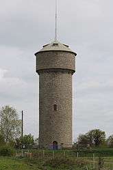 The water tower, in Malansac | |
 Malansac Location within Brittany region  Malansac | |
| Coordinates: 47°40′43″N 2°17′37″W / 47.6786°N 2.2936°WCoordinates: 47°40′43″N 2°17′37″W / 47.6786°N 2.2936°W | |
| Country | France |
| Region | Brittany |
| Department | Morbihan |
| Arrondissement | Vannes |
| Canton | Questembert |
| Government | |
| • Mayor (2001–2008) | François Hervieux |
| Area1 | 36.18 km2 (13.97 sq mi) |
| Population (1999)2 | 1,889 |
| • Density | 52/km2 (140/sq mi) |
| Time zone | UTC+1 (CET) |
| • Summer (DST) | UTC+2 (CEST) |
| INSEE/Postal code | 56123 /56220 |
| Elevation | 6–97 m (20–318 ft) |
|
1 French Land Register data, which excludes lakes, ponds, glaciers > 1 km2 (0.386 sq mi or 247 acres) and river estuaries. 2 Population without double counting: residents of multiple communes (e.g., students and military personnel) only counted once. | |
Malansac (Breton: Malañseg) is a commune in the Morbihan department of Brittany in north-western France.
Geography
The river Arz forms all of the commune's northern border.
Demographics
Inhabitants of Malansac are called in French Malansacais.
See also
References
- Mayors of Morbihan Association (in French)
- INSEE commune file
External links
| Wikimedia Commons has media related to Malansac. |
- Official site (in French)
- French Ministry of Culture list for Malansac (in French)
- Map of Malansac on Michelin (in English)
This article is issued from
Wikipedia.
The text is licensed under Creative Commons - Attribution - Sharealike.
Additional terms may apply for the media files.